By Monika
10-day Iceland Itinerary – Epic Road Trip on the Ring Road and into the Highlands
Welcome to our “10-day Iceland Itinerary”!
We started planning this trip immediately after returning from our first trip to Iceland – we were so charmed and fascinated that we knew we had to go back.
Each of us had things we wanted to see and do and trying to fit it all into our limited vacation time was quite a challenge, but we did it. Multiple edits and additions later we created what seemed like an amazing travel plan.
And then… our flight to Iceland got cancelled!!! While we stood in line to board our already twice delayed flight!!! Ugh… Luckily, we got rebooked quickly and, long story short, we started our trip a day later than we were supposed to. So now we had our original 11-day plan that we were determined to squeeze in to 10 days. Hmmm…
It took some thinking and some serious driving on day 1 but we made it work.
I’ll keep this itinerary as was originally planned, but I will also explain how we fitted it into a 10-day trip.
These kinds of unforeseen situations are exactly why – and I can’t stress that enough – it’s really important to have travel insurance!

Did you know you can get compensation for delayed/cancelled flights from the airline? For a hassle-free experience, just fill out a quick form on AirHelp and leave all the hard work to them!
Our initial plan was to drive the entire length of the Ring Road. After debating which direction to go for, we settled on clockwise, made a plan and started booking accommodations. I’ll provide links to our choices at the end of each day’s description.
After we thought we had a perfect travel plan we decided to add Kerlingarfjöll to our itinerary! A mesmerizing, otherworldly spot in the Icelandic Highlands that we just HAD to visit!
Since we couldn’t extend our vacation, we had to replace something, and it ended up being the western stretch of the Ring Road from Reykjavik to Akureyri. So instead of the Ring Road, we drove through the remote, breathtaking scenery of the Highlands – and loved it! A must-do!
Keep reading to see how we did!
This is a map of our route. You’ll find detailed descriptions of what we did each day below in this travel guide.

You can easily extend this plan into a 12-day itinerary and go at a slower pace (especially on Day 5) or pack a lot into the long summer days and keep it as a 10-day itinerary.
Follow along and choose what’s best for you!
This post contains affiliate links to trusted products and services that I use and love myself. If you make a purchase through these links, I may receive compensation at NO EXTRA COST TO YOU. I appreciate your support! Also, as an Amazon Associate I earn from qualifying purchases. See the Disclaimer Policy and the Privacy Policy for more details.
- 10-day Iceland Itinerary – Epic Road Trip on the Ring Road and into the Highlands
- Day 1 & 2: Arrival, Gullfoss, Geysir, Kerlingarfjöll, Hveravellir, Akureyri
- Day 3: the Diamond Circle
- Day 4: Lake Mývatn area
- Day 5: Möðrudalur to Höfn (+ Stuðlagil Canyon and Vestrahorn)
- Day 6: Glacier lagoons, Vatnajökull glacier ice climbing
- Day 7: Ingólfshöfði Puffin Tour, Svartifoss waterfall, Fjaðrágljúfur Canyon, Dyrhólaey Cliffs
- Day 8: Vik, horseback riding, Seljavallalaug Pool, waterfalls of the South Coast
- Day 9: Friðheimar tomato farm, Hrunalaug hot spring, Secret Lagoon
- Day 10: Landmannalaugar
- Day 11: Reykjavik
- Helpful resources to make this itinerary a success:
Day 1 & 2: Arrival, Gullfoss, Geysir, Kerlingarfjöll, Hveravellir, Akureyri
As you can see, we have a whole lot listed for that day, and that’s because we ended up combining day 1 and day 2 into one super long day. We had to unfortunately skip a couple of things that we originally planned but in the situation we were in, something had to go on the next visit plan.
So here is an overview of our original plan: (detailed description of what we actually did will be below that)
Day 1: arrive, grab our rental, drive to Kerlingarfjöll (re-visiting Gullfoss and Geysir on the way), spend the night at Hveravellir Lodge in the Highlands.
Caution! There is Hveradalir – which is an incredibly beautiful geothermal area near Highland Base at Kerlingarfjöll and Hveravellir – a nature reserve located just a little off rt. F35, with its own accommodation, a natural hot spring and hiking trails. It’s about an hour away from Kerlingarfjöll. More on each later in the itinerary. The names are similar and it’s very easy to confuse them! There is also Hverir – another geothermal area located near Lake Mývatn in North Iceland – more confusion!
Day 2: breakfast at Hveravellir, hike one of the easier hiking trails there, drive towards Akureyri, stopping at Fosslaug natural hot spring along the way.
Akureyri is about 3 hr. drive from Hveravellir and this was supposed to be our “rest and recover day”. The plan was to walk around town, hit the gift shops, check into our apartment at some point and soak in the fairly newly opened Forest Lagoon. And by the next morning be ready for our usual fully packed sightseeing schedule. Sounds pretty perfect right?
Well… Here is what we ended up doing:
We arrived at Keflavik Airport just before 5 am and were greeted by the most beautiful sunrise!
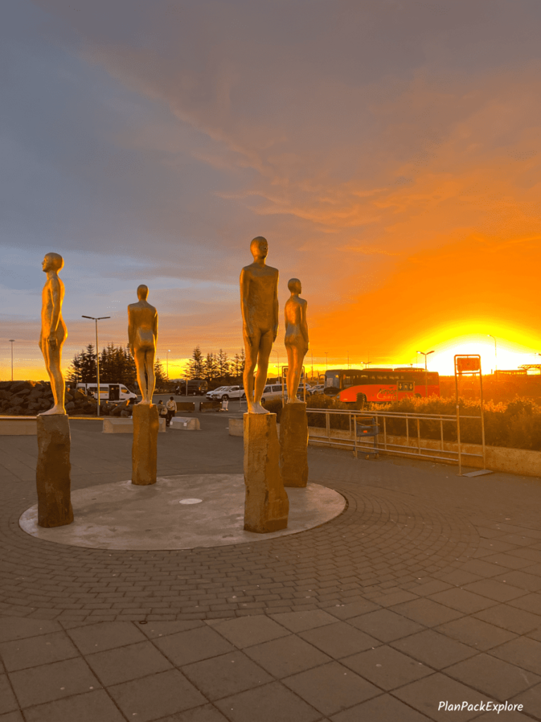
After grabbing some hot dogs and food for the road at the little airport store/café AND filling our two thermoses with hot water to make food and coffee later, we got our rental car. Blue Car Rental held our car for us after we emailed to let them know about our unfortunate delay and we finally hit the road.

Check my budget-friendly and practical packing list for more details about other really handy items to bring with you to Iceland, especially for a road trip on the Ring Road.
It felt sooo good to be back in this amazing country! Especially after all the fight drama – we were finally here!
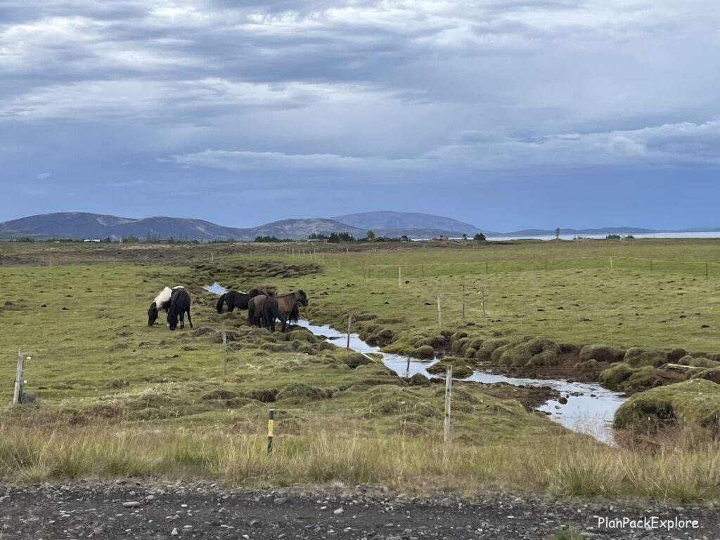
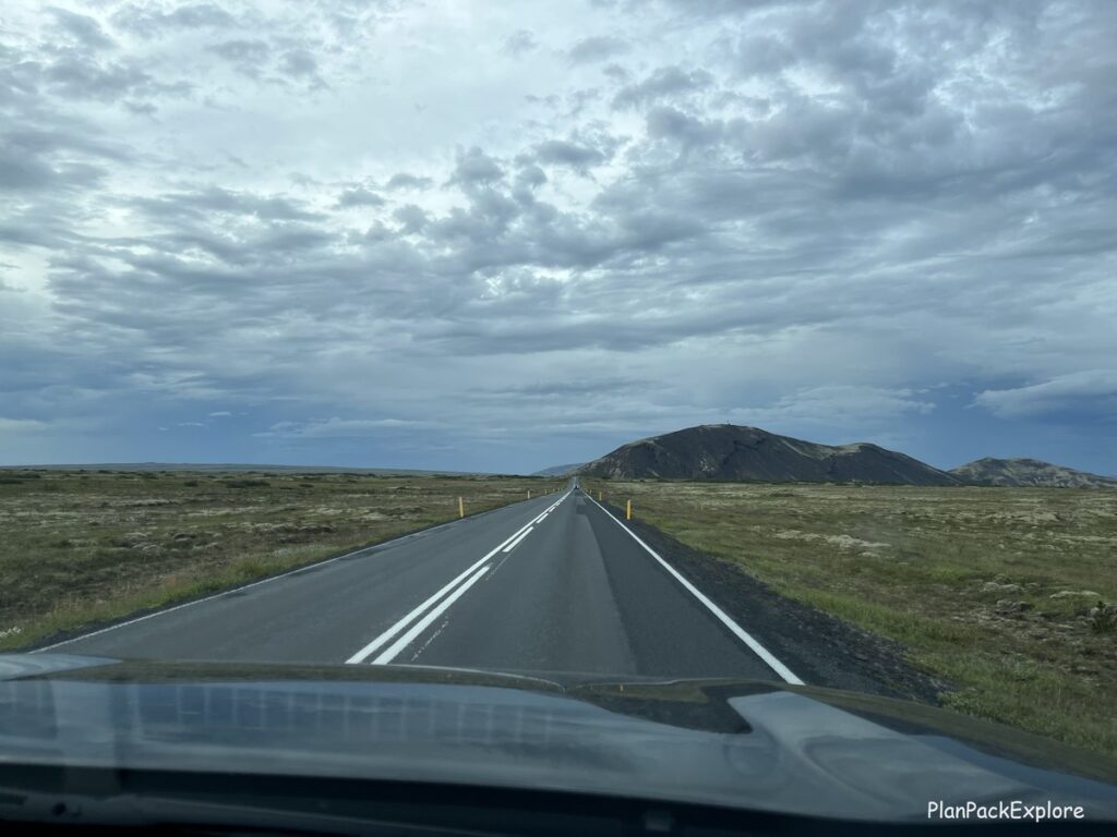
We stopped by Geysir since it was on the way, and we wanted to stretch our legs and watch Strokkur erupt again!
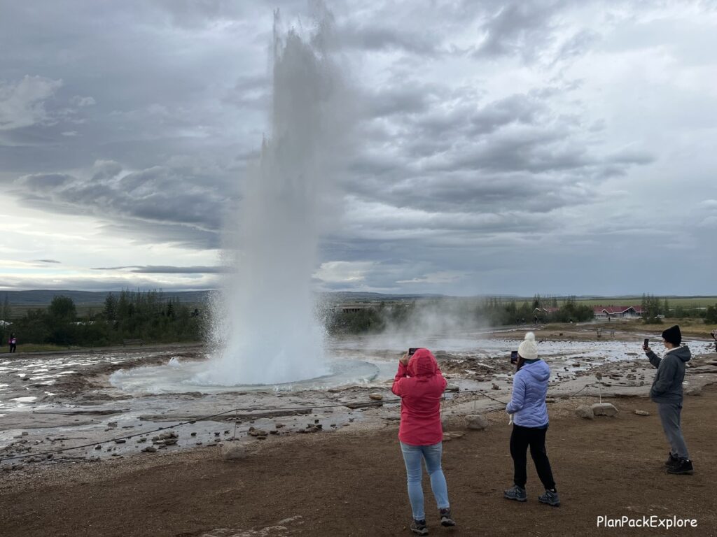
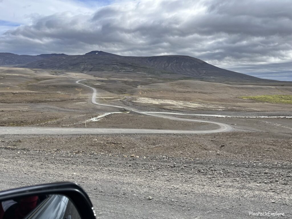
Then we were off to Gullfoss where the road to Kerlingarfjöll starts. It’s one of the easiest and best maintained F-roads in Iceland and it will take you through some unbelievable landscapes.
Read more about driving on road F-35 in my detailed guide, complete with photos and videos from our drive!
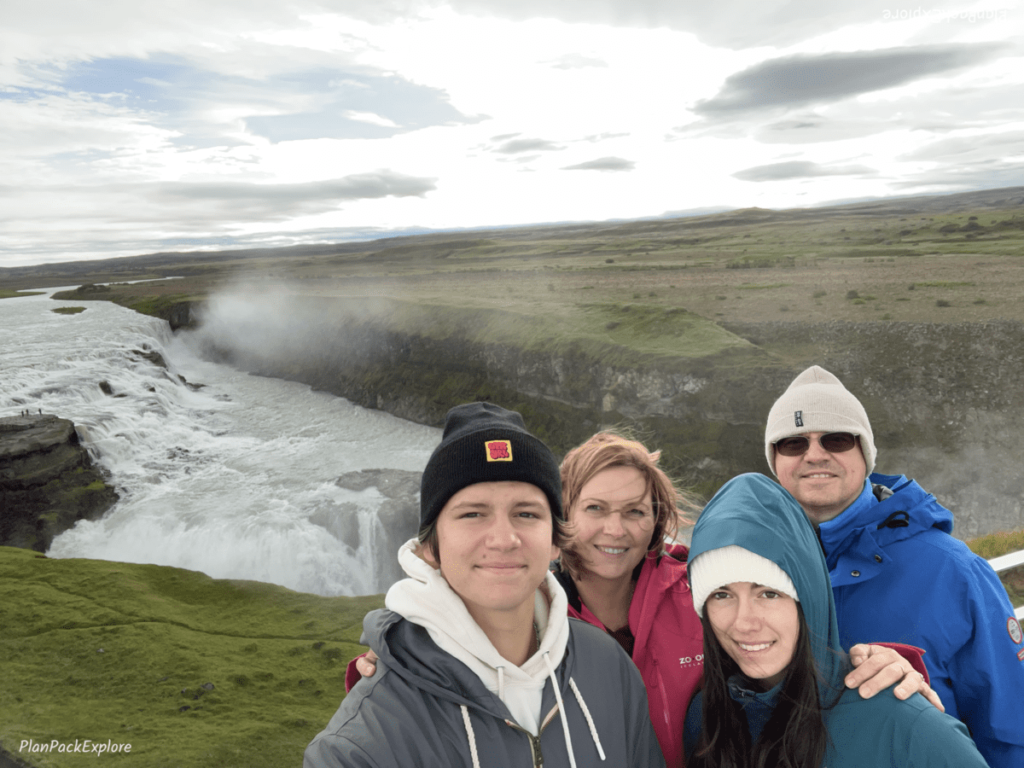
We quickly visited the majestic Gullfoss waterfall again (it just never gets old!) and got some hot food at the Gullfoss café.
By then we’ve been on the road for about two hours. We had wanted to get some of the geothermal bread at the Fontana Laugarvatn earlier, but it was way too early in the morning…
Read more about Geysir, Laugarvatn and Gullfoss in this article: Golden Circle in One Day – Full Guide to the Main Stops and Best Detours.
After that we were ready to conquer our first F-road ever and to start our drive into the Icelandic Highlands.
Helpful tip: Read my full guide about driving road F35 for important information, photos and videos of the drive, but here is one quick tip – gas up at Geysir! It’s the last gas station before F-35 and there aren’t any services along that road, so you really want to make sure you have a full tank.
The drive from Gullfoss to Kerlingarfjöll took about 1.5 hours. It’s about 70 km of unpaved bumpy gravel road, the last 10 km after you turn from F-35 to F-347 even bumpier. We were lucky to have gorgeous sunny weather and the views along the way were breathtaking.
After arriving we checked out the newly renovated Highland Lodge, got directions there to Hveradalir Geothermal Area and headed back to the car.
By the way – you can also hike to Hveradalir from the Highland Base. We just didn’t have the time or energy for this hike today though…
So we drove and what a drive it was! It’s only 12-15 minutes long, but talk about rough, windy and full of potholes!
Hveradalir is so worth the effort to get there! You are mesmerized just standing in the parking lot, and the farther into this geothermal valley you go, the more dramatic and colorful the landscape gets.

It is one of the most incredible places I’ve been to so far.
READ my in-depth guide to Kerlingarfjöll , including the hot spring and Hveradalir Geothermal Area with tons of photos, videos and helpful tips!
We spent about 2 hours exploring the area and headed back to the base.
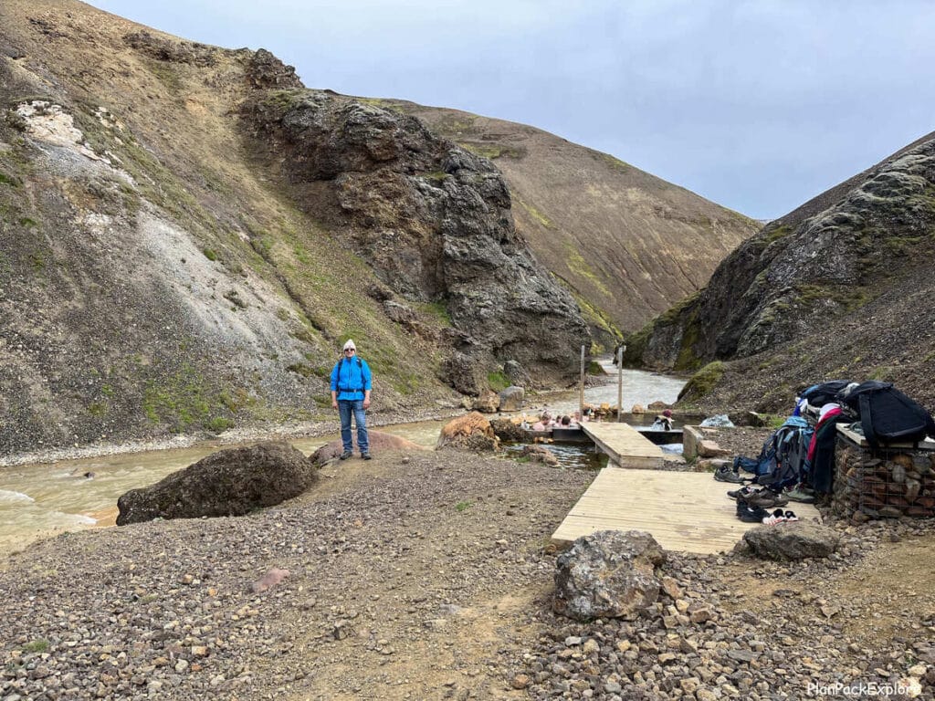
After a quick rest and some food we decided to also check out the Kerlingarfjöll hot spring, which was only a relatively easy 1 mile hike away. It took us about 30 minutes to get there with multiple photo stops. The hot spring is also very pretty but on a small side, so it only takes a few people to consider it crowded.
After a short rest we went back to the lodge, had some much-needed delicious coffee and tried their famous waffles – also delicious!
Now it was time to continue our road trip and drive one more hour to Hveravellir, where we were supposed to spend the night per our original travel plan. By the time we got there it was about 6:30 pm. By Icelandic standards it’s still considered early, since the summer days are long and bright well into the night hours.
So after a quick family huddle in the car we decided to keep going to Akureyri, which would bring us closer to our next day plan and pretty much catch us up with the original itinerary.
The question was – can we drive another 3 hours? We decided that we can. That between the two of us driving (my husband and I) we will make it. So he took a quick nap in the car, while our daughter and I went to look around the area.
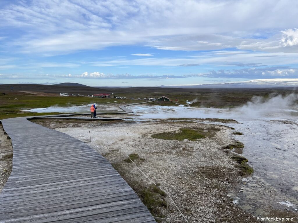
Hveravellir is a nature reserve with a restaurant, two lodges, a campsite and hiking trails around the geothermal area. And of course, a hot spring – also crowded that night.
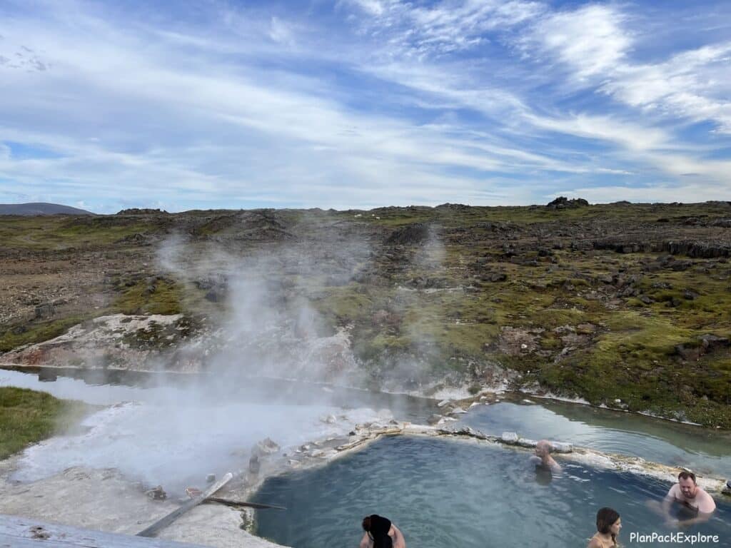
We didn’t spend much time here as it was getting late but what we did get to see definitely made me put Hveravellir on a “come back” list.
So we took another sip of our coffee and kept going. It was such a long day! By the time we arrived at our apartment in Akureyri, having done grocery shopping in the only grocery store open this late (more on grocery shopping in Iceland here) it was close to midnight! But we did it!
What we didn’t get to:
- We didn’t explore Hveravellir enough or hike there
- We didn’t visit Fosslaug natural hot spring (and the nearby Reykjafoss waterfall) – that was supposed to be our break after finishing the drive on road F-35, before we got to Akureyri. It’s a picturesque hidden gem located about 7 km from the town Varmahlíð. Next time!
- We didn’t walk around Akureyri or visit the Forest Lagoon spa.
Where we stayed:
- Hveravellir New Hut (we didn’t but that was the plan…)
- Saga Apartments in Akureyri – a wonderful place, right on the main street, close to shops, restaurants and night life 🙂
You can also stay right in Kerlingarfjöll. The newly renovated Highland Base offers private rooms in the lodge, dorm style rooms, huts, cabins and a campsite.
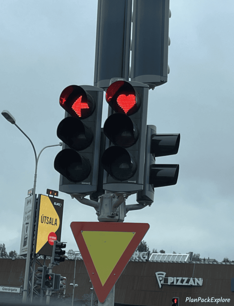
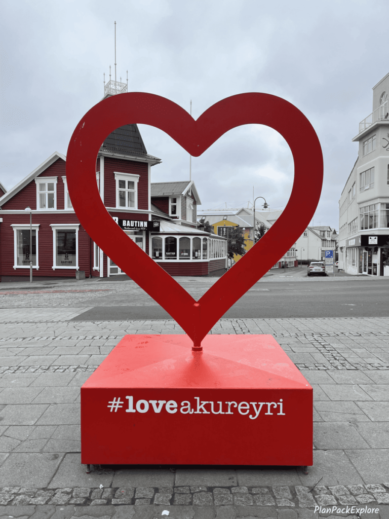
Quick note: Since we didn’t get to see Akureyri the way we wanted to, I can only offer you a glimpse of this coastal town, also known as “Iceland’s Capital of the North.”
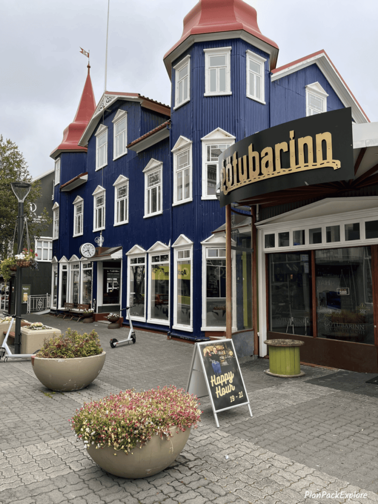

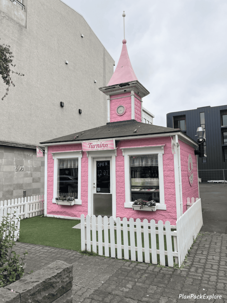
Not interested in driving into the Highlands?
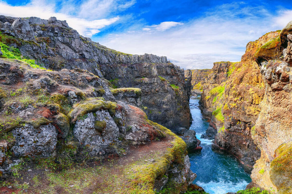
No problem at all! Just follow the Ring Road from the airport or Reykjavik and see some amazing things along the way to Akureyri:
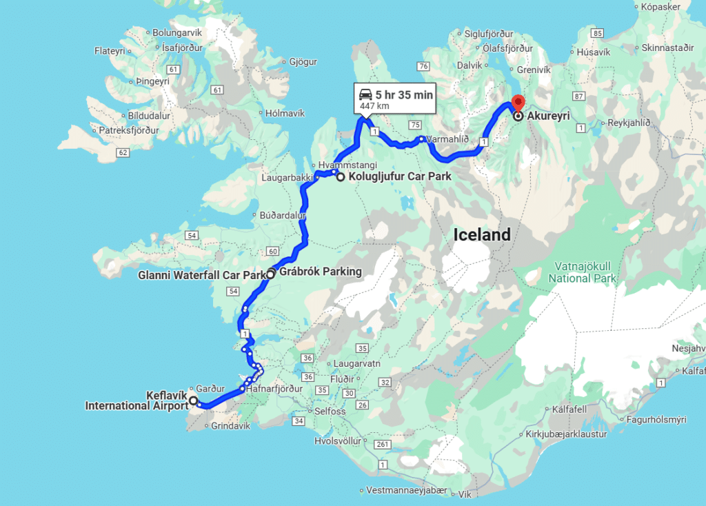
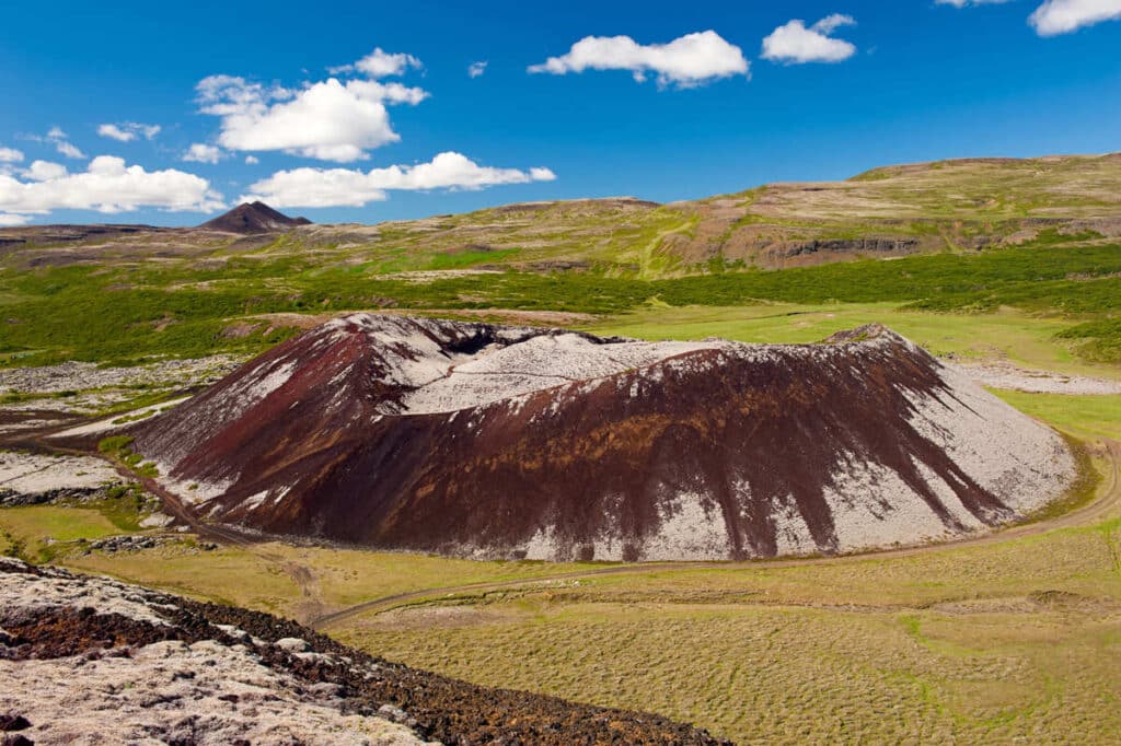
These are some stops worth making along the way:

Day 3: the Diamond Circle
The agenda for the day was the famous Diamond Circle.
Diamond Circle is a 250 km (….miles) long incredibly scenic loop in North Iceland, connecting 4 unique destinations:
- Goðafoss (waterfall)
- Dettifoss (waterfall)
- Ásbyrgi (canyon)
- Húsavík (fishing village)
We had a very ambicious plan to have an early start to our day and SEE IT ALL!
Well… we didn’t see it ALL, but we saw A LOT, almost everything on our list. We started a little later than we wanted due to a very long day yesterday and a very late night, but we had a great time exploring this epic route.

Isn’t it just the best map of the Diamond Circle? We saw it on the back of a campervan in the Dettifoss parking lot.
Our first stop was Goðafoss – a smaller, yet stunning horseshoe-shaped waterfall, also called a “Waterfall of Gods”.

It only took us about 35 minutes to get here from Akureyri.
There are two parking lots for Goðafoss, east and west, connected by a short pedestrian bridge. We parked on the west side first and took the path to the viewpoint. Afterwards, we moved to the east side and went down to the base of the canyon for different views of this beautiful waterfall. You have to brave some crowds here, as the tour buses also stop here, but even crawling with people Goðafoss is a must see!
We spent about an hour admiring Godafoss, then checked out the gift shop, the café – and restrooms!- in the building across the street and headed to stop number two – Dettifoss.
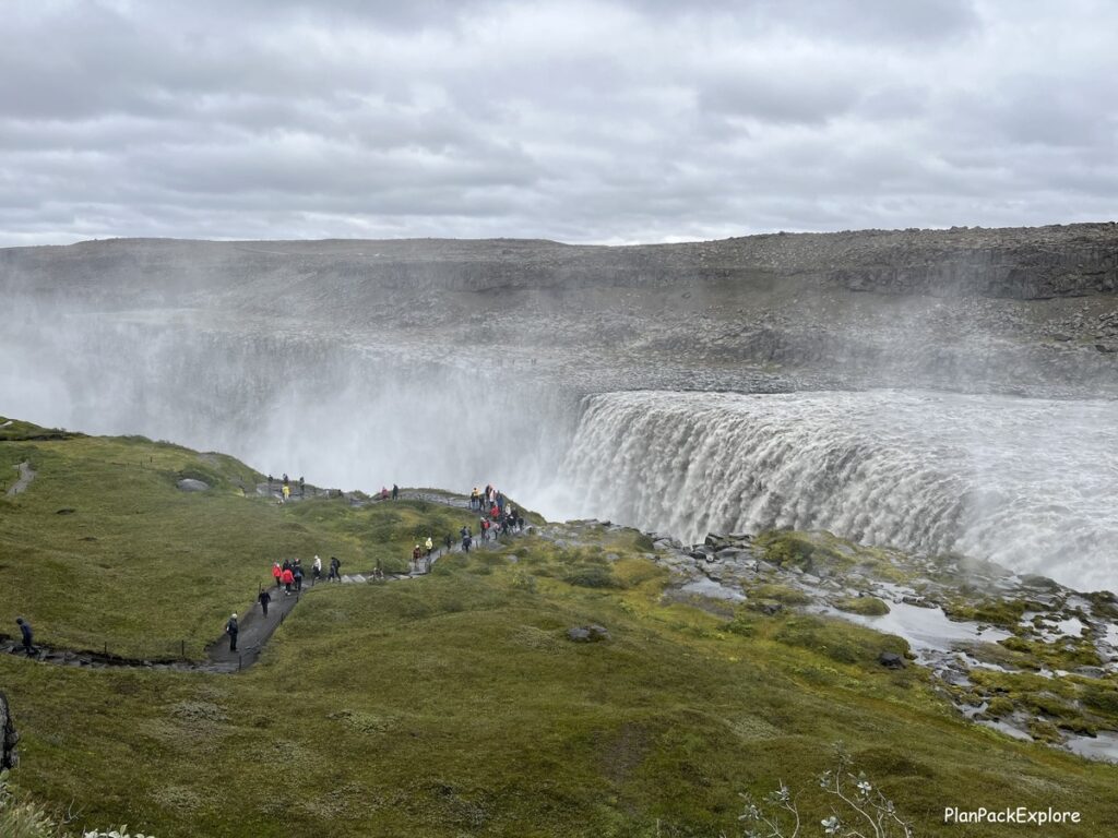
Now, THAT is a powerful majestic beauty!
It also has two different parking lots. The west side is easily accessible by a paved road 862 and has a huge (and again busy!) lot with restrooms. The east side can be reached by an unpaved road 864 which you should only attempt if you have a 4×4 rental car/camper van.
We only went to the west side, as our plan for the day was already pretty full and because of the late night we had yesterday, we started today a little later than we wanted. So, we took the well-marked rocky, but flat path to the waterfall and after about 10-15 minutes arrived at a viewpoint for the roaring Dettifoss. It drops so much water that it churns, and you can get wet (and you will get wet!) just from the mist!
Read “Diamond Circle in North Iceland – a Perfect Itinerary” for more details about visiting both Goðafoss and Dettifoss with photos, videos and a ton of helpful tips.
You can also see the people on the east side, where you can get very close (scary close!) to its top of Dettifoss…
Be aware that it takes about an hour to drive from the west to the east lot, so allow extra time if you want to visit both sides.

On the way back to the parking lot, you can take a short detour to see another waterfall, Selfoss, pictured above, which I wish we did, but we didn’t… For the same reasons why we didn’t go to the east side of Dettifoss – just too little time. Next time for sure! We considered doing that vs Ásbyrgi canyon and in the end Ásbyrgi won.
Ásbyrgi Canyon is a horseshoe shaped green canyon and the third official stop on the Diamond Circle. We first stopped at the Visitor Centre and decided on two trails: The Botnstjörn Pond and the Eyjan Trail. Since it seemed to us that the pond is just a quick stop, we decided to go for the Eyjan first.

We did the entire 4.5 km round trip trail and since we honestly found it just a bit underwhelming, we decided to skip the pond, thinking it would be the same…
Read my full Diamond Circle guide to find out if we made the right choice!
We got back on the main road for our 50-minute drive to Húsavík. You may be thinking “what’s there to see in Húsavík?” Well, for one, it’s an adorable fishing town, known primarily for the whale watching tours it offers.

It is even called “Iceland’s Whale Watching Capital”.
BUT for us, the main draw was… the Eurovision Exhibition at the Húsavík Cape Hotel! You see, we are diehard Eurovision Song Contest fans and saw the “Eurovision Song Contest – The Story of Fire Saga “movie a few times. So going into the “Jaja Ding Dong Bar” and watching all the Eurovision memorabilia inside was a real treat! We all had a blast!

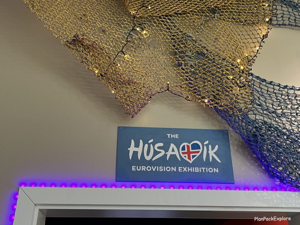
Read a full report from our visit to this fun exhibit in my Diamond Circle detailed guide.
We ended this amazing day with a soak at the GeoSea Geothermal Sea Baths – a fairly new geothermal spa, with hot pools looking right into the ocean.

You feel like you are at the edge of the ocean… And the sunset was spectacular!
Our day was very long but filled with so many fabulous sights that we didn’t even feel too tired – Iceland just doesn’t disappoint!
If you’d rather visit the Diamond Circle with a tour here are some options you may like:
- From Akureyri: Diamond Circle Guided Day Trip with Lunch – this tour covers top Diamond Circle destinations, and a packed lunch is included.
- Diamond Circle Day Tour from Akureyri – this tour will also take you to GeoSea, a beutiful geathermal spa in Húsavík (read more later in the post)
- North Iceland Waterfalls and Nature Baths Small Group Tour – this small group tour combines all the main attractions of the Diamond Circle with other highlights of the Lake Myvatn area.
Where we stayed:
This was our second night at the Saga Apartments in Akureyri.
Day 4: Lake Mývatn area
We started our day by loading the car and taking a quick walk around our street to at least get a feel for Akureyri. We took some fun pictures (see Day 1), crossed the Vaðlaheiði Tunnel again and headed to our next destination – Lake Mývatn area.
There is a 36 km scenic drive on the east side of the lake filled with viewpoints and amazing places to visit.

We chose to go counterclockwise around the lake, making Skútustaðagígar our first stop. It’s a cluster of bizarre pseudocraters formed not by volcanic explosions but by gas explosions when melting lava flowed into the lake.
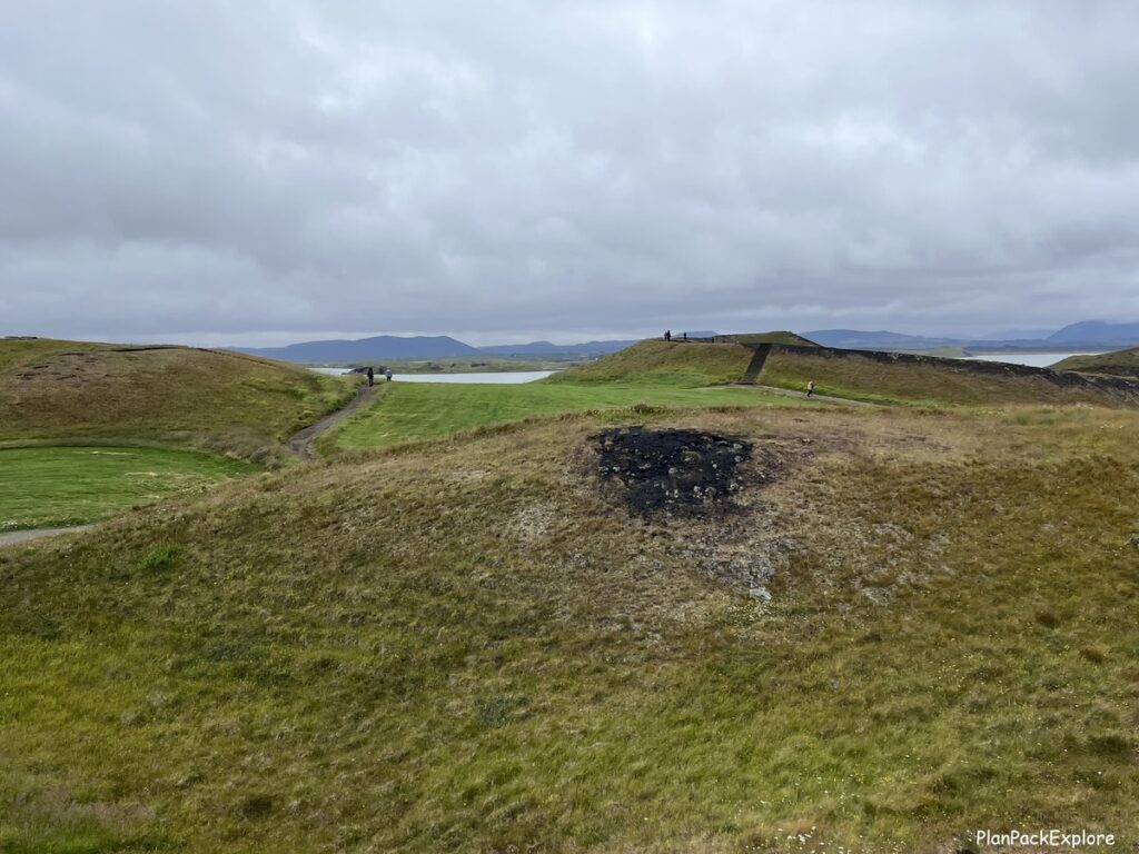
It was about a 1-hour drive from Akureyri. The day was a bit cold and cloudy, but it didn’t rain so we were happy!
And when we got out of the car in the parking lot of Skútustaðagígar we understood right away why Lake Myvatn is also known as the “Midge Lake” – “lake of the flies”. They were everywhere! Swarming around our heads! We started laughing as it was a pretty comical sight, the four of us trying to not let them into the car, while at the same time swatting them away!
But despite the flies (thankfully there were much fewer of them the further away from the warm car engine we got!) and cold weather, we thoroughly enjoyed walking around those unusual structures.
Even though it was cold we couldn’t resist getting ice cream from the little farm shop across the street. We saw the sign and realized that we’ve never actually had ice cream in Iceland! It was sooo yummy! Real milk and berries – you have to try it when you’re visiting the pseudocraters. Remember the name – Skútaís Farm!
We also stopped by the little gift shop and then started driving to the next destination – Dimmuborgir lava field. It was only a 10-minute drive, but we stopped on the way right before the entry to Höfði Park, to take a look at the volcanic structures visible right from the road!
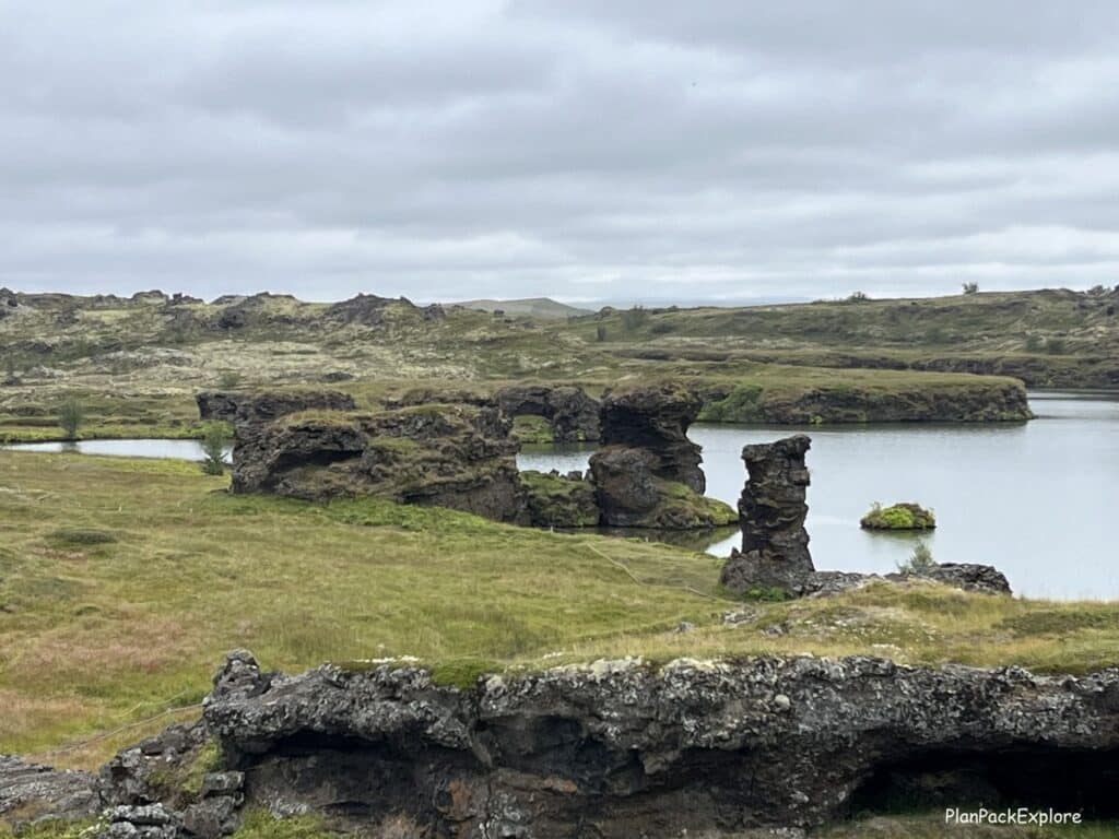
The flies weren’t as relentless here, so we took our time walking around the unique rock formations.
We did not drive into the park itself but went straight to Dimmuborgir.

Dimmuborgir means “Dark Castles” and is a vast lava field with many color-coded walking trails. We followed the red trail to the most famous formation called “the Church” (in the photo above), stopping by the Gatklettur arch and the Hallarflöt cave on the way. This area is associated with many Icelandic folklore tales.
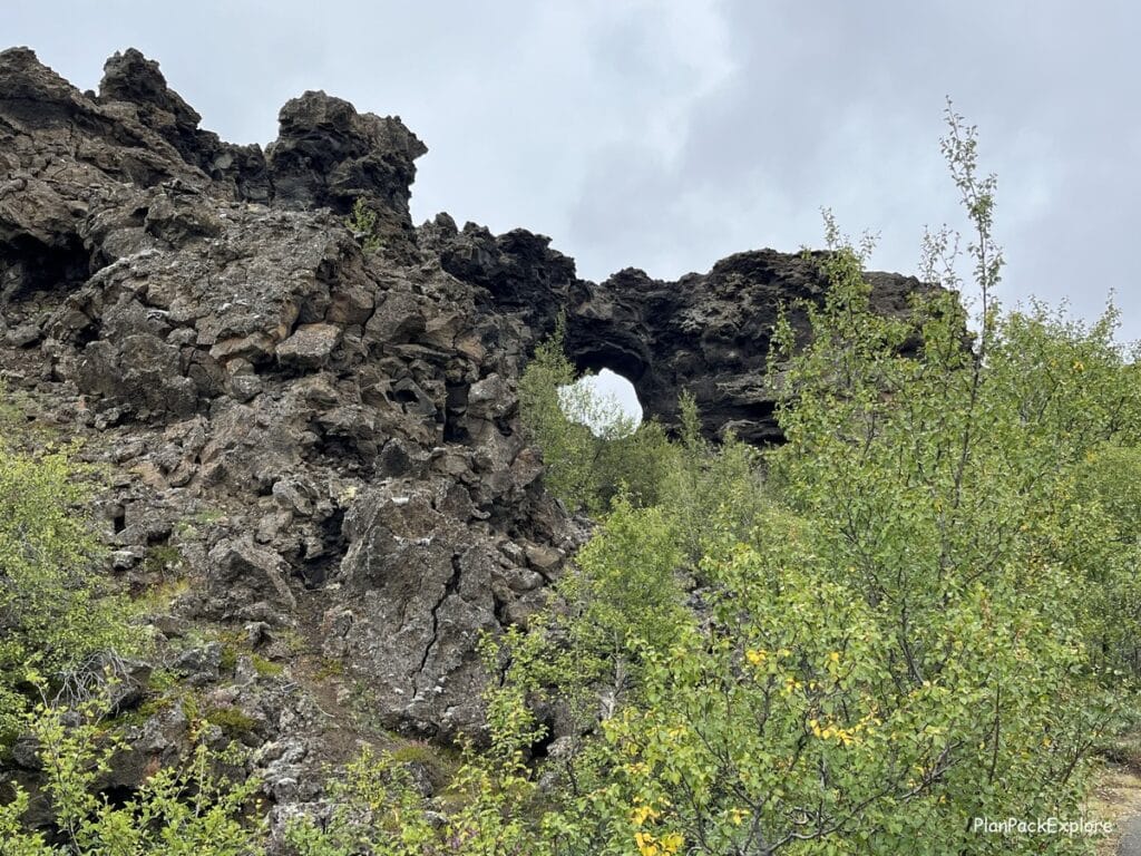

Read my full guide to Lake Mývatn to find out more about this incredible place!
After walking for about an hour or so we left for the next destination on today’s Lake Mývatn agenda – Hverfjall Volcano Crater.

A 10-minute drive, some of it on an unpaved gravel road, got us to the parking lot in front of this massive bare “Cinder Cone”.
We hiked to the top, walked some of the trail around the crater, and of course, peeked inside it! There is no lake at the bottom, but it’s still really cool to see. I felt like I was on another planet!
Next on the route was Grjótagjá Cave – an ancient cave with a geothermal hot spring inside that once was used for bathing.

We scrambled down some rocks into the warm cavern and found ourselves facing a beautiful crystal blue hot pool. It was mesmerizing…

When we came out of the cave, we went to see a dramatic rift that runs through the ground near the cave.
In the background you can see Mt. Námafjall and steam rising from Hverir Geothermal Area – our next and I believe the most popular stop of the Lake Mývatn area.
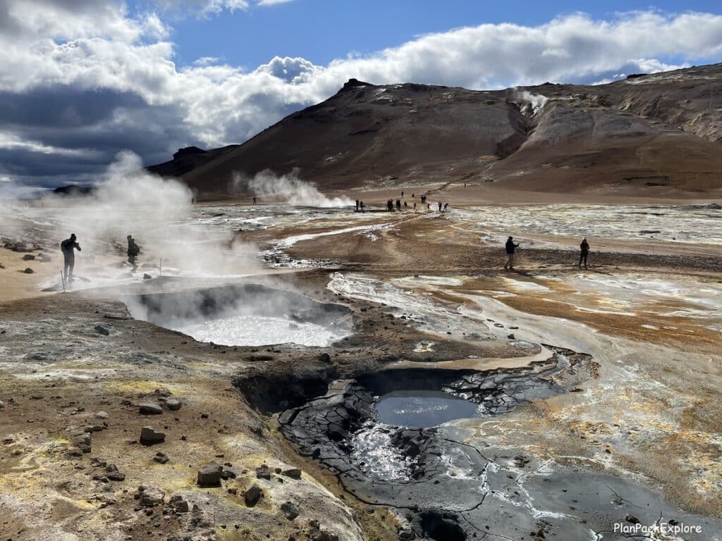
It was only a 7-minute drive from Grjótagjá to the huge parking lot for Hverir/Námafjall. By now the sun decided to come out and the whole area looked phenomenal – golden and rust colored soil stained with vibrant minerals around the steaming vents and bubbling mud pools.
Helpful hint: the sulfur smell here can be A LOT! We’ve been to a few geothermal areas already but here, at Hverir, it’s at a whole different level of intensity! If you’re sensitive to it, you may want to grab something to cover your nose just a little bit to make it bearable.
We walked along the paths (please don’t stray from the marked paths!) taking in the otherworldly landscape and then started our Mt. Námafjall hike for more incredible views of the area.
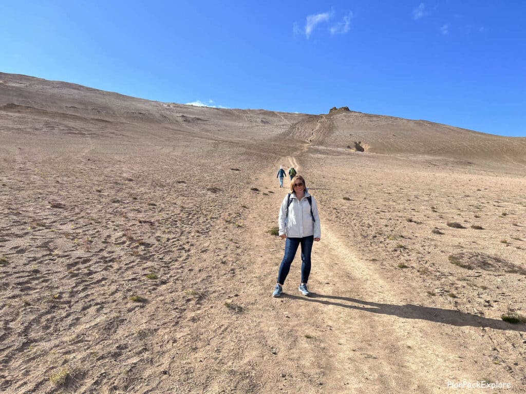
This was definitely the highlight of the day – a very unique area where you can literally feel the geothermal activity under your feet.
Read my detailed guide to Hverir Geothermal Area and Mt. Námafjall hike for helpful information about how to best visit this amazing area + lots of photos and a video to give you a sneak peek before your trip.
By now it was late afternoon and we were tired! After a quick discussion we decided that a soak in a geothermal hot spring was in order for our sore muscles, so we booked tickets for the nearby Mývatn Nature Baths.
There was still time to see one more thing, so we took a short drive to the Krafla Viti Crater.

You will pass the Krafla power plant and a funny lone standing shower head (actually called the “Krafla Shower” as I learned later!) that I wish I took a picture of but we drove by it and there wasn’t a good place to turn around.
We then spent a few minutes exploring the Viti Crater with its gorgeous blue lake
Leirhnjúkur Lava Field is nearby, the parking area only 3 minutes away from the crater but having read that to really see the cool geothermal features there we’d have to hike for a couple of hours we decided to forgo this attraction. It was getting close to our ticket time for Myvatn Nature Baths and we have already seen other lava fields in Iceland so we decided to go straight for the soak.
If you have the time in your itinerary, I’d recommend visiting this lava field – we are definitely adding it to our “must see next time in Iceland” list.
The hot spring was just what we needed after a full day of exploring! The milky blue water of Jarðbödin, as the baths are also known, felt really good.
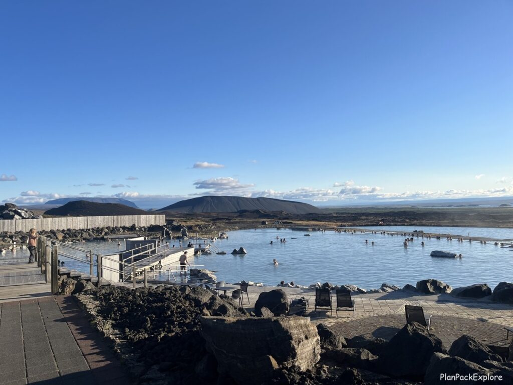
It does have a slight sulfur smell to it, so if you’re sensitive to it (like my son, who by then just about had it with the rotten eggs aroma!), you may not enjoy this place as much. Overall, for us it was a lovely end to a long day. The sun was still out and the surroundings were very relaxing.
If you’d rather explore the Lake Mývatn attractions with a guided tour, there are plenty of great options – most departing from Akureyri. Here are a few very well reviewed tours you may like:
- From Akureyri: Lake Mývatn Guided Tour with Lunch – this tour will take you to some of the main attractions of the area and includes lunch and admission to Mývatn Heritage and Nature Museum.
- From Akureyri: Myvatn Lake, Craters, & Waterfall Tour – includes some of the main stops of the lake area and a visit to Goðafoss waterfall.
- Lake Mývatn Classic Tour from Akureyri – this tour will take you to the main sites around the lake and also to Mývatn Nature Baths to relax after a day of sightseeing.
Where we stayed:
We drove about an hour to the Möðrudalur farm, where we spent the night. It was an unexpectedly magical place.
Read my full article on Fjalladýrð/Möðrudalur to find out why!
It’s a true hidden gem that is absolutely worth exploring!
To book an overnight stay, which I highly recommend, click here.
Day 5: Möðrudalur to Höfn (+ Stuðlagil Canyon and Vestrahorn)
This was definitely the longest driving day of the entire trip. But don’t let that discourage you – the drive is beautiful with plenty of captivating stops to take a break, go for a hike or a soak in a lagoon!
We left Möðrudalur in the morning – later than we planned but we had so much fun at the farm it was really hard to leave!
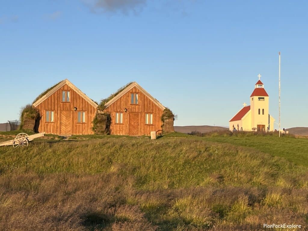

Read my full guide to Fjalladýrð/Möðrudalur and see for yourself why it’s such a special place!
Our first major stop of the day was Stuðlagil Canyon.
From Möðrudalur you can get there by following gravel rt. 901 (the same road that got us there the day before) before you reach rt. 1 or by rejoining rt. 1 right away which is slightly longer but smoother. We chose the latter option and after about an hour of driving we got to the canyon, the last 15 km on the unpaved rt. 923.
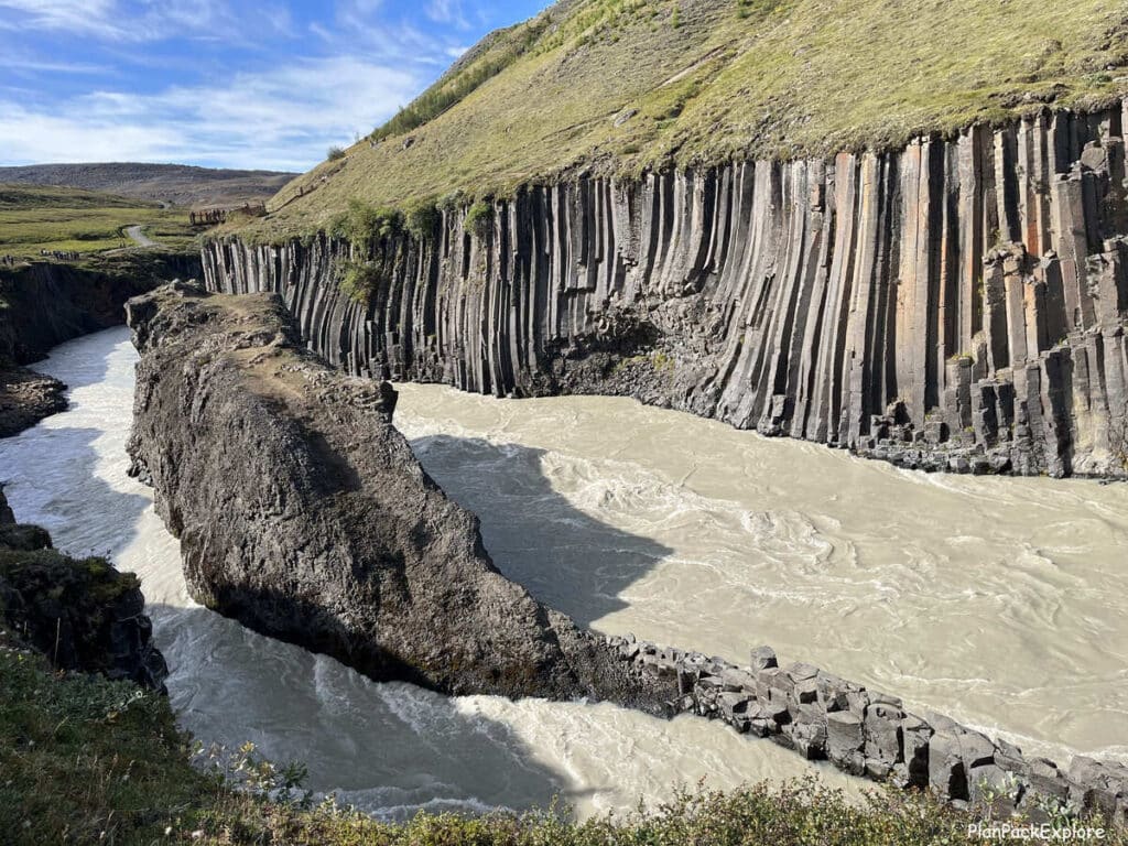
The day was gorgeous with sunshine and clear skies, and we really enjoyed the 20-30 minute easy hike to the canyon, shedding layers as we went 😊
The canyon was as breathtaking as we saw on pictures before the trip, except for the color of the water. Despite the sunny day, the water wasn’t blue, it was actually kind of brown… It all depends on the time of day and how the light hits the water, but – Stuðlagil Canyon is fantastic regardless!
Read my detailed guide to Stuðlagil Canyon with all the tips on how to get there, where to park and what to put in your GPS to make sure you get to where you’re supposed to be!
All in all, including the hike we spent about 3 hours here, and after a quick lunch in the car, we drove another 50 minutes to Vök Baths located on the outskirts of Egilsstaðir. Our initial plan was to actually soak and rest but we decided we didn’t have enough time for that, so we just walked in to take a look.
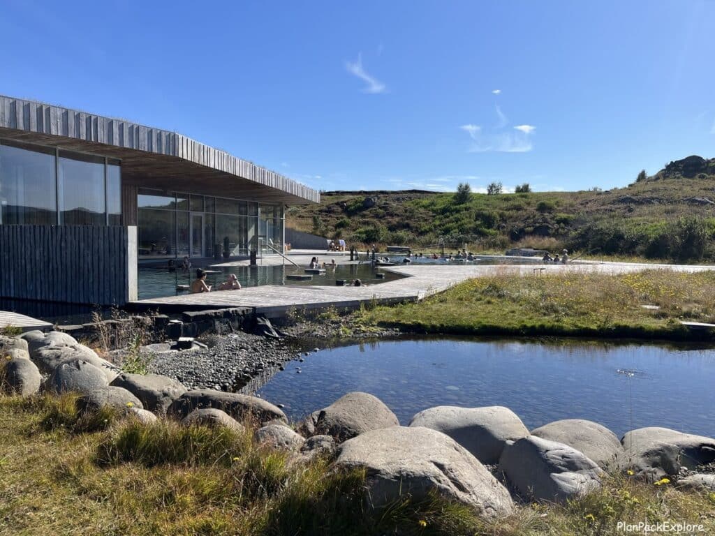
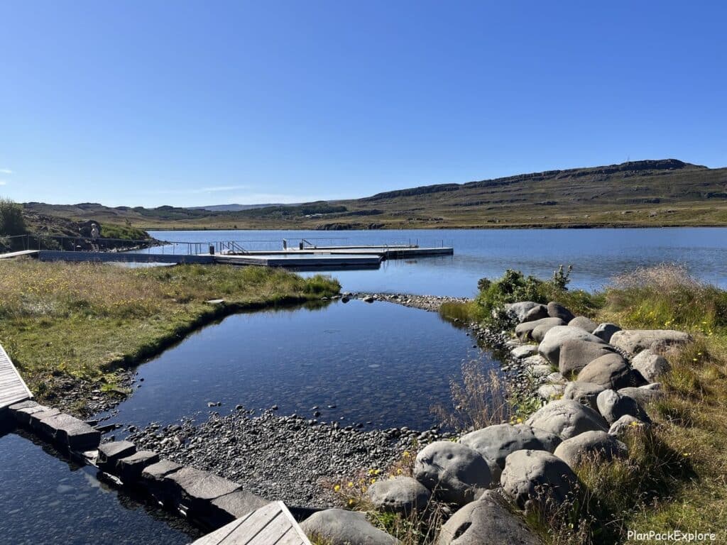
It is a really nice place. The one-of-a-kind floating pools are set right on the lake (you can actually take a swim in the cold lake and hop right back into the warm waters of the geothermal pools!).
It’s modern, clean and has this peaceful aura about it that makes you just want to stay… And with your admission ticket you get access to the tea bar in the lobby, where you can brew herbal tea with Vök’s geothermal water (approved for consumption!).
After a quick stop at our favorite grocery store in Iceland, Bónus, we got back on the road.
This is where you want to pay attention!
There are two ways to get to Höfn from Egilsstaðir: rt 1 (the Ring Road) or a shortcut called the Öxi Pass (rt. 939).
If you put Höfn in your GPS as the next stop, in the summer months it will automatically direct you to a shortcut via rt. 95 and rt. 939 – the infamous Öxi Pass. Öxi Pass, also known as Axarvegur, is a 20 km (12 miles) narrow, winding, gravel mountain pass with steep inclines and drop offs at times and mostly no actual guardrails (unless you count the yellow road markers), so not for the faint of heart. It’s also known for the fog, reducing visibility.
It does shorten the distance between Egilsstaðir and Djúpivogur by 71 km (44 miles), which translates to about 45 minutes of drive tome, however unless you have good weather, a 4×4 vehicle and nerves of steel, I’d stick to the Ring Road 🙂
The split happens right after you pass the Bónus store in Egilsstaðir (driving from Akureuri) or right past Djúpivogur (driving from Höfn). We didn’t pay attention and ended up on rt. 95, luckily only for a few minutes… Then I realized the road is way too narrow to be rt. 1, so we turned around. It cost us some additional time but saved us from a stressful drive!
Helpful tip: If you want to make sure you stay on rt. 1, put one of the coastal towns, like Reyðarfjörður as your stop before Djúpivogur and then GPS will keep you on the Ring Road. Don’t remove this stop from Google Maps navigation till you’re way past the point where it would keep telling you to turn around!
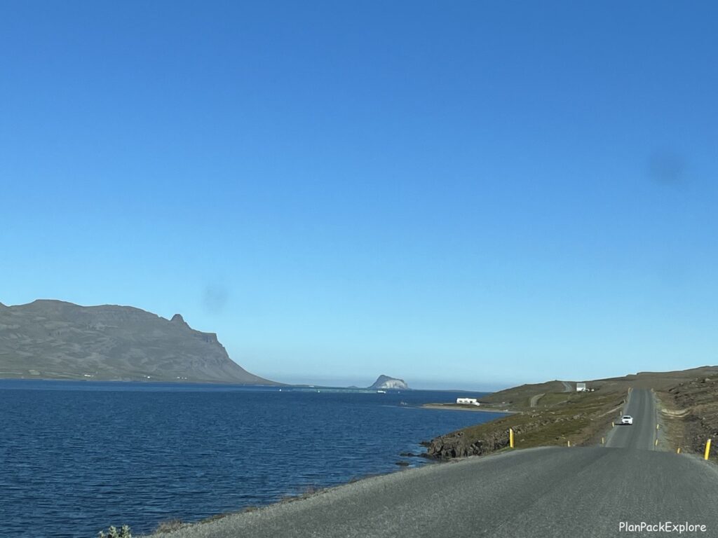
With our little detour it was about a 2.5-hour drive to Djúpivogur on the Ring Road and the closer we got to the ocean, the more picturesque the drive became. Of course, having a blue-sky day made the views even more captivating.

We stopped at Eggin & Gleðivík in Djúpivogur, a tiny coastal village, to stretch our legs and to see the famous egg sculptures.
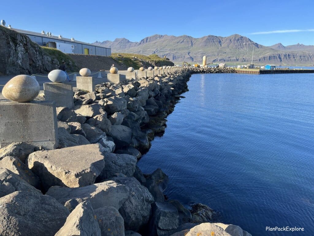
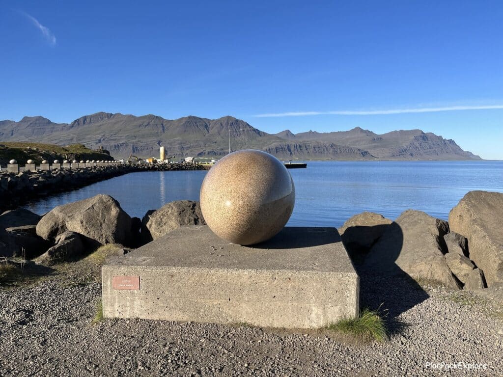
The giant granite eggs (also known as “The Eggs of Merry Bay”) are set on concrete pillars (remnants from an abandoned fish factory) along the waterfront and represent 34 bird species native to this area. The largest egg is the red throtted diver – the official bird of Djúpivogur.
It’s a quick fun stop to break up a long drive!
Our next “big stop” for the day was Vestrahorn and Stokksness Beach, about 1.5 hours away, but on the way we did a quick stop at Hvalnes Nature Reserve Beach – another beautiful area… I wish we had more time to take a stroll on the beach! As we drove on, we saw many swans just resting on the shore.
About 15 minutes before reaching Vestrahorn we spotted Iceland’s Big Red Chair!
I’ve seen it mentioned here and there as a kind of “curiosity”, but no one really described where it was. Well, we found it! And it actually has its own Google Maps location, which I didn’t realize – just type in “Red Chair, Höfn, Iceland”
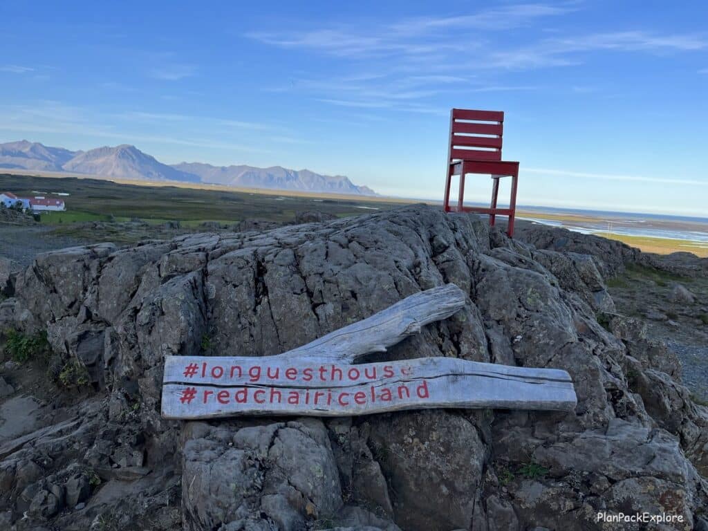
It’s just a chair on a pile of rocks but it was another fun stop on a long drive.
By the way, don’t try to sit on the chair – it’s not secured to the rock!
And then we finally arrived at Vestrahorn – a famous distinctly shaped saw-tooth mountain, best visible from Stokksness Beach.
After we turned (quite sharply) from the Ring Road, a winding track took us down to the parking lot and the Viking Café.


It’s private land so we paid a fee of 900 ISK per person then were free to explore. We drove to the farthest parking area (closest to the ocean) and walked down the signature black sand dunes with the spiky grass clusters, down to the beach.

On a clear day, if the water is still, the mountain will reflect in the water, creating a spectacular sight, one that this particular beach is most famous for.
We then moved the car to the parking lot closer to the abandoned Viking Village, which was built as a set for a movie that was never actually made. It was still a lot of fun to see it.
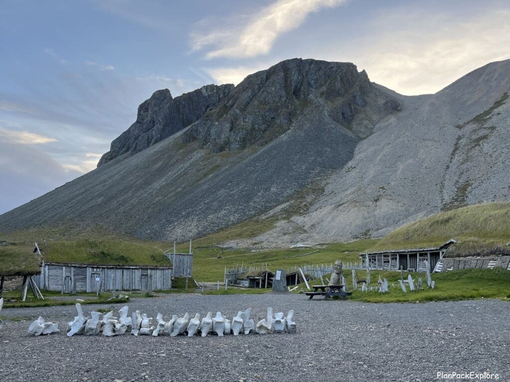
Read more about this incredible place: How to visit Vestrahorn and Stokksnes Beach.
This was a REALLY LONG DAY!
You can easily split it into 2 days if you prefer a slower place. That way you can enjoy some more time at Möðrudalur, visit Stuðlagil Canyon and enjoy a nice relaxing soak in Vök Baths the first day. Spend a night in Egilsstaðir and continue to Höfn the next day. That will give you plenty of time to explore Hvalnes Nature Reserve (and stop by the nearby Fauskasandur Black Beach) and get to Vestrahorn before it’s too late in the day. You’d also have time to visit Breiðdalsvík – a charming fishing town with “The Old General Store” (“Kaupfjelagið”), where you can check out the original 1950s décor, buy local merchandise and also grab a cup of coffee and some cake (the store doubles as a café!)
Where we stayed:
We spent the night at Hótel Jökull in Höfn – great views, nice spacious room and breakfast was included.
Helpful tip: plan your meal stops wisely! Keep in mind that restaurants close early in Iceland, so if you will be arriving late (like we did!) I strongly suggest you eat on the way! We got to Hótel Jökull just after 9 pm, hungry and tired only to find out the hotel restaurant was already closed and there was only one place in the entire village of Höfn still open. On a recommendation from the super helpful hotel staff (thank you!) we rushed to a small diner, called “Hafnarbúðin”, only to find a really long line of hungry tourists… We were lucky enough to place our orders before the line was closed. 30 minutes later (yes, definitely not fast-food!) we had our burgers, and they were delicious! It was 10:30 pm …
Day 6: Glacier lagoons, Vatnajökull glacier ice climbing
We started the day with a really nice breakfast at Hótel Jökull. They even had cod liver oil and shot glasses for those who really wanted a health boost for the day! I can absolutely recommend it as a great place to stay in Höfn.
Then we drove about an hour to Jökulsárlón Glacier Lagoon. The drive itself was just beautiful… We had another sunny day and the volcanic landscapes with the glaciers in the distance were breathtaking.


The lagoon itself is also something not to be missed! It’s filled with pieces of icebergs, floating or travelling down to Diamond Beach. You can see the beach if you look towards the bridge, just across the street from the lagoon. We were lucky and saw a piece of an iceberg breaking off – a loud groan alerted us to it. We saw it flip and float away. Pretty amazing!
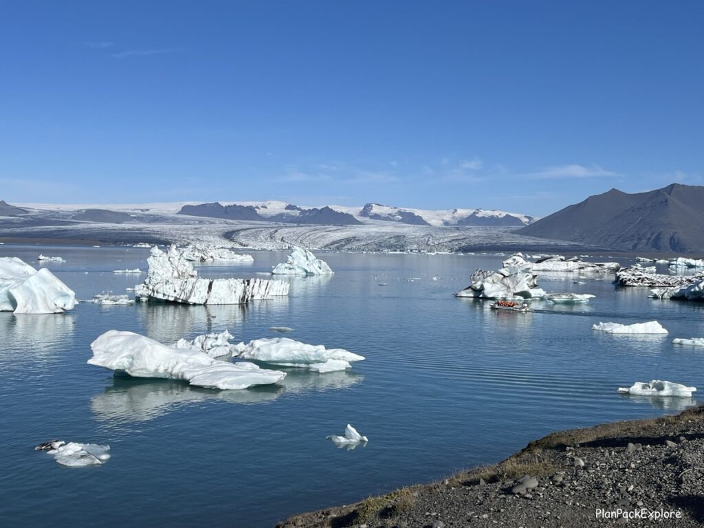
You can book a boat tour around the lagoon or a kayaking session.
We chose the smaller Fjallsárlón Lagoon for our tour – more on that a little later in this post.
For more information about glacier lagoons and a full report from our zodiac boat ride read my “Ultimate Guide to Visiting Glacier Lagoons in Iceland” – complete with photos and videos to give you a glimpse of what you can expect!
Diamond Beach is also spectacular! It’s everything you read about in the guidebooks – the crystal-clear ice pieces really do look like diamonds against the black sand! We had a blast exploring it and taking photos!

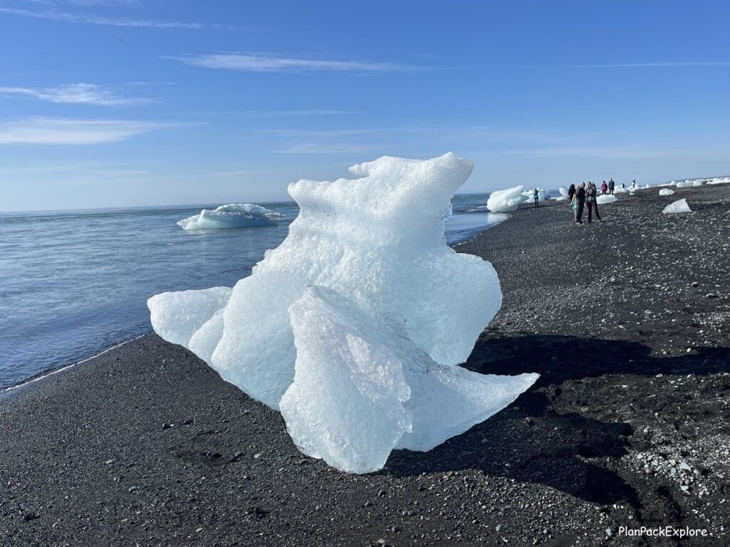
Helpful tip: The parking lot for the lagoon and the two parking lots for Diamond Beach only require one parking fee. Pay via parka.is app or at the pay station in the main Jökulsárlón Lagoon lot.
From here it was only a 15-minute drive to Fjallsárlón Lagoon, where we had a Zodiac Boat Tour scheduled. After checking in we were given big warm jackets and floatation vests, and we were ready to go! I can’t recommend this boat ride enough! We had a phenomenal guide, giving us a lot of information about the glaciers and lagoons. He was also very friendly and made sure everyone was safe and had fun.
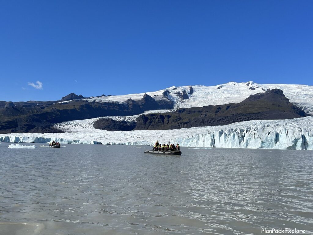
The boat ride was about 45 minutes long.

You even get to hold a piece of the iceberg!
There is a small bistro here, called the “Frost Restaurant”, serving soups, sandwiches, drinks and desserts from 9:30 am to 4 pm, but we planned our own lunch for today…
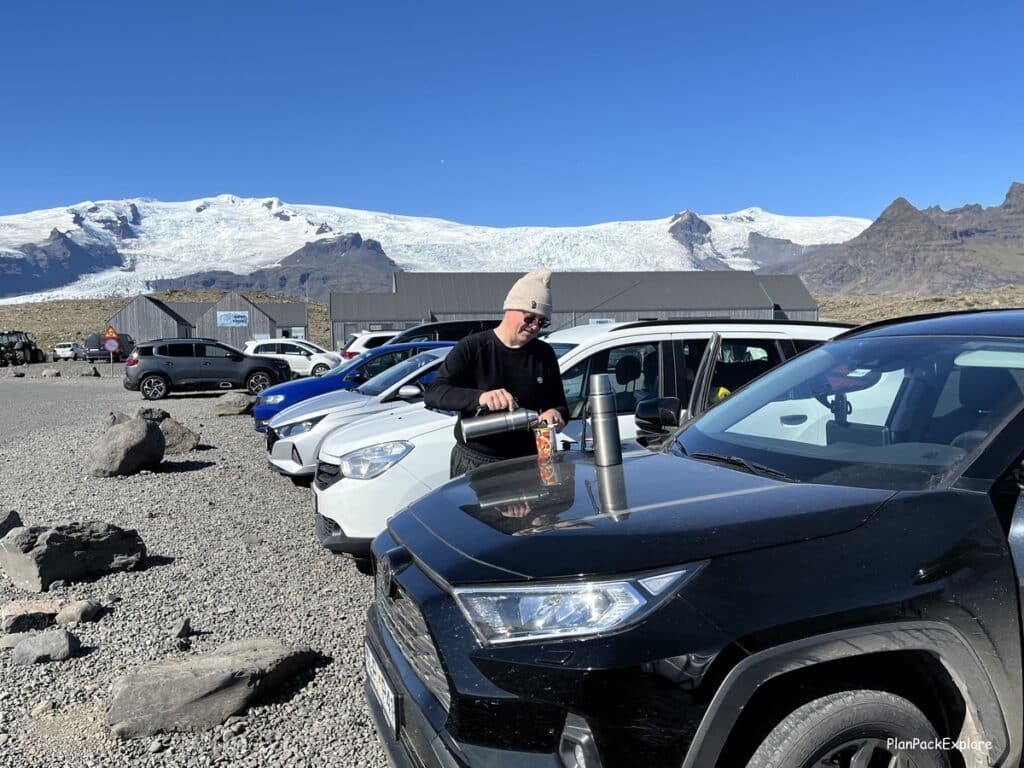
…which we ate right in the parking lot!
Now we were ready for the big event of the day – ice climbing on the Vatnajökull glacier!
The meeting point for the tour was Tröll Expedition Skaftafel – a large parking lot, easily accessible from the Ring Road. From the parking lot of Fjallsárlón lagoon it was only a 25-minute drive.
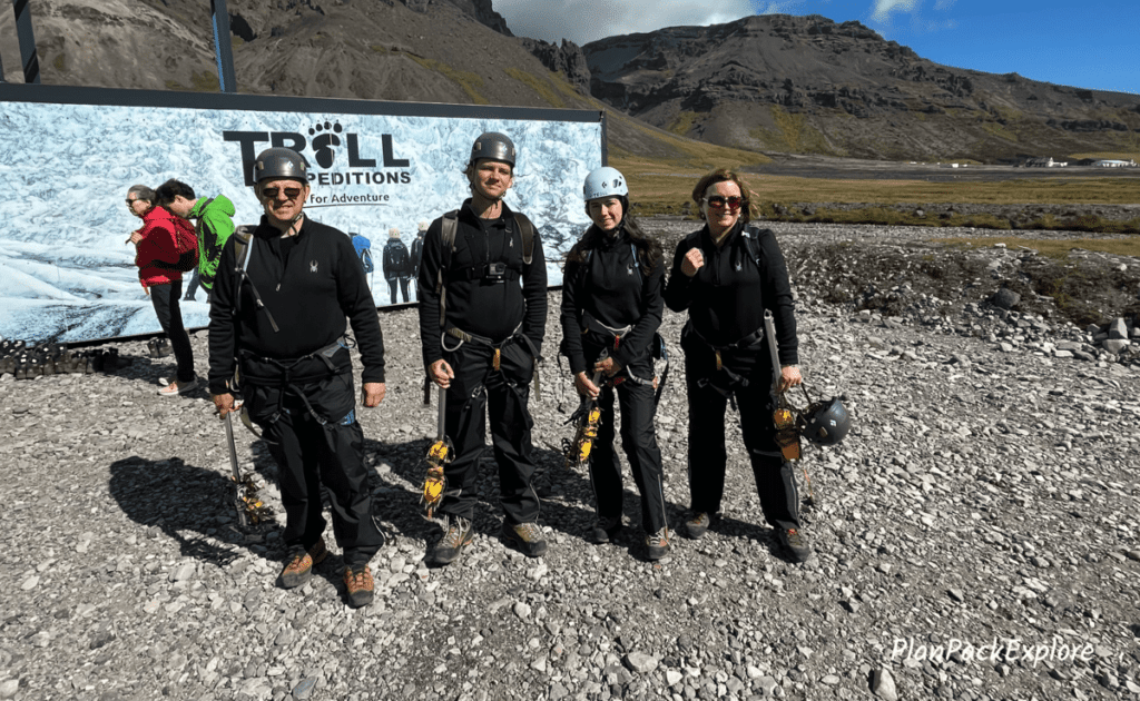
Once we checked in, we got our equipment – helmets, harnesses, ice picks and crampons. We were also given special ice climbing boots.
Then we got on the bus and drove to the glacier area, probably about 15 minutes. Once there, we were split into appropriate groups and took off with our guides. The hike was not that long and relatively easy. Finally, we reached the area where we put on our crampons, and we started walking on the glacier.

It looked different to me than Solheimajökull glacier (which we hiked the year before) – less blue, more ashy, not as flat, but equally amazing. After we reached our climbing spot, we got a quick tutorial on the basics of ice climbing with a demonstration.
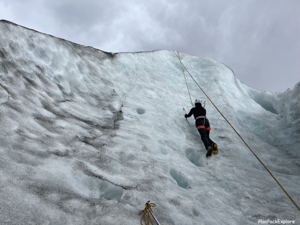
Then it was show time!
You don’t need any prior experience (we didn’t have any), and it was so much fun!
READ MORE: Best Glacier Hikes in Iceland – Top Tours + Tips for a Great Experience.
Then we hiked back down, and the bus brought us back to the base. We realized that over 4 hours had passed, and we barely noticed! This was a really great experience, and I highly recommend trying it!
READ MORE: How to visit glaciers in Iceland – need to know facts, safety tips and best tours.
A little side note:
We also realized that we were hungry, and food options were scarce in that area – it really is in the middle of very beautiful nowhere! We had a choice of backtracking 15 minutes to the Fosshotel Glacier Lagoon restaurant that was closing soon (it was about 7 pm then) or keep going towards our guesthouse and hope for a gas station and some hot dogs. Well, our prayers were answered!
Put a big star next to the name “Freysnes” – it’s a little restaurant (Veitingasala Restaurant) inside the Orkan gas station about 10-15 minutes from Tröll Expeditions Base, as you’re heading towards Vik.

Located across the street from Hotel Skaftafel, it’s open till 8:30 pm and serves absolutely delicious food at very reasonable prices. We had soup and burgers, and my kids still talk about them!
There is also a little gift shop there and a small grocery section with some basics. And restrooms, of course! A real treasure on the Ring Road!
Before we got to our guesthouse, we spotted the ruins of Skeiðará Bridge. Our glacier guide was telling us about how the eruption of Vatnajökull volcano in 1996 caused the destruction of the bridge.
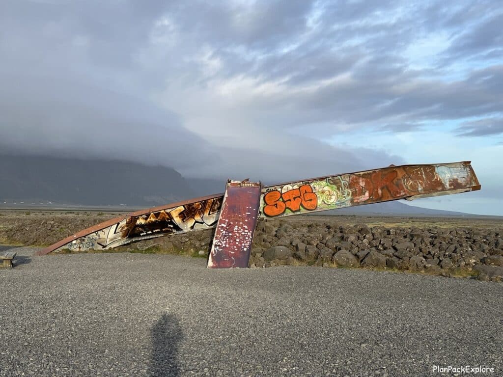
Where we stayed:
We spent the night at Selfell Guesthouse in Kalfafel (about 45 minutes from Tröll Expeditions Skaftafel parking lot) – very comfortable little house, had everything we needed.
Alternative activities:
If you’re not interested in ice climbing on the glacier, you can do a glacier hike which is just as awesome – remember – glaciers are shrinking at an alarming rate – experience them while you can!
But if this isn’t something that fits your itinerary, there are other equally fun options:
- You can still see the glacier and get quite close to it by doing a quick easy 30-minute hike from Skaftafel Visitors Center (about a 40-minute drive from Fjallsárlón Lagoon, heading towards Vik). While there, you can also hike to another fabulous Icelandic waterfall – Svartifoss. It will ease the schedule for the next day (Day 7) and allow for a more relaxed pace.
- You can book an afternoon Puffin Watching Tour at Ingólfshöfði – it’s an amazing experience that we squeezed in last minute into our already packed plan for tomorrow (Day 7). I guess that’s what happens when you keep on researching after your plan is supposedly finalized! 😊
More information: Best Places to Visit on the South Coast of Iceland.
Day 7: Ingólfshöfði Puffin Tour, Svartifoss waterfall, Fjaðrágljúfur Canyon, Dyrhólaey Cliffs
Another busy day ahead of us!
It started off a little drizzly, but we weren’t too worried. We had to backtrack a little (about 50 minutes) to get to the meeting spot of the first attraction of the day – the Ingólfshöfði Puffin Tour. Like I said earlier – that’s what happens when you keep on researching after your trip and all the reservations are finalized!
We squeezed this tour in and what a good idea it was! It started with a one-of-a-kind tractor dawn wagon ride across the marsh to the Ingólfshöfði nature reserve. Then we hiked up a black sand dune and found ourselves on top of Ingólfshöfði promontory.

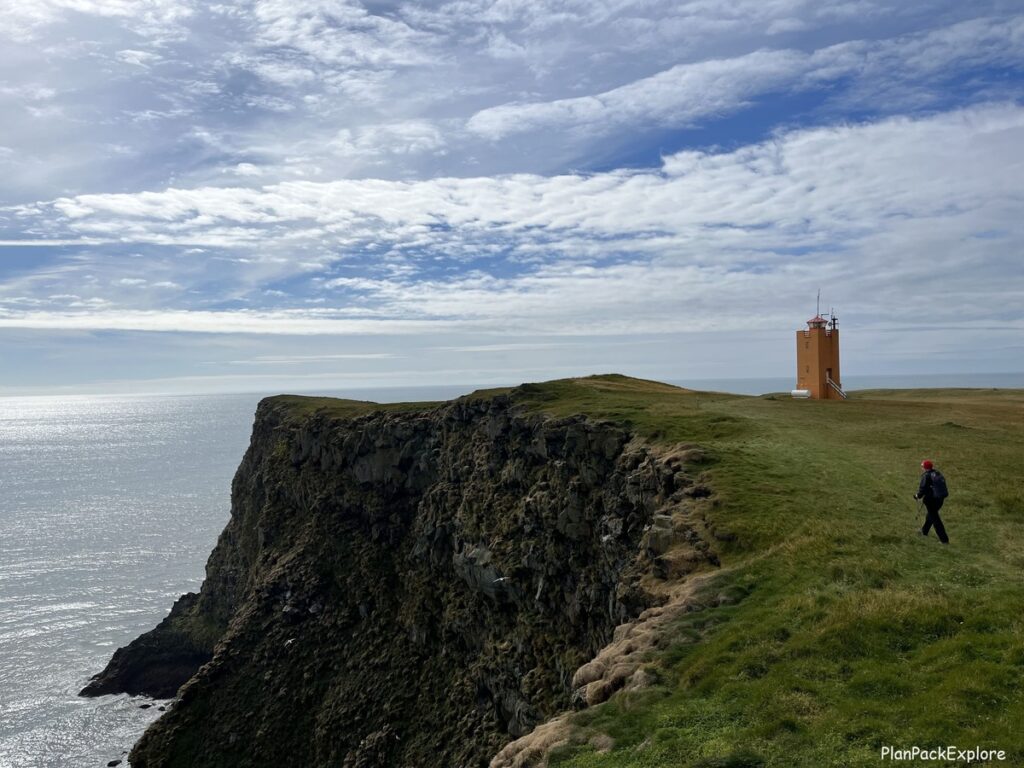
The views were just breathtaking, especially that the sun came out and made the whole experience even better! The cliffs are a major nesting site for puffins, but also other kinds of birds, like skuas.
Our guide Matta was fun and full of facts and information. We did see puffins also, however at the time of our tour they were mostly at sea, so Matta set up her telescope and we saw them just chilling on the water through the lens. To some it might have been disappointing, but to us the whole experience was just magical, puffins or not.
READ MORE: Ingólfshöfði Puffin Tour – an Adventure in South Iceland.
Note: we did see puffins up close later today at Dyrhólaey Cliffs – read on!
Our next stop was Skaftafel Visitors Center (“Skaftafellsstofa”), where the trailhead for the Svartifoss waterfall is located – the next hike on today’s agenda. It was a 25-minute drive back on track towards Vik. The parking lot was huge and very busy, but we found a spot.
The Visitor Center is also huge and has restrooms, a gift shop and a café.

It’s a start point for some great hiking trails, two main ones being the Svartifoss waterfall and the Skaftafellsjökull glacier viewpoint.
We decided to do the waterfall hike first. Svartifoss waterfall is unique for being nestled in an oval cove made of black basalt columns. It is said to have been an inspiration for the design of the Hallgrimskirkja in Reykjavik.
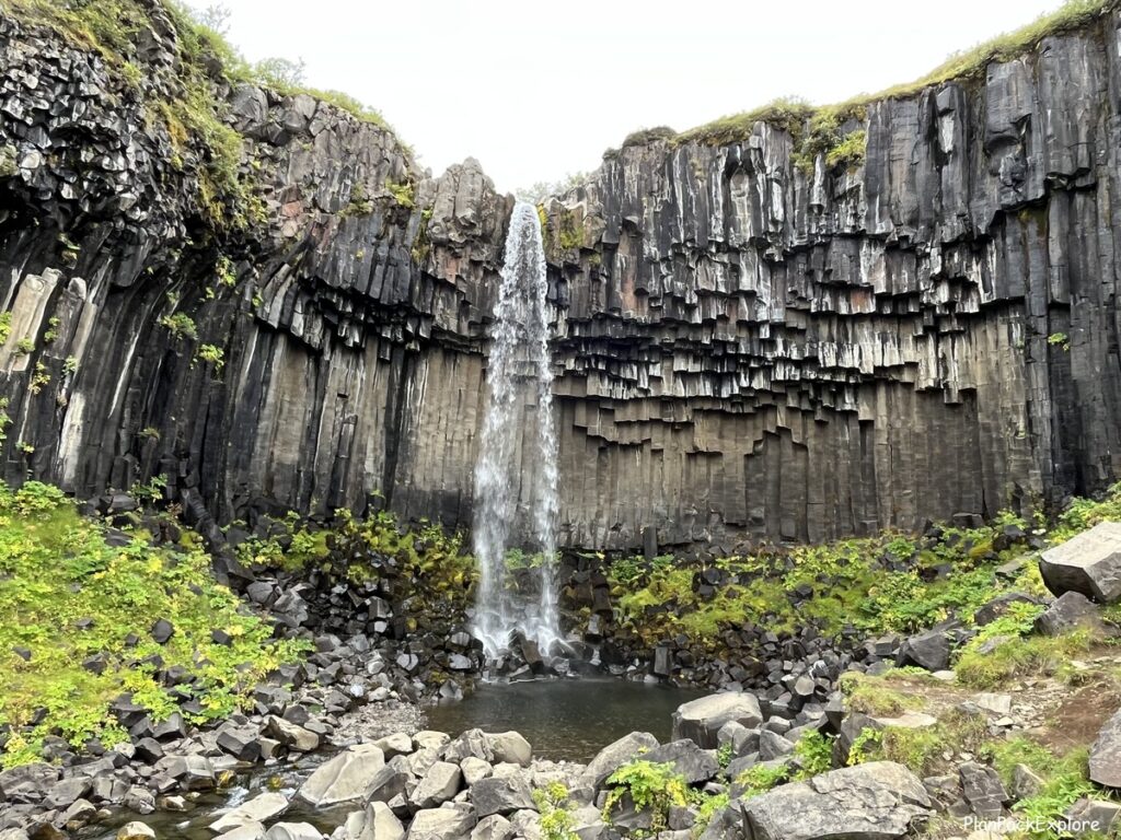
The hike to the viewing platform took us about 45 minutes and then you have an option to either head back the same way you came or continue over the bridge in front of Svartifoss to hike a longer trail.
We took the first option and retraced our steps.
We also decided to skip the short easy walk to get close to the Skaftafellsjökull glacier wall, since we hiked and climbed this very glacier the day before, but if you haven’t had a chance to see a glacier up close yet, I’d definitely recommend it!
Update 2024 – I did hike to Skaftafellsjökull glacier during my recent trip to Iceland. Read about the hike and other fun ways you can experience glaciers in Iceland in THIS GUIDE.
The next “big thing” on the list today was the Fjaðrágljúfur Canyon, but first we made a few other quick stops on the way.
Driving from the Skatfatel Visitors Center towards the canyon we passed by Lómagnúpur – a majestic looking mountain with a flat top, easily noticeable from the Ring Road. It towers over the nearby Núpsstaður Farm.
About 20 minutes later we came across the parking area for Dverghamrar Cliffs – hexagonal basalt rock formations, creating a picturesque horseshoe shaped canyon.
Read more about these places and other amazing things to see on the South Coast of Iceland (+ maps, tips and photos!)
Now I must mention the stop that we didn’t make – we honestly simply forgot, just drove on straight to Fjaðrágljúfur Canyon after taking gas at the Kirkjubæjarklaustur N1 station without stopping at Kirkjugolf National Monument. It’s also known as “The Church Floor” and it’s an area of what looks like hexagonal tiles, hence the name. These tiles are actually ancient basalt stone formations. Another “must return to” item on our list!
We finally arrived at the parking lot for Fjaðrárgljúfur Canyon, located on rt. 206, just off the Ring Road.

A very well marked slightly uphill path led us to multiple viewpoints, the first one only after about 5 minutes of walking. The canyon is breathtaking – lush green moss-covered walls, standing tall around the meandering Fjaðrá River – gorgeous!
The entire hike is about 2 km long and it’s totally worth it to get to the very end, where the last viewing platform literally hangs over the river.
READ MORE: Fjaðrárgljúfur – How to Visit Iceland’s Fairytale Canyon
We got back to the car tired but soo happy!
It was getting late, but we decided to try to see the puffins at Dyrhólaey Cliffs before heading to our guesthouse. The best decision of the day!
We arrived at the main viewpoint area around 7:30 and saw a group of people congregated in one spot, not far from the parking lot. As we were getting closer, we knew – there were puffins there!
It was all we could do not to run! We were told by our awesome tour guide from this morning that puffins are pretty chill and used to people but spook at sudden movements and loud noises.
So. Many. Puffins!!!

Just sitting there on the grass, fluttering their wings, almost posing for pictures!
This was cherry on top of the VERY LONG and absolutely amazing day!
READ MORE: 5 Best Places to See Puffins in Iceland.
Now we were ready to get to the guesthouse and REST!
Where we stayed:
We spent the night at Prestshús 2 Guesthouse in Vik. It was a charming farmhouse with super nice owners and a couple of very friendly dogs. Loved it!
Day 8: Vik, horseback riding, Seljavallalaug Pool, waterfalls of the South Coast
Today started with a horseback riding tour. This was something we tried last year for the first time and we fell in love with Icelandic horses, so per my daughter’s request we came back for a beach ride.
We booked a tour with Vik Horse Adventure and it was great – about an hour-long ride on Vik’s scenic black beach on super friendly Icelandic horses. We walked and then tried the Icelandic gait “tölt”. We even crossed a small stream!


I will say that in the end we wished it lasted a little longer – that hour went by really fast.
After the ride we drove a short distance to the famous Vík í Mýrdal Church – a beautiful Icelandic white, red roofed church, set on a hill with wonderful views of the coast and Reynisfjara Black Beach sea stacks.
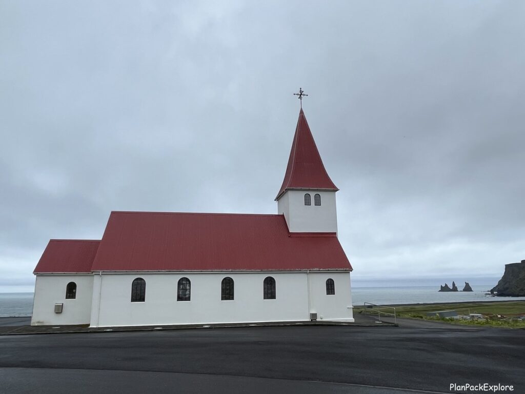
Next, we had delicious coffee and muffins at the nearby Skool Beans Café – a unique, quirky, and very cozy café set up inside an old yellow school bus! Definitely go check them out!

READ MORE about what else you can do in Iceland’s southernmost village in my guide to the best things to do in Vik!
After our snack we headed for the next stop – Seljavallalaug Swimming Pool – one of the oldest swimming pools in Iceland. It was a 40-minute drive to the parking lot and – typical for Iceland – the scenery was just beautiful, despite less than perfect weather.
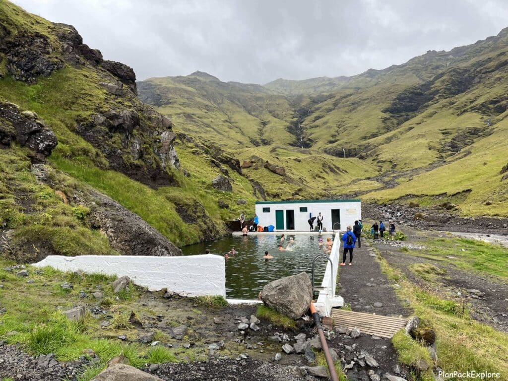
We parked by the farm and hiked for about 20 minutes through a gorgeous green valley, on a well-defined path along the riverbed. It was a fantastic easy hike and the misty, cloudy weather added to the mystical feel of the whole experience.
All of a sudden you come to the pool – peaceful, standing alone next to a basic changing room, in the middle of nowhere – absolutely amazing! There were actually quite a lot of people swimming, so we just hung out for a bit, rested, explored the river a little past the pool and walked back.
Read my full photo guide for everything you need to know about visiting Seljallavaug Swimming Pool.
This was the day with a lot of short easy hikes on our list, the next one being Kvernufoss waterfall. The trailhead for it is located only a couple of minutes away from the well-known Skógafoss waterfall, right next to the Skógar Museum, but many people still don’t know about it, so it’s a true hidden gem!
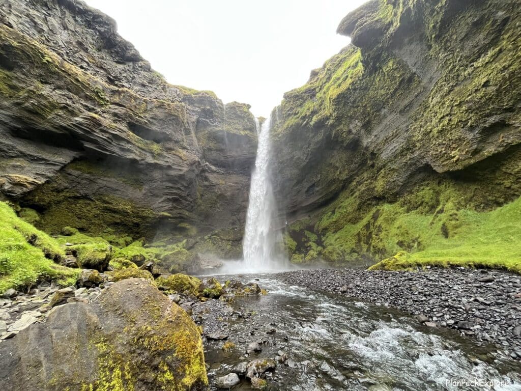
The hike was easy (about 20 minutes), through another breathtaking green valley.
Kvernufoss is another waterfall that – like Seljalandsfoss- you can walk behind! Much smaller, but still amazing when you stand in the cavern behind the crushing water…
We didn’t visit the museum but stopped by the Visitor Center inside. There is also a café there, and restrooms.
We also stopped by Skógafoss waterfall again (we visited it last year), and Solheimajökull glacier, where we hiked during our previous visit. We wanted to see if the glacial lagoon changed since our trip – couldn’t quite tell, but it was fun to be back there again.

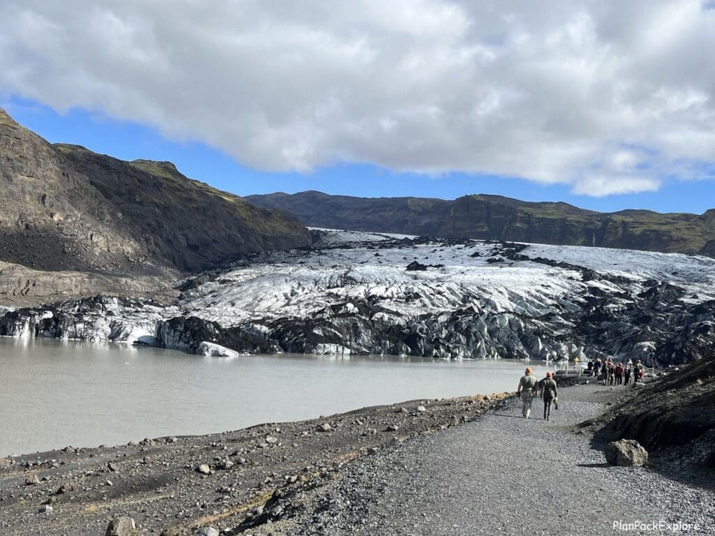
We kept on driving along the Ring Road toward our guesthouse for the remainder of our stay, admiring the views, that just never get old – the moss covered mountains, sheep climbing higher than you’d think possible, horses grazing on roadside pastures…
How can you not love the South Coast?
The last item on today’s agenda was Gljúfrabúi waterfall – another hidden gem, only a few minutes on foot from the famous Seljalandsfoss.

Since we did the walk behind Seljalandsfoss on our previous trip, we just quickly stopped to admire this powerful beauty (how can you not?) and walked about 5 minutes down the paved path towards Gljúfrabúi – the hidden waterfall.
We found the opening in a cliff wall that took us into a short narrow canyon which opened up to a cave with a large boulder. We could see the waterfall behind the boulder. The cliff that the water comes down from forms a small opening above and creates an opportunity for some amazing photos!
Read my detailed article about visiting both Seljalandsfoss and Gljúfrabúi.
If you haven’t visited Seljalandsfoss yet, take the time to do it now! Walking behind this massive waterfalI is an unforgettable experience…
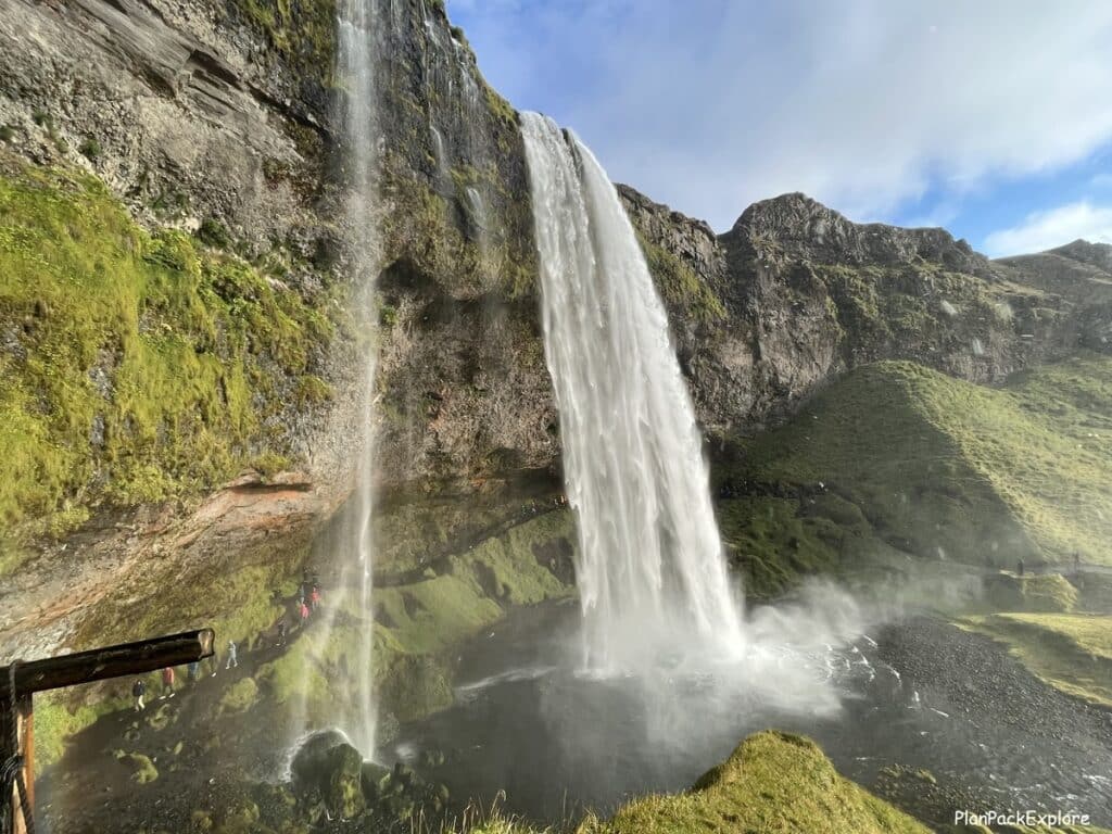
Helpful tip: Seljalandsfoss, Kvernufoss and Gljúfrabúi can get you wet! Make sure you wear proper rain gear and protect your electronics!
Not sure what to pack? Check out my practical, budget friendly list of essentials – things you really need for your trip to Iceland.
Don’t forget to stop at the Seljalandsfoss gift shop – it doesn’t look like much but inside it’s stocked with authentic Icelandic wool sweaters and hats, other crafts and of course souvenirs.
And now our day was done! It was great exploring new things and re-visiting sights we fell in love with last year…
Where we stayed:
We spend the next 3 nights at the BSG Apartments in Selfoss and it was wonderful – a very spacious 3-bedroom apartment in a convenient location at a surprisingly affordable price.
Inspired to learn more about what the show-stopping South Coast of Iceland has to offer? Click here!
Day 9: Friðheimar tomato farm, Hrunalaug hot spring, Secret Lagoon
Before I get to what we did today I will start with an explanation and some advice: we knew that we wanted to hike in Landmannalaugar (an amazing, rainbow-colored area in the Highlands) and for that day trip it’s ideal if the weather is good. So, we had day 9 and day 10 planned in a way that we could easily flip the schedule, depending on which of the two days is nicer.
We kept on checking the weather and it looked like tomorrow was going to be nice and sunny, so we decided to do the big hike then.
For that switch to be possible we had to make two reservations for the Fridheimar Tomato and Horse Farm – one for today and one for tomorrow. They are very busy, and you should reserve your table well in advance – it will all make sense soon, just trust me and read on! We cancelled our reservation for tomorrow (which I’m sure got filled immediately) and started our day.
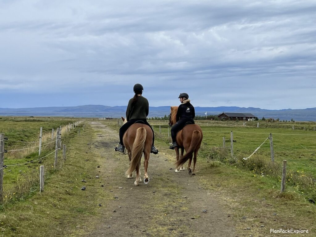
With the plan set and decided on, we ended up with an unscheduled morning today. However, since my daughter is an avid horse rider and was slightly disappointed with the short beach ride in Vik, she really wanted to ride Icelandic horses one more time and maybe a little faster.
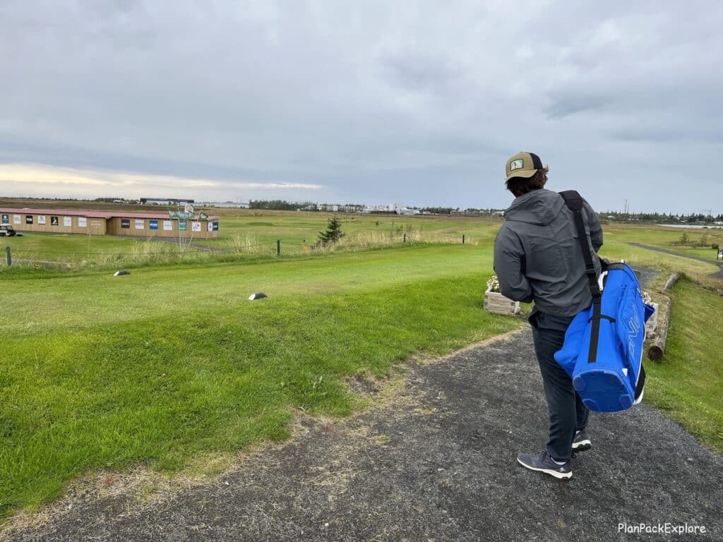
My son loves playing golf and we kept passing different golf courses as we drove around the country, so he asked for a round of golf. Luckily, there was a golf course about 5 minutes from our apartment and a riding center about 20 minutes away, so we got them both to their respective activities and enjoyed a laid-back morning …
In the afternoon we drove to the Friðheimar Tomato and Horse Farm – a unique place to have lunch, right in the greenhouse full of tomato vines! They serve their famous tomato soup with incredible bread baked onsite and delicious cucumber salsa, other tomato-based dishes and even desserts!

It’s an unforgettable experience – we loved it! It was one of the best meals we had in Iceland!
After such satisfying lunch we decided to go for a short hike to the nearby Hrunalaug Hot Spring. It’s a natural hot spring, located a short walk from a parking lot, in Flúðir.
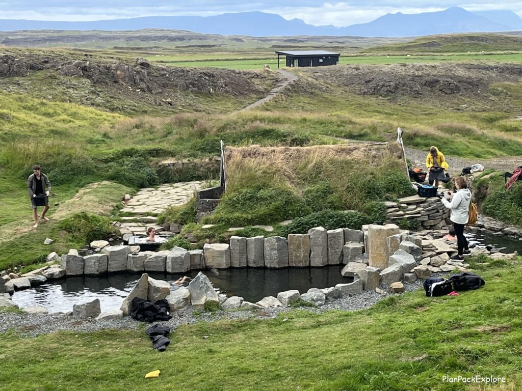

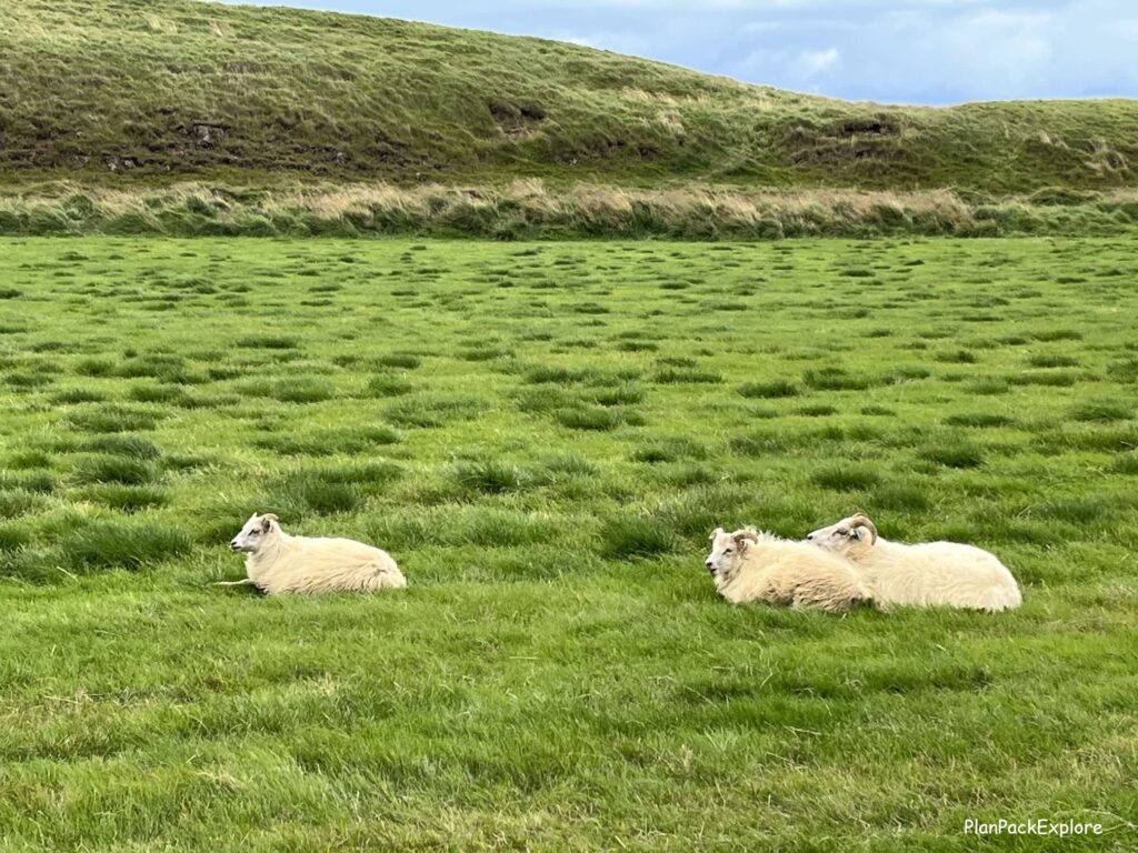
We didn’t plan to soak in it as we booked tickets for our favorite hot spring so far, the Secret Lagoon, but we wanted to see it. And it was so worth the walk – a beautiful quick stroll, through a green meadow, with sheep looking on!
There were people bathing so we tried not to bother them as we explored. It is a very peaceful hot pool, in serene, picturesque surroundings, with an old shed that now serves as a changing facility. We felt a little like we stepped back in time.
The only thing that reminded us that we were still in the 21st century were the plastic baskets that you get to put your clothes in after you pay the entry fee.
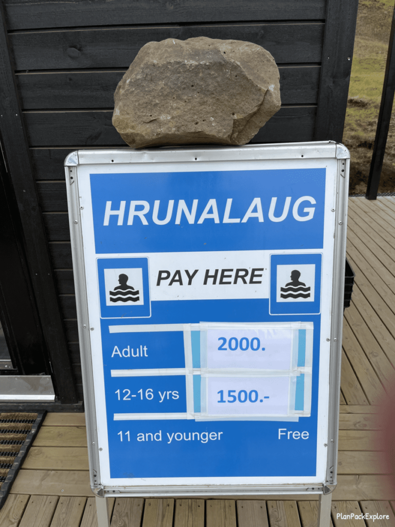
Yes, despite everything I read, this hot spring isn’t free! You now pay a 2000 ISK fee to be able to use it…
To end the day, we went back to one of our favorite spots in Iceland and definitely our favorite lagoons – the Secret Lagoon.
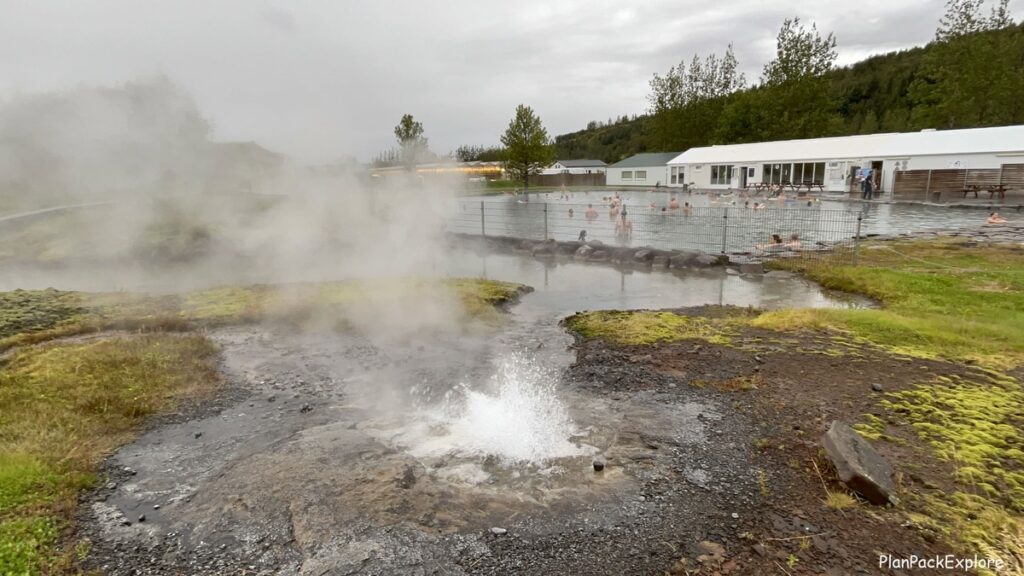
We just love the old world, authentic charm of this hot pool. It’s a simple, single stone walled pool, deeper than most, so you can easily dip in it – AND – they have pool noodles to float on! It’s just a peaceful, no frills, relaxing place… When you’re done soaking, take a walk on the wooden platform around the pool and check out the small geysers and troll houses!
We felt rejuvenated and ready to start the day early tomorrow morning – Landmannalaugar, here we come!
Where we stayed:
Night two at the BSG Apartments in Selfoss.
Alternative itinerary:
If you’d like to fill the morning with a fun activity, I strongly recommend a hike (my favorite short hike in Iceland so far!) to the Reykjadalur Geothermal River (“Steam Valley”).
The other option is visiting the Raufarhólshellir – one of the longest lava tunnels in Iceland.
Or – if you haven’t visited the Golden Circle yet, this would be a great option to start your day with, either on your own or with a tour that also includes a visit to Friðheimar Farm and/or the Secret Lagoon.
Day 10: Landmannalaugar
This was a big hiking day and we all looked forward to going back to the Highlands.
We got up early and by 7:30 am we were on the road to Landmannalaugar. We chose the easiest route via rt. 26 to F208 north (Fjallabaksleið Nyrðri).
The drive took us about 2.5 hours with a quick stop at the Highland Center Hraunayjar, which has a cafe, restrooms and hotel rooms if you need a place to stay near Landmannalaugar.

Our time in Landmannalaugar was absolutely amazing, the drive an incredible experience, the hiking epic and the landscapes were just mesmerizing.
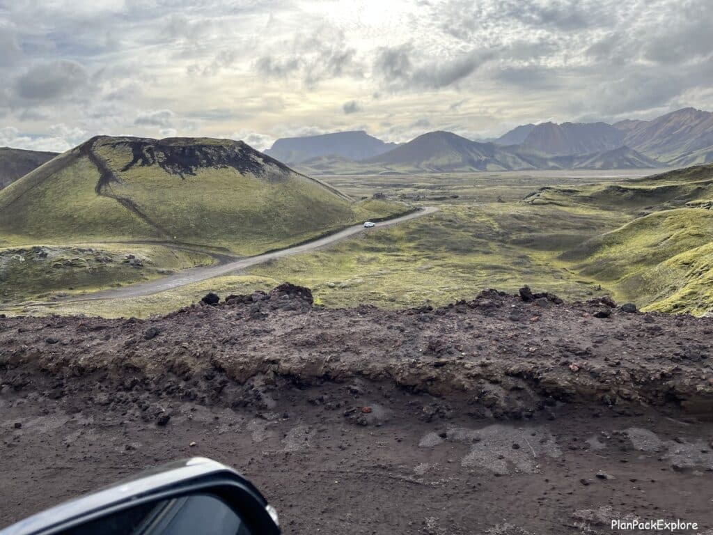

We also checked out the hot spring, called “People’s Pool” and just took it all in…
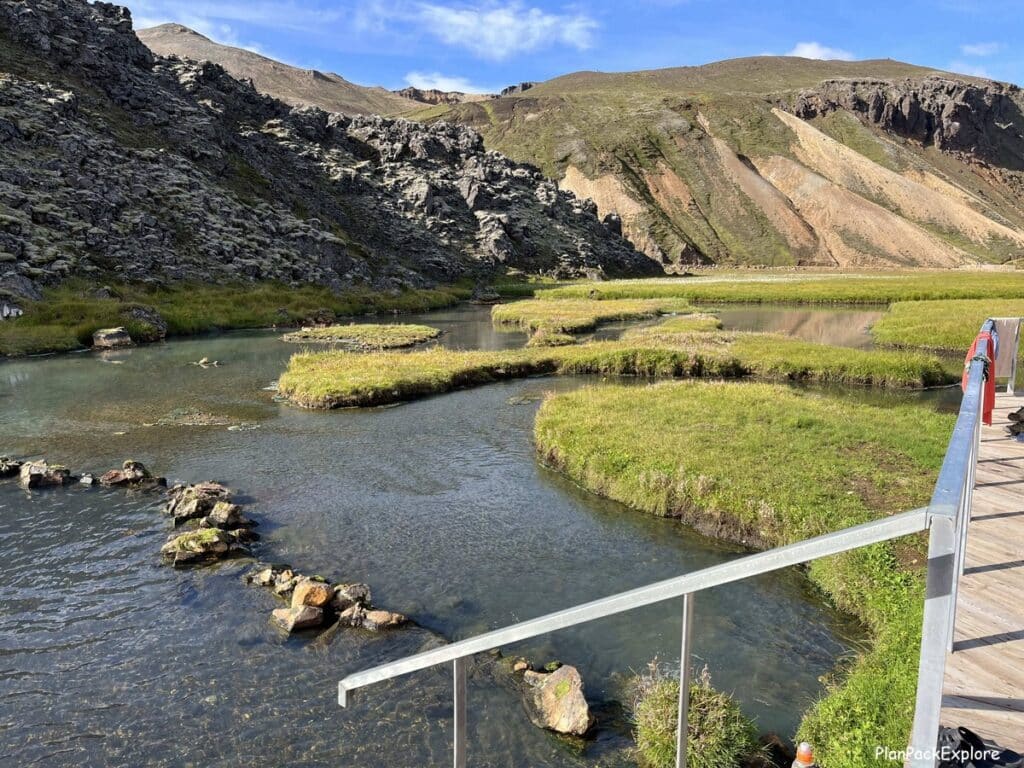
It’s very hard to describe this day “in a nutshell” – it was simply one of the best we spent in Iceland.
Please read my Landmannalaugar Travel Guide – All You Need to Know + Best Things to Do to get all the information you need to prepare for a great day trip to this incredible area, including a video of a full drive.
I also recommend that you read our Ultimate Guide to Hiking the Bláhnúkur – Brennisteinsalda loop for details about how we hiked the two most popular trails in Landmannalaugar. And of course, a ton of photos to give you a taste of our experience.
We got home in the evening quite tired but soooo happy we did it!
And a little sad that the next day was our last day…
Not up for driving into the Highlands? Spend the day exploring the amazing Þjórsárdalur Valley, located along rt.32.
Day 11: Reykjavik
Our last day greeted us with sunshine and warm (for Iceland) temperatures.
We planned to spend the day in Reykjavik, browse the gift shops and just relax. The only thing we had scheduled was a free walking tour through citywalk.is.
I read many reviews of this tour and they proved correct. We had a 10:30 am tour and met our group and the guide in front of the Parliament building. It was a great experience, and we learned a lot about Icelandic history, customs, and traditions.
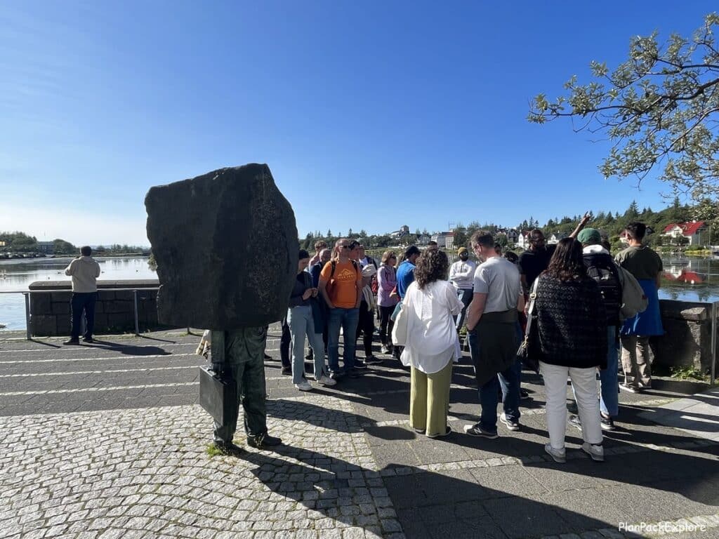
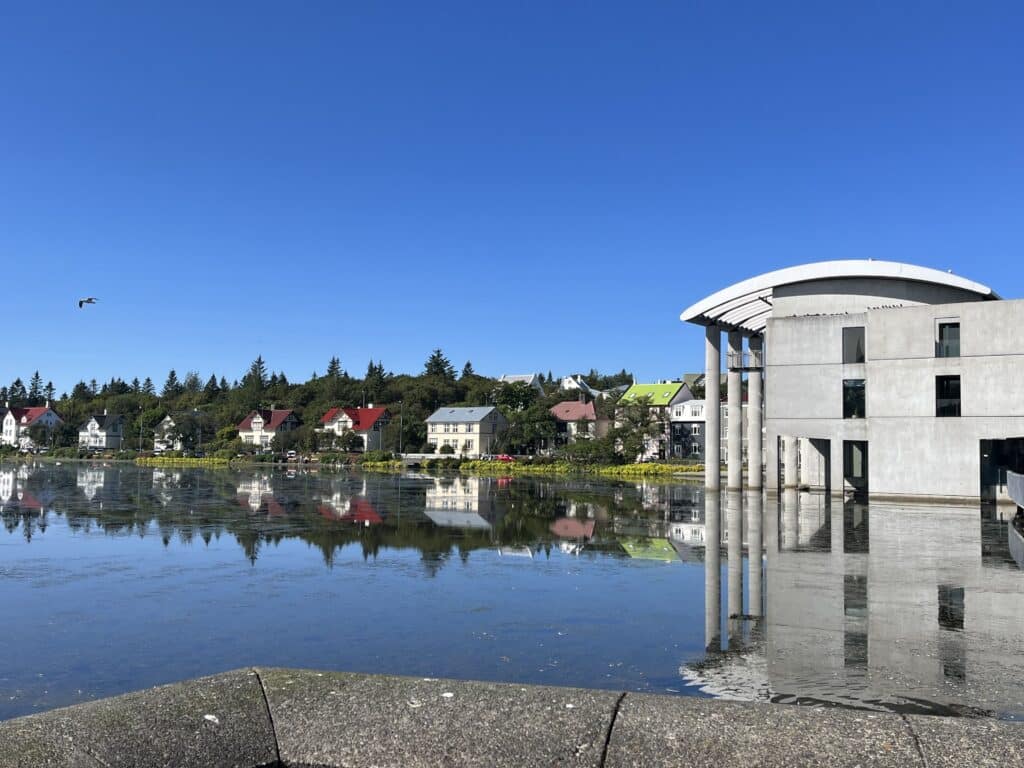
Our guide delivered all that with humor and in a very engaging way. He gave us some suggestions for places to visit, like the flea market (“Kolaportið”) or a relatively newly opened food hall (“Pósthús Mathöll”).
We checked out both places. The flea market is only open on weekends, luckily our last day in Iceland fell on a Sunday so we were able to visit it. I bought the cutest Pandora charm in the shape of Iceland! This place is full of handmade crafts, jewelry, clothes. A great spot to buy souvenirs.
The food hall is big and has a lot of international options to choose from.
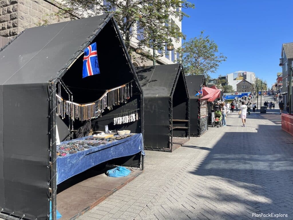
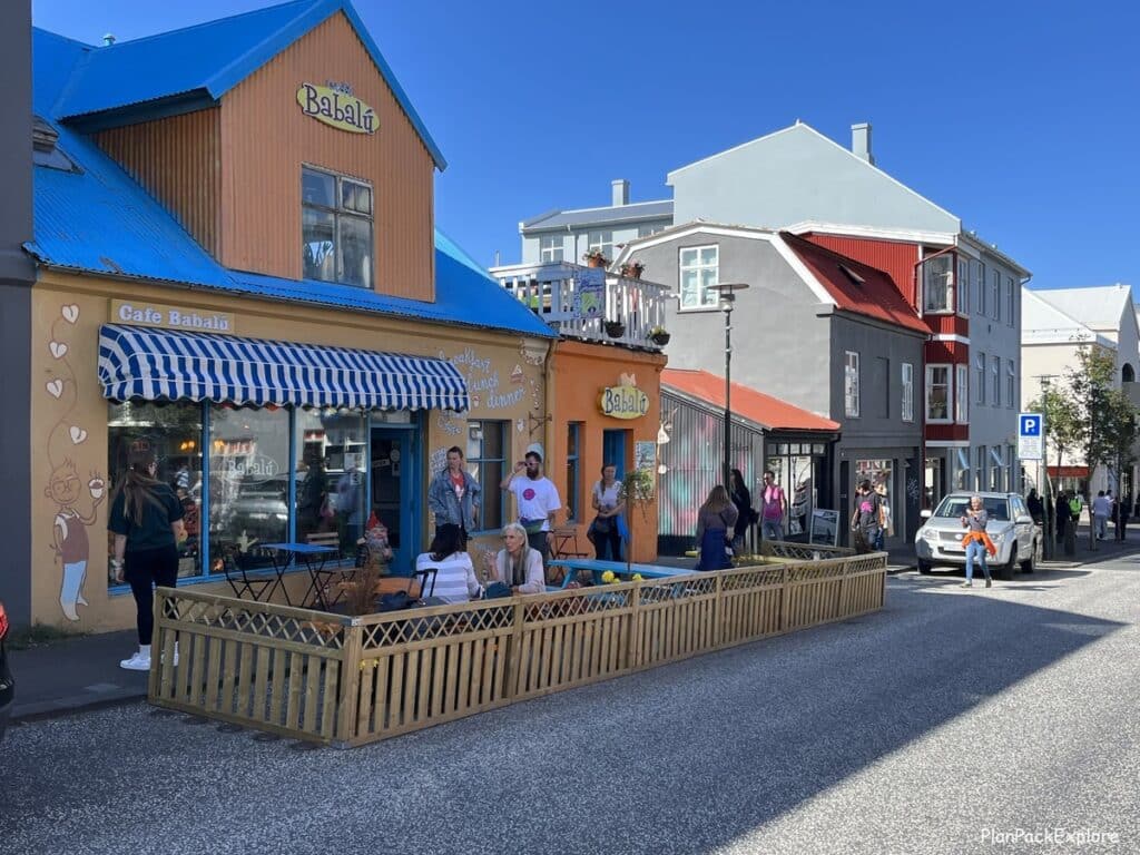
We spent the rest of the day walking around and revisiting favorite spots from our last visit – Iceland’s oldest bakery (Bernhoftsabakari), Café Babalú and the Rainbow Street.
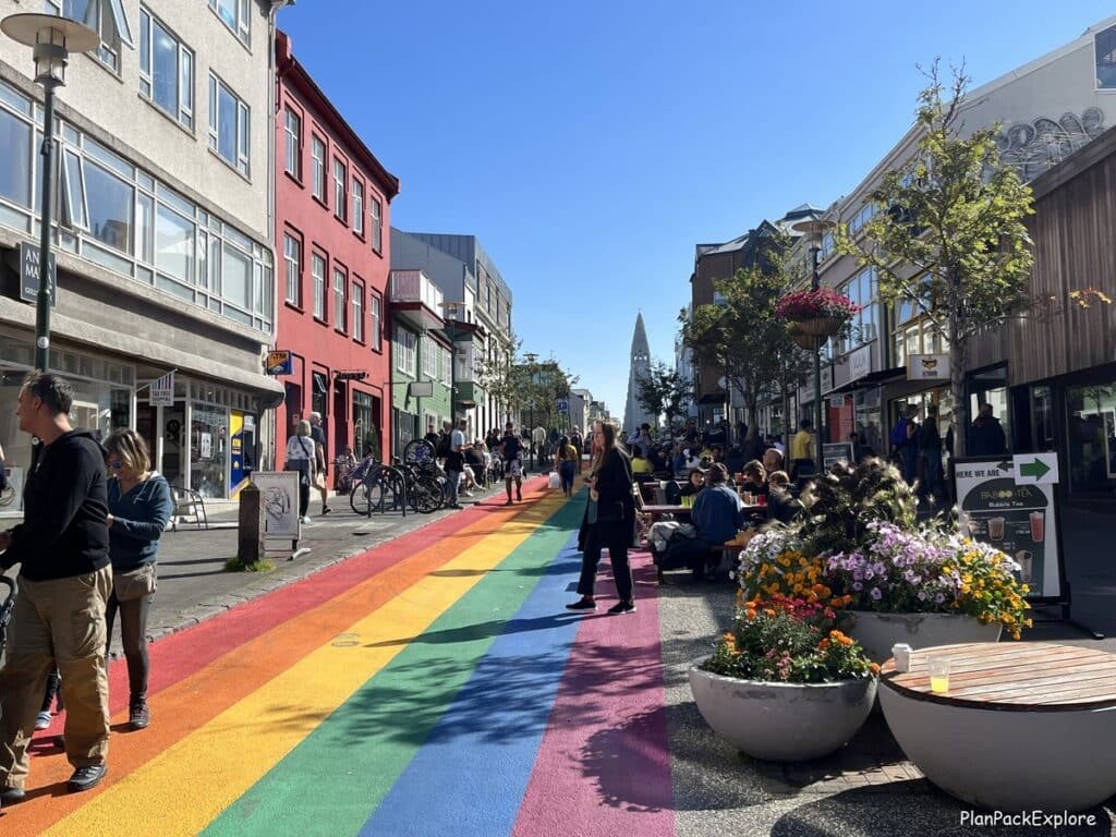
Once again, we didn’t make it to Perlan Museum or the Phallological Museum – next time!
Update: I finally made it to Perlan! Read my full guide here!
We had a great time on this trip, we saw a lot and also realized how much more there is still left for us to see. Time to start planning the next trip!
Helpful resources to make this itinerary a success:

Rent a proper car for your adventure with a 5% discount automatically applied to your reservation from a trusted local company I always rent from – Blue Car Rental!
MUST READ: Driving in Iceland – Essential Tips for a Great Road Trip

👉 Don’t forget TRAVEL INSURANCE! I don’t travel without it. Get a quote from my personal #1 choice – Travel Guard – or check more options here!
MUST READ: Iceland Accommodation Explained: What to Know Before You Book.
Want a fantastic, easy-to-read, high-quality map of Iceland to have as a navigation backup? AND listing gas stations on your route? You need the Iceland Adventure Travel Map that I personally don’t travel to Iceland without!
Let me help you plan your trip!
Get organized with this printable, fillable 45-page ICELAND TRAVEL PLANNER – keep track of flights, hotels, tours, daily itineraries and even your trip budget!
BONUS! The planner has journal pages for your memories!
You may also like:
- 6-day Iceland Itinerary (How to See the Best of Iceland in a Short Time)
- First Trip to Iceland Travel Tips – All You Need to Know to Plan Your Trip
- Driving in Iceland – Essential Tips for a Great Road Trip.
- Best Black Sand Beaches in Iceland – a Practical Guide
- Landmannalaugar Travel Guide – All You Need to Know + Best Things to Do
- Snæfellsnes Peninsula – A Complete Guide and Top Things to See.
- Reykjadalur Valley – a Beautiful Hike to a Hot River (+ Tips for the Best Experience)
For more Iceland inspiration and travel guides click HERE.
Need more help planning your trip? Join my Explore Iceland: Travel Tips & Advice FB Group community to ask questions, share your experiences, plus get expert travel tips and advice from a supportive community of Iceland enthusiasts! Join today!
🎙️ Prefer to listen to the travel guides instead? Check out my Explore Iceland Travel Podcast and easily plan your trip on the go!
About Monika
An avid traveler and a passionate trip planner, mildly obsessed with being organized and prepared 🙂
Well aware of how precious travel time is, I’m here to share my experience and help you get the most out of your vacation time.
“Taking the hassle out of trip planning”