By Monika
Ultimate Guide to Hiking the Bláhnúkur Brennisteinsalda Loop.
If you only have one day in Landmannalaugar and you can’t make up your mind about which hike to choose, I’ll make it really easy for you: go for what I would call the epic Landmamnalaugar hike, the Bláhnúkur-Brennisteinsalda Loop!
It combines trails to two magnificent, yet very different mountains – the orange-colored “Sulphur Wave’, Mt. Brennisteinsalda, and the black-colored “Blue Peak”, Mt. Bláhnúkur.
Can these hikes be done individually?
Absolutely! More on that later in this post, but together, they will give you a hiking experience you’ll never forget, taking you through some otherworldly landscapes with panoramic views that will make you wonder if you’re still on planet Earth!
This post contains affiliate links to trusted products and services that I use and love myself. If you make a purchase through these links, I may receive compensation at NO EXTRA COST TO YOU. I appreciate your support! Also, as an Amazon Associate I earn from qualifying purchases. See the Disclaimer Policy and the Privacy Policy for more details.
- Ultimate Guide to Hiking the Bláhnúkur Brennisteinsalda Loop.
- How to get to the Bláhnúkur-Brennisteinsalda Loop trailhead
- Can I hike the Bláhnúkur – Brennisteinsalda Loop with a tour?
- The trail map
- In which direction should you hike the loop?
- Bláhnúkur – Brennisteinsalda loop hike statistics
- Best time to hike Bláhnúkur – Brennisteinsalda Loop
- Our experience hiking the loop
- Choosing only one mountain to hike
- How to prepare for hiking in Landmannalaugar
- How much time do you need to hike in Landmannalaugar?
- Do I have to be fit to hike Bláhnúkur and/or Brennisteinsalsa trails?
- Where to stay in the area?
- Are these hikes worth the long bumpy drive?
How to get to the Bláhnúkur-Brennisteinsalda Loop trailhead
To get to these two hikes you need to reach an area of Fjallabak Nature Reserve, called Landmannalaugar.
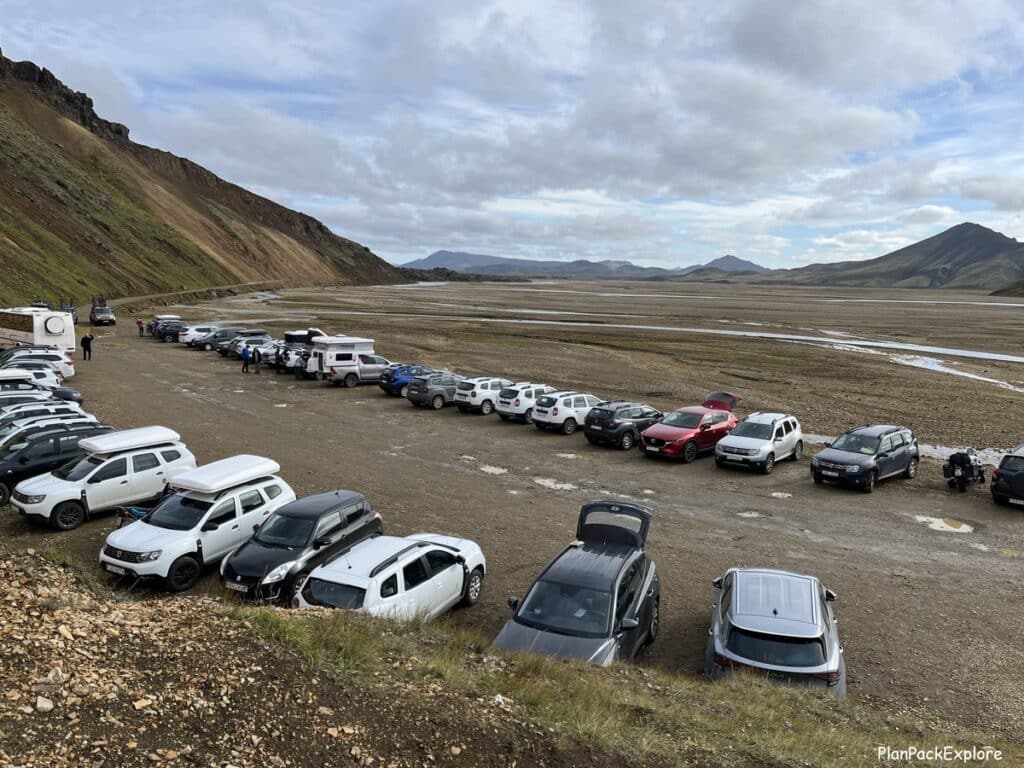
The easiest way to do it is by car. You’ll need a 4×4 SUV or a 4×4 camper van, approved to be driven on Icelandic unpaved roads, called F-roads.

Rent a proper car for your adventure with a 5% discount automatically applied to your reservation from a trusted local company I always rent from – Blue Car Rental!
There are a few different ways to reach the main Landmannalaugar parking area.
For more information about Landmannalaugar – where it is, different ways to get there, and how to best plan your visit, including the NEW as of 2024 parking reservation requirements, please read my detailed Landmannalaugar guide.
If you’re new to hiking in the Icelandic Highlands, these are the two best trails showcasing the vibrant colors and beauty of the area, without the stress of river crossings and driving more challenging F-roads.
Landmannalaugar is a very popular summer hiking destination. Some even call it a “hiker’s paradise” so expect a lot of people on the trails in peak July – August months.
Can I hike the Bláhnúkur – Brennisteinsalda Loop with a tour?
Yes and no… Yes, you can join a guided hiking tour to Landmannalaugar, but keep in mind that most hiking Landmannalaugar tours only guarantee Mt. Brennisteinsalda hike in their itinerary, and Mt. Blahnúkúr will only be added if time allows.
The trail map
Before you start your hike, you should stop by the warden’s information desk and purchase a map of the area. It costs 300 ISK and has very basic information about the trails, but it’s a good visual aid for this hike.
The trails on the map are color-coded and the actual hiking paths are also marked by wooden posts with tips painted in corresponding colors to help you navigate and follow the map.
Speaking of trail colors – please double-check with the warden, but it looks like part of the Brennisteinsalda trail that also is a part of a multi-day Laugavegur Trail has changed the color from red to blue.

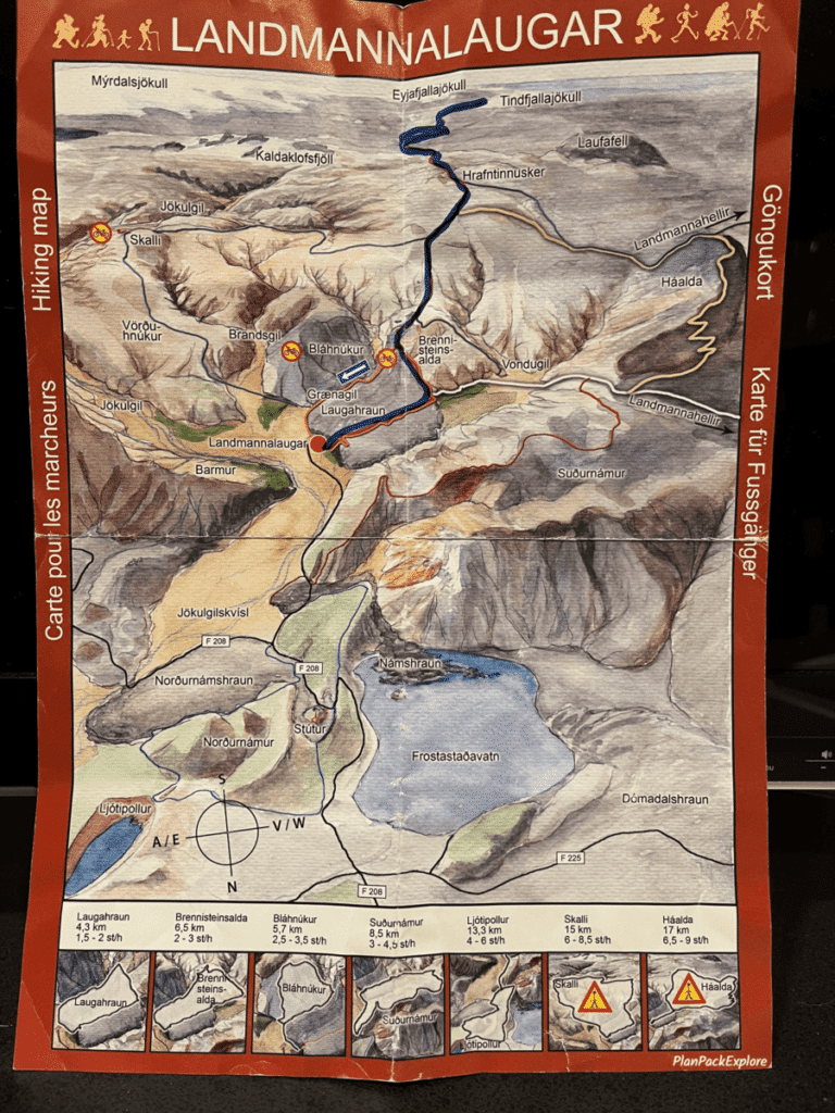
We visited in August of 2023 and purchased the map. Our friends also gave us one that they purchased just a month earlier, in July. Notice the difference in trail colors?

We did come across wooden stakes marked with blue on our way to the summit of Mt. Brennisteinsalda, so I believe this is a permanent change.
Did you notice these changes during your hike? Please let me know in the comments!
In which direction should you hike the loop?
You can do it clockwise or counterclockwise. We debated this for quite a while and eventually settled on the plan to do it clockwise.
Why clockwise?
- you get the tougher part of the hike (like the ascent to the Blahnúkúr summit) out of the way first, so later on when you’re a little tired you have the less challenging Brennisteinsalda hike ahead.
- the initial climb up the Blahnúkúr trail is a bit challenging and we preferred to have steeper ascents vs. steeper descents.
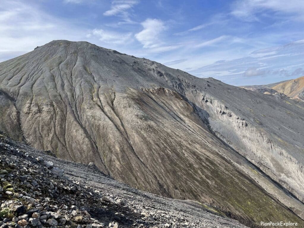
Helpful hint: The Blahnúkúr summit may seem somewhat intimidating from the ground and may appear further to reach than you’d like it to be, but once you start your hike, you’ll find that it’s actually not as tough as you first thought. You can do it!
Why counterclockwise?
- if you’re short on time and unsure if you have the time for both peaks, start with the Mt. Brennisteinsalda hike. It’s THE HIKE of Landmannalaugar, and if you’re unable to continue the loop for any reason, you’ll at least have the “Sulphur Wave” checked off your hiking list.
- if you’re not sure of your hiking abilities, also start with Mt. Brennisteinsalda. If you’re feeling good once you reach the summit, rest up a bit and go for the Bláhnúkur hike!
- if you prefer a steeper descent vs a steeper ascent on Blahnúkúr
Either way you choose you’ll have a great experience and the same breathtaking views as you hike.
Bláhnúkur – Brennisteinsalda loop hike statistics
Distance: about 6 miles (10 km)
Time needed: 4-6 hours, depending on your pace, hiking abilities and the number of stops.

We completed this hike in 5 hours and 10 minutes, at a rather leisurely pace, stopping for a nice lunch break after coming down from Mt. Bláhnúkur.
Elevation gain: about 2000 ft (600 m)
To put it in a more relatable perspective – our iPhones told us that this hike is the equivalent of climbing about 200 flights of stairs 😊
Best time to hike Bláhnúkur – Brennisteinsalda Loop
This trail is only accessible in the summer, so plan your visit between mid-June and mid-September. As mentioned earlier, to get to Landmannalaugar, you will be driving on F-roads (unpaved dirt roads) so please rent an F-road-approved 4×4 vehicle with good ground clearance!
Also, even though roads to Landmannalaugar are usually open with no issues during the summer months, always check F-roads status before you head out.
For more information on getting to Landmannalaugar, A NEW IMPORTANT PARKING UPDATE and everything else you need to know for a successful hassle-free experience, read my Ultimate Landmannalaugar Guide
Although Iceland is beautiful in any weather, for this particular hike try to choose a clear day so that the trails are dry and you get the best views of this incredible landscape. It also makes it the safest experience, as there is no mud on the trails. If you don’t have that kind of flexibility in your schedule, just come prepared with proper hiking gear and 4-season clothing. And remember – layers!
If I were to choose the top 3 things to have for this hike, it would be:
- hiking boots with good traction
- trekking poles (for me they are a must, making hiking this loop a lot easier)
- a really good raincoat/windbreaker (it can get windy even on a nice day)
Need more packing tips? Click here for my more practical, budget-friendly Iceland packing list.
Our experience hiking the loop
So let’s get to the nitty-gritty details of this amazing hike!
Here is how we did it:
We left our guesthouse in Selfoss at 7:30 am, stopped by the Hrauneyar Highland Center for a quick break and were at the parking lot (the one before the river crossing) at 10:10 am.
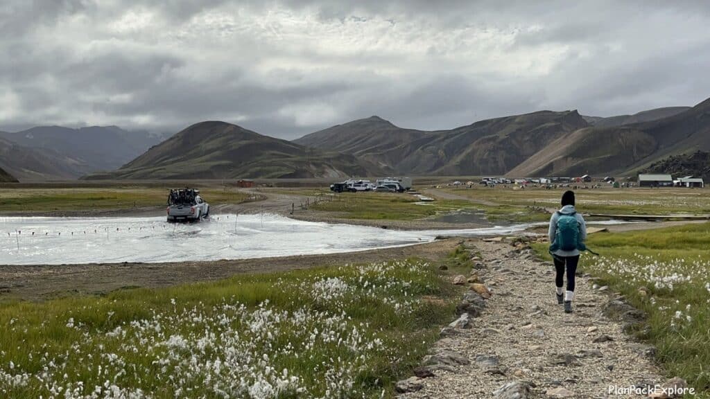
Bláhnúkur part of the loop trail
As I said, before we started hiking, we got our map and asked the warden for directions to the trail. It was now 11 am. We were told to just go to the left, past the bathrooms, and “follow the zig-zags”. So that’s exactly what we did. That section of the trail was an easy walk to the base of the mountain.
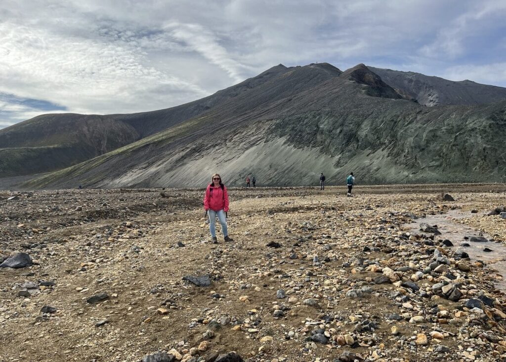
You can see the trailhead and the “zig-zags” from a distance – it’s how the official Bláhnúkur hike begins, in a series of switchbacks.
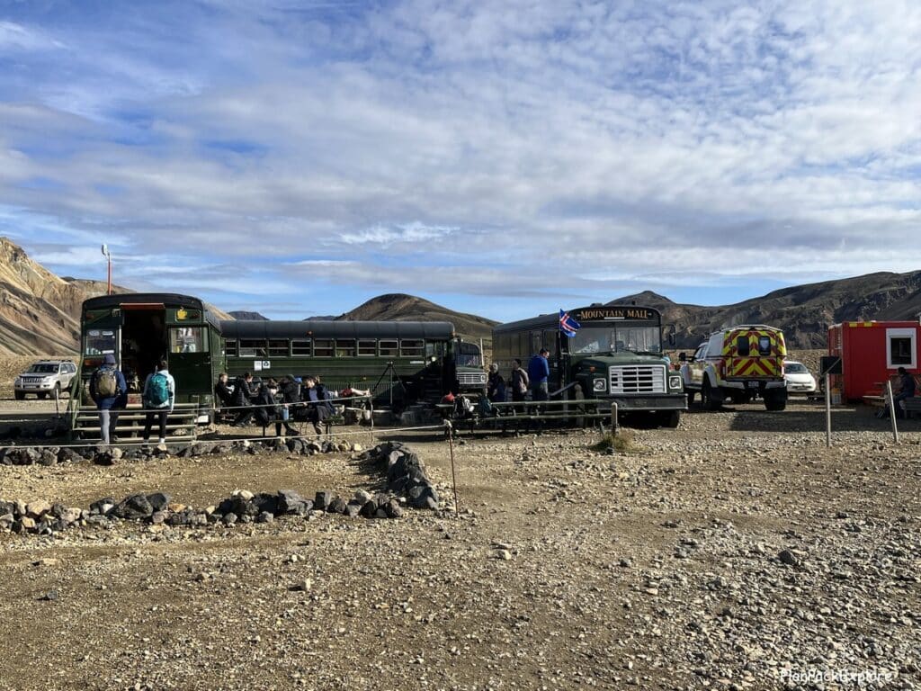
But before you get there, you’ll pass the Mountain Mall (a trio of school buses set up as a small store/café) …
… then a paddock with friendly Icelandic horses …

… then you’ll cross a small stream …
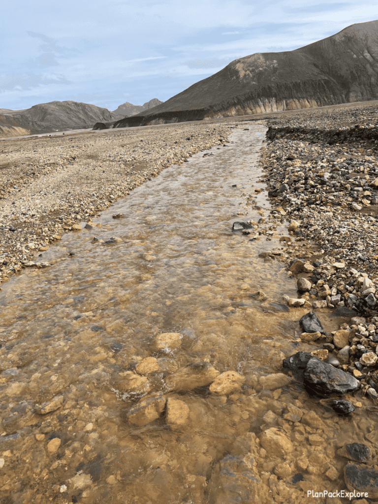
… and then you will begin to climb.
The warden told us that we’d hike to the “lower peak” first, and then to the “higher peak”. At first, I didn’t know what she meant, but as we got closer to the trail, I understood. There are in fact two peaks of the Blahnukur mountain, which you can see from the bottom – the higher being the actual summit.

The start of this hike is pretty straightforward, on a well-defined path.

The path is a bit narrow and because the trail is quite exposed, it can get windy there. But it’s not anything that would make most people nervous, it’s wide enough for hikers going in opposite directions to safely pass each other, and there are no canyon-like drop-offs on either side of the trail.
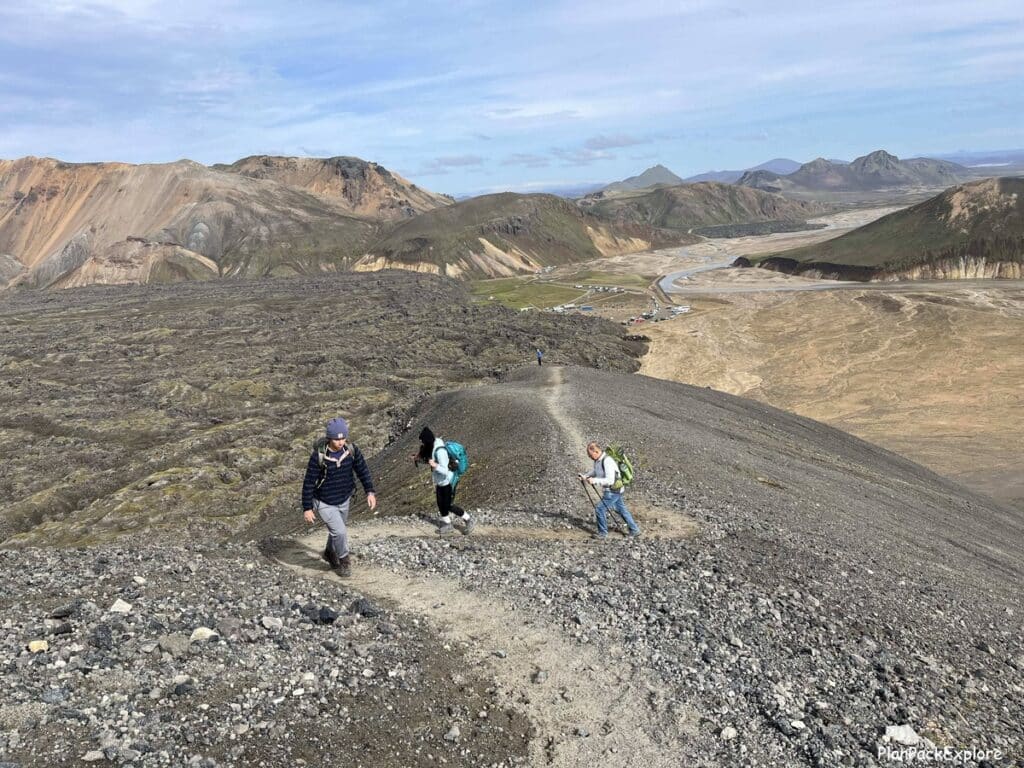
A quick story of kindness on the Bláhnúkur trail
However – our daughter did get nervous during the ascent, as she wasn’t used to hiking in such bare exposed conditions. So we stopped to calm her down, regroup, and decide what to do next. We were about halfway to the lower peak at this point. We started setting up trekking poles to give her additional support and that’s when a kind gentleman caught up to us and we started talking.
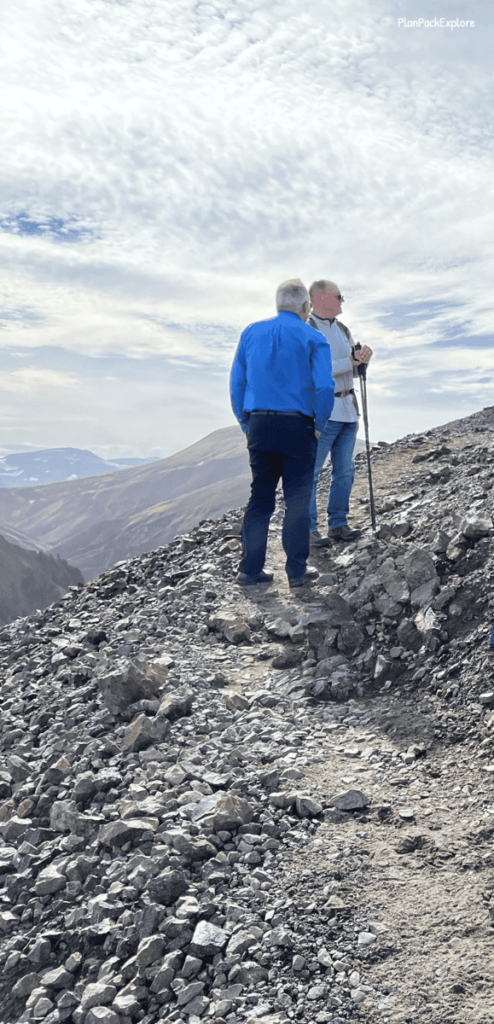
I spotted him earlier, a little farther down the trail from us during one of our stops and he caught my eye, wearing a dress shirt and elegant pants, hiking up the trail in such calm, steady way, that you could tell he had done this before.
I asked him if he knew the trail well and what the hike was like further up. We were considering just coming down and switching to the Brennisteinsalda hike instead (which seemed a little more mellow).
When he found out why we were considering this, he looked at our daughter and in the kindest, calmest voice reassured her that there was no need to be nervous and that “the worst was behind her”.
He then proceeded to explain the entire loop for us using our map as a visual help, pointing out which way to go at the fork during the downhill hike on the other side of Bláhnúkur (keep reading, this will be an important tip!), and how exactly to get to Mt. Brennisteinsalda.
It turned out that he was a tour bus driver and while his group was on a guided hike on the Sulphur Wave, he would usually do at least a part of the Blahnukur trail. I found it incredibly impressive!

To this kind gentlemen – thank you again for talking our daughter off the ledge – or, as she laughs about it now – for keeping her ON the ledge! Just those few words of reassurance convinced her to take a deep breath, grab the trekking poles, and to keep on going!
So we kept on hiking.
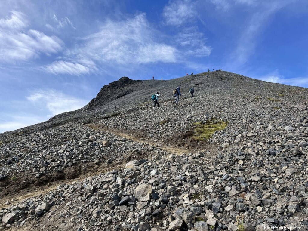
Just follow the path. Take in the views! Don’t rush…

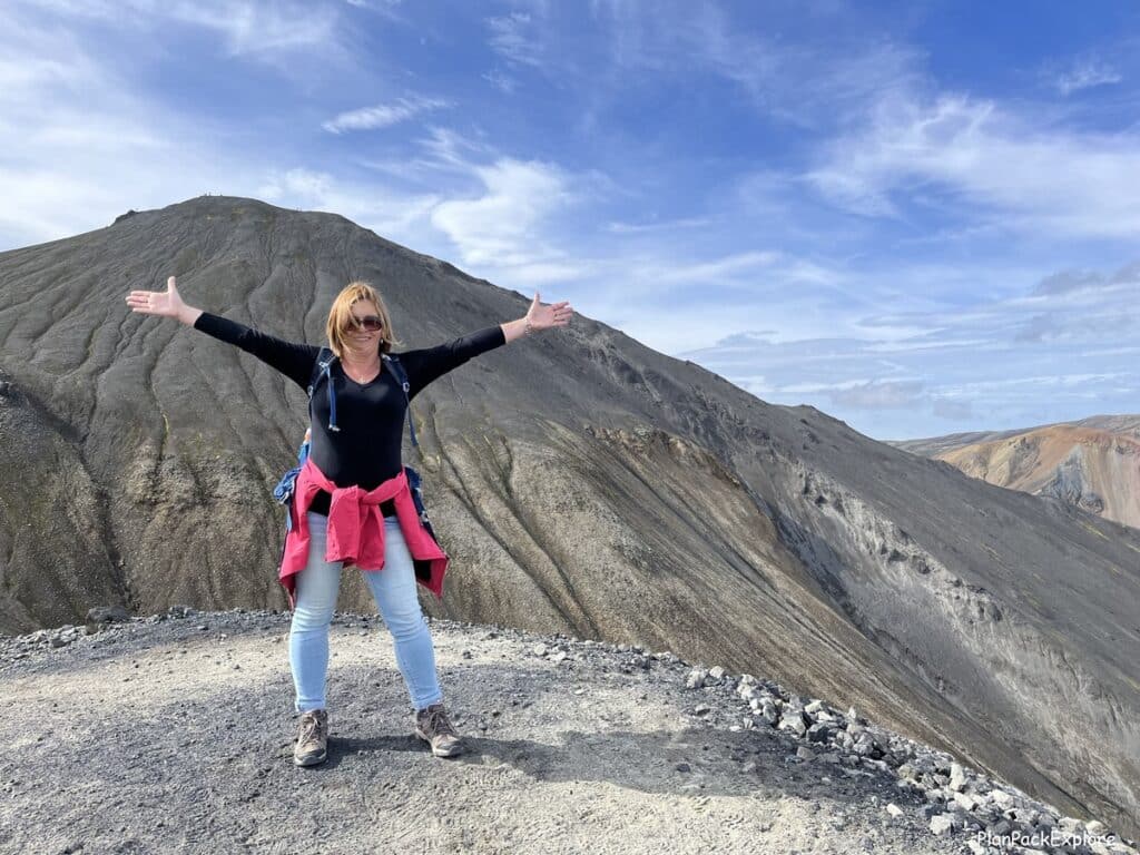
We reached the “lower peak” …
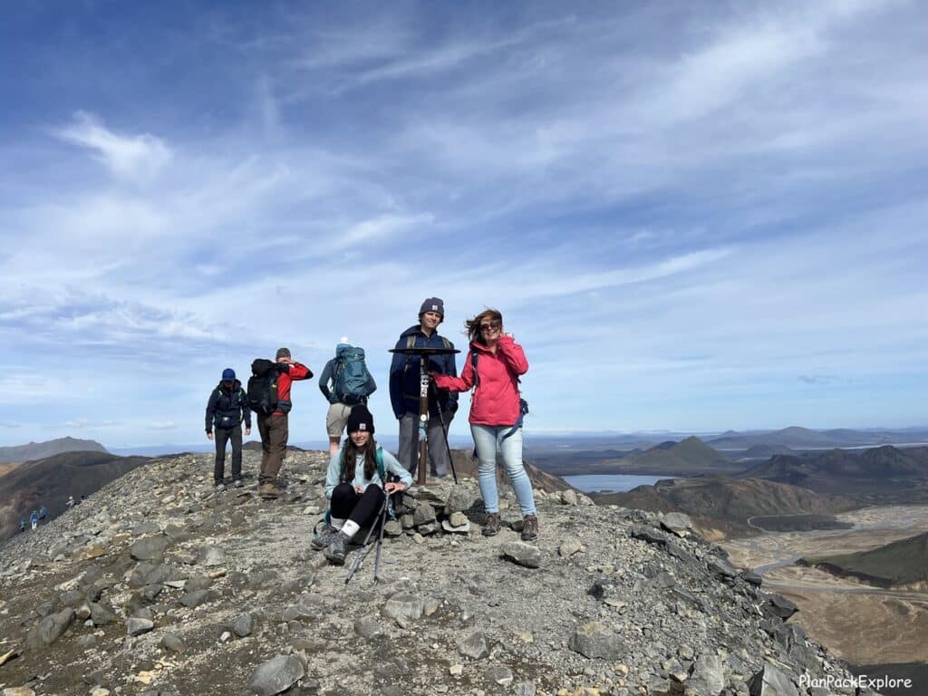
… then the actual summit!
It took us about 1.5 hours to reach the summit. We high-fived each other and had a few minutes of well-deserved rest on the black lava rocks. The joy and satisfaction of actually getting there was exhilarating.

We didn’t take too long at the summit as it was getting windy, so we decided to start trekking down.
To hike down Bláhnúkur, you just continue to follow the path. It’s not steep, but I felt that hiking poles were still really helpful.


At some point on your way down you’ll come to a fork on the trail.

You have a choice of going to the right for a shorter but much steeper descent or taking the trail on the left for a longer but much easier, level way around the mountain.
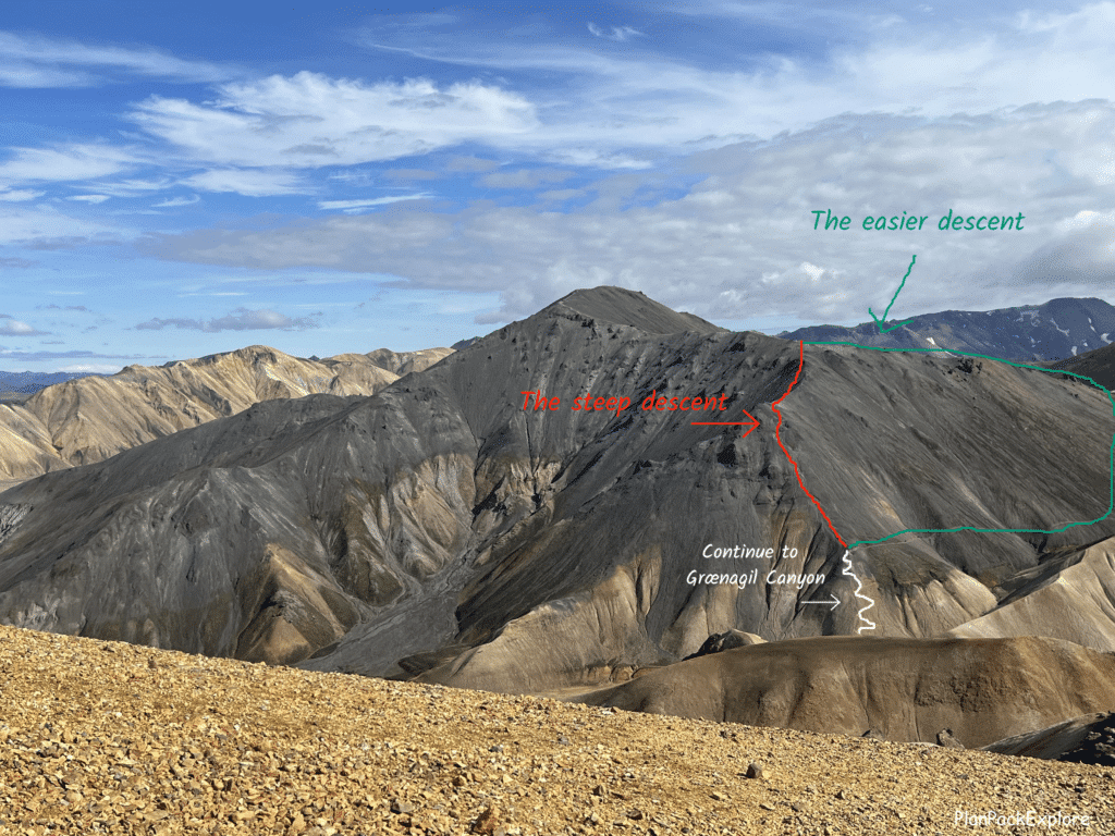
Our kind “trail angel” recommended that we go left, so left we went. It was worth it for us to take a few extra minutes for a safer way down.

Only the very last SHORT part of the trail right before you reach the floor of the Grænagil Canyon gorge is steeper, but totally doable.
Once we came down, we spotted a comfy-looking rock formation (pictured earlier in the article) and decided it was a perfect spot for a well-deserved lunch break.
Grænagil Canyon
The trail between both mountains leads through the Grænagil Canyon. Follow yellow-topped stakes and head towards the lava field.

You’ll have to cross a small creek, usually just by hopping from stone to stone.
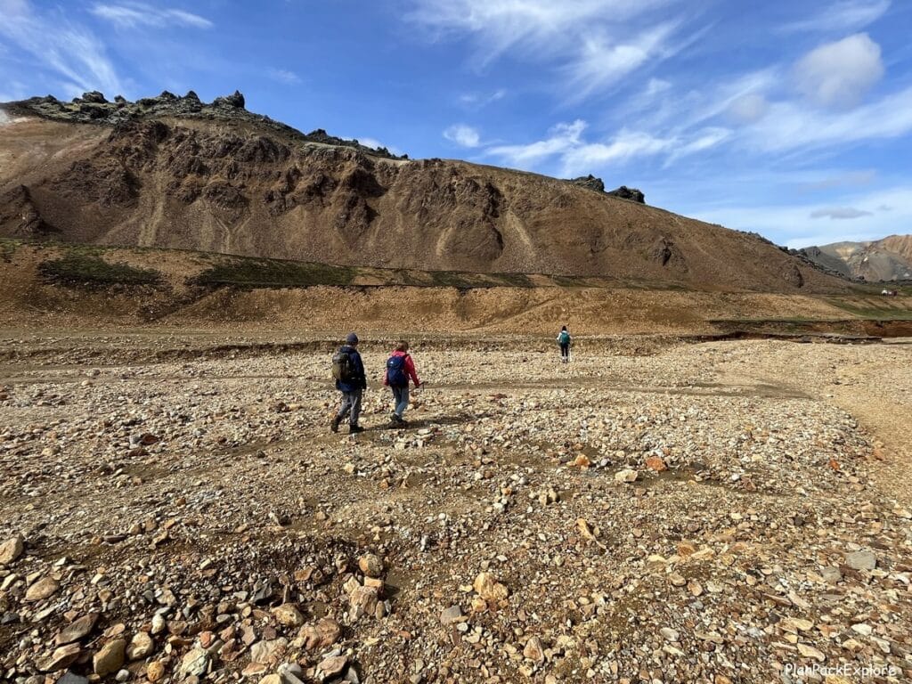
It’s a nice flat stretch of the trail that will allow you to rest a bit before you start part two of your hike to the summit of the rainbow-colored Mt. Brennisteinsalda.

Brennisteinsalda part of the loop trail
Once you reach the lava field the markers change to green/blue.
Follow the signs for the Laugevagur/Hrafntinnusker till you reach a fork where the trails split.
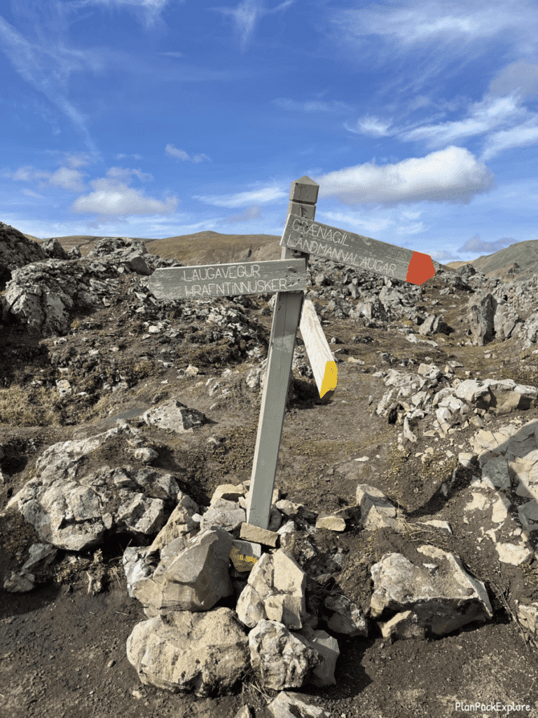

Blue posts (to the left) will continue to mark the Laugavegur trail, and green posts will guide you to the summit of Mt. Brennisteinsalda.
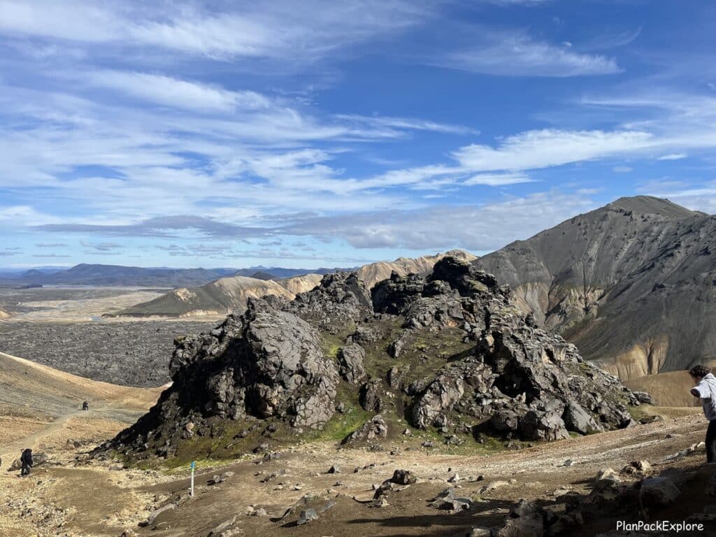
This is where we saw 3 people going up the trail on mountain bikes!!!
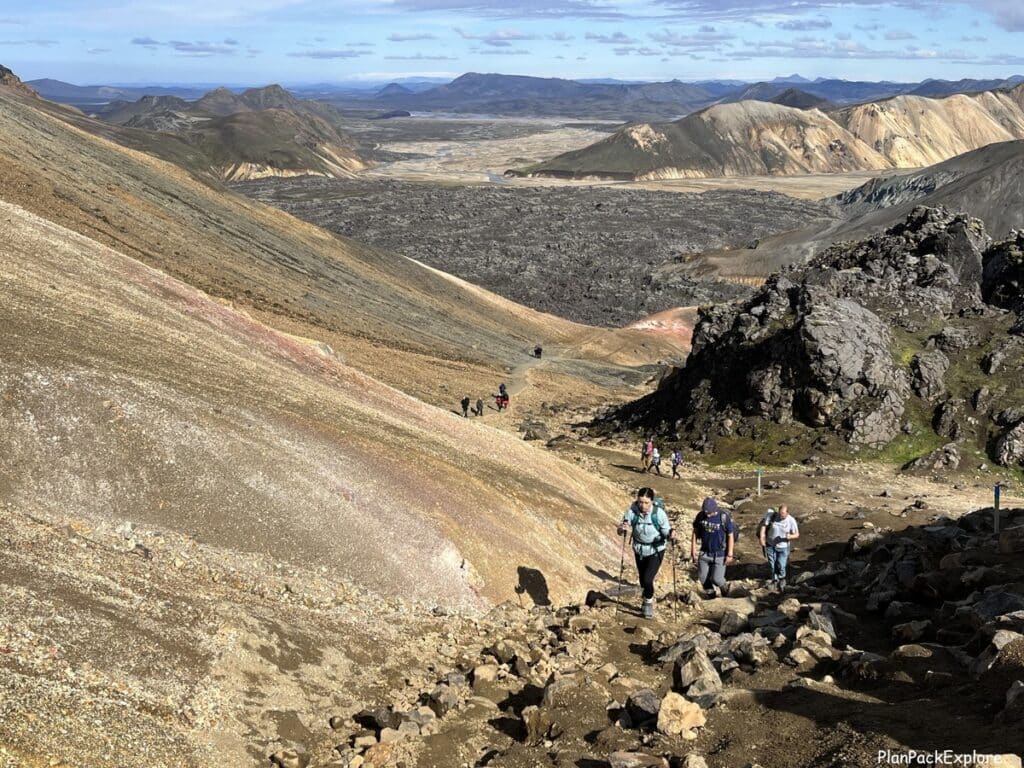
Before you reach the summit, you pass by this funky looking rock formation.

It took us about 40 minutes to reach the top after crossing the creek.

Once you’re up there, there is plenty of room to stretch – the summit is large and relatively flat.
We took our time taking in the rhyolite landscape around us and looked back at Mt. Blahnúkúr. The only word that came to mind was just WOW!
Here is a sample of what you can see from Mt. Brennisteinsalda summit:
Vondugil Valley
To hike back to the campsite, you can go down the way you came and then go back through the lava field.
We chose to take the scenic route and followed the green trail to the other side of the mountain.

That trail took us to Vondugil Valley, which was just gorgeous.

Again, a nice flat walk, during which you get to relax, catch your breath, and admire where you are.
Just keep an eye out for white trail markers.
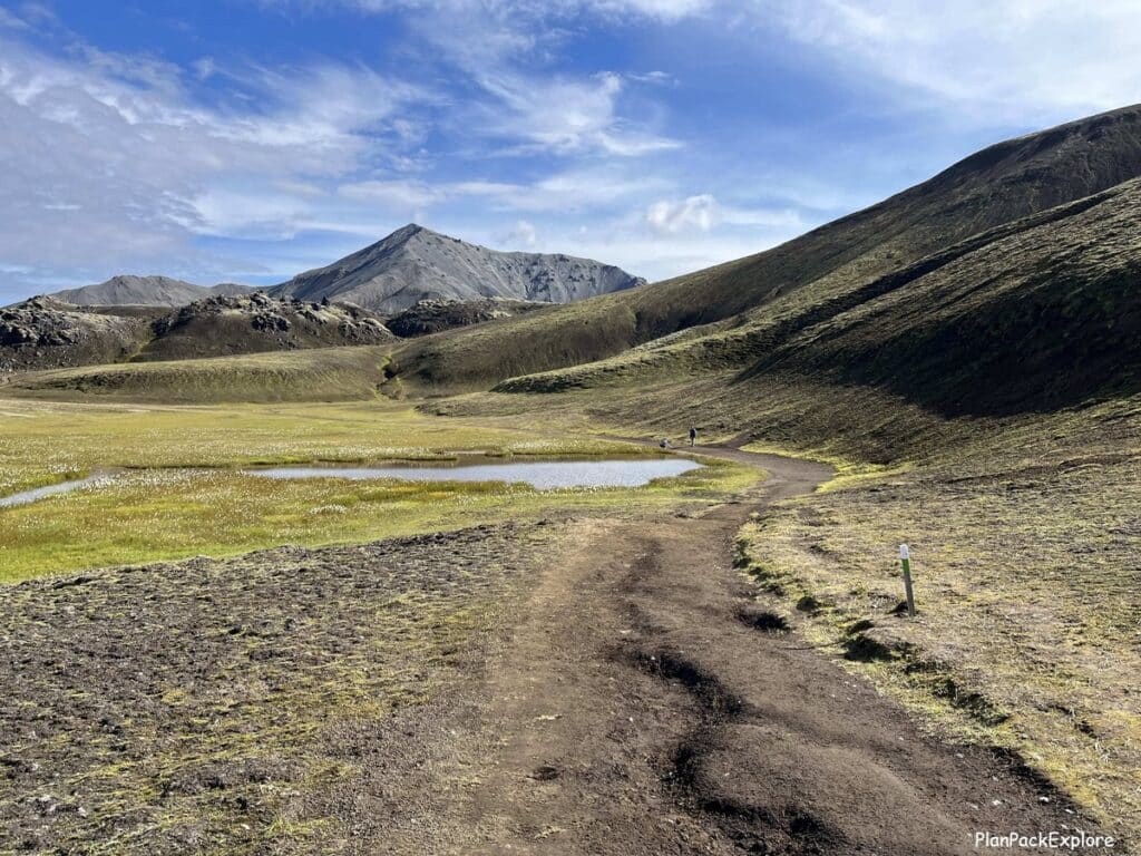
Shortly, the trail joins the lava field again and the markers change to yellow/white.
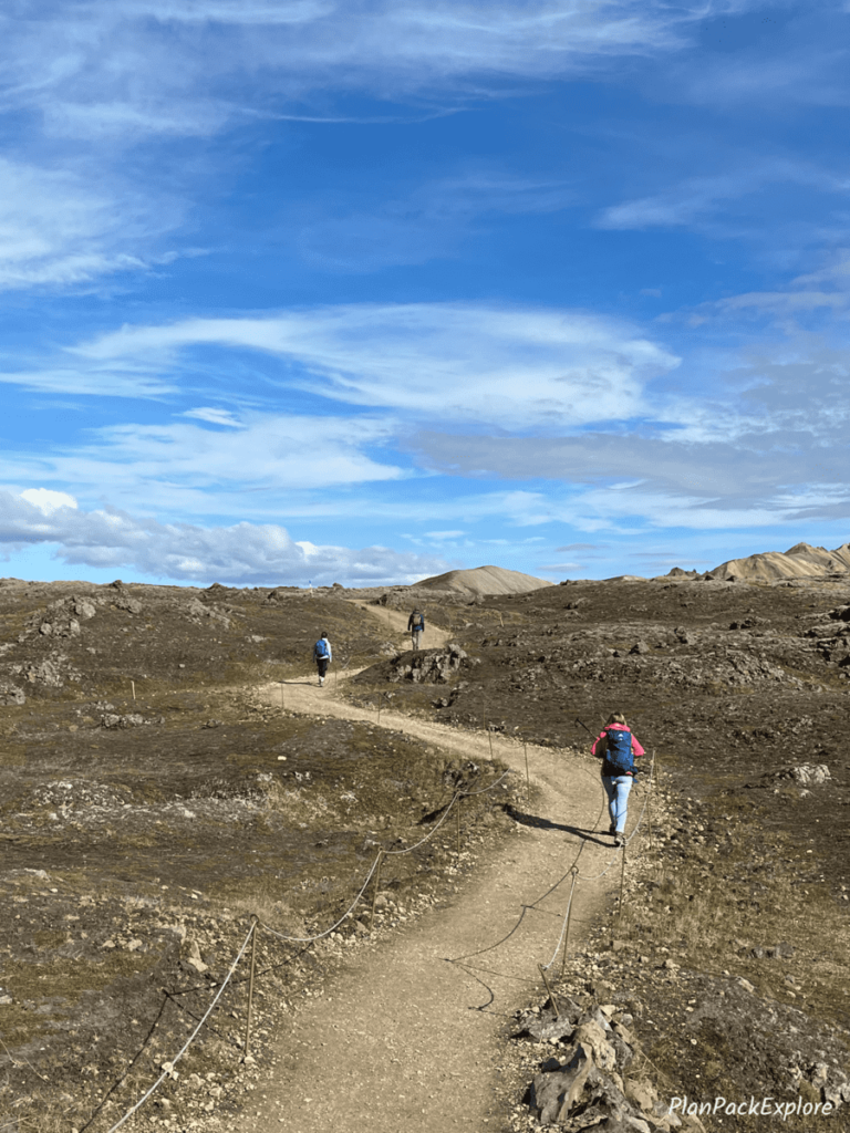
Follow the wide path through Laugahraun and the signs for Landmannalaugar to get back to the campsite.
By the time we came back to the campsite, it was late afternoon.

We were very tired but very happy that we completed this beautiful hiking trail. This was probably one of my favorite hikes we did in Iceland so far.
However, if this seems like too much, you can choose just one of these mountains. It’s a tough choice, so here is some more information to help you decide.
Choosing only one mountain to hike
Mt. Brennisteinsalda:
Distance: 6.5 km / 4 mi
Elevation gain: 200 m / 660 feet
Estimated time: 2-3 hours
You have a few options for this hike. You can do the long loop, starting at the Laugahraun lava field, then Vondugil Valley and then turn to the left to go up the green trail to the summit. Come down following the green, then green/blue posts till you reach Grænagil Canyon that will take you back to the campsite. You’ll have Bláhnúkur on your right during this last stretch.

This loop can also be completed in the opposite direction. The map in the photo is a close-up of the map available for purchase from Landmannalaugar’s warden.
OR:
Start by going through the lava field, then take a left turn before you get to Vondugil Valley and follow the trail markers that used to be red and are now blue towards the summit. They will change to green shortly before you actually reach the top. You can come down partly the same way just off the summit and stay to the right to follow yellow stakes to Grænagil Canyon, which will take you back to the campsite.
The trails are well marked, but if you don’t want to deal with navigating them yourself and following the map, you can take a guided hiking tour to Landmannalaugar.
Mt. Blahnúkúr:
Distance: 5.7 km / 3.5 mi
Elevation gain: 320 m / 1,050 ft
Estimated time: 2.5 – 3.5 hours
To begin this hike, follow the directions from the beginning of this post, describing hiking the Bláhnúkur – Brennisteinsalda Loop. It covers everything you need to know to get to the summit and how to come down.
After you hike down to the riverbed, you’ll simply follow the yellow markers and the sign for Grænagil Canyon and Landmannalaugar to get back to the campsite.
Another option is to just climb down from the summit the same way you hiked up, as an out-and-back trail. Most hikers choose the first option to take advantage of different views and scenery.
Are you inspired to visit?
Whether you hike one or both peaks you’ll love the experience. The mind-blowing views are well worth the effort these trails require!

How to prepare for hiking in Landmannalaugar
Here are some tips to help you get your hiking essentials ready:
- pack correctly! I can’t stress that enough! This is the Highlands which means the weather can be very different from wherever your starting point is and it can also change in a heartbeat. So be prepared with layers, raingear, windproof jacket/pants, hat and gloves.
As I mentioned earlier in the post, comfortable hiking shoes, and trekking poles are crucial.
- check the weather forecast! It’s good to have a bit of flexibility in your schedule, to pick a nice clear day for your visit if possible. If that’s not possible, cross your fingers and prepare for all four seasons 😊
Important: Please don’t check the weather for the Highlands (or anywhere in Iceland actually) on AccuWeather or another popular phone weather app. Always go to the most reliable source, Icelandic Meteorological Office, for the most accurate forecast and do your final check a day or two before your trip.
- bring food and drinks! There are some provisions and ways to buy some food here at the Mountain Mall, but it’s best to bring your own. You’ll have to carry enough food and drinks for everyone to last the duration of your hike. Be prepared especially with the drinks – you do cross a small stream, but it may not always be deep enough to refill your water bottle, so please take enough with you to stay hydrated.
Check out my packing list for helpful tips and practical items to make this easy!
- always check in with the warden for the latest trail and hiking conditions before you take off. They have information that may not be available to you otherwise. They know the area very well and can give great advice on how to best plan your day at Landmannalaugar.
- download the trail maps to your phone! The cell signal is spotty at best so cell phone communication and using navigation apps may not be possible. If you have a charged Wi-Fi box in your rental car it may be a good idea to take it with you just in case as it will provide a way to use your cell phones. A portable GPS can also be helpful. The maps sold at the warden’s office are not the most detailed ones, but it is good to have one as a general area guide.
🛜 Stay connected during your trip with an eSIM like Airalo, Saily or Sim Local!

Use promo code PLANPACK to unlock your 5% discount!
- bring a portable power source for your electronics! You’ll be draining those batteries taking photos of this incredible area!
Helpful hint: don’t hesitate to ask questions on the trail – for advice, directions, really anything. Most hikers are willing to help and there are plenty of tour guides to answer your questions, too! As my “story of kindness” described earlier in this post proves – there is always someone to help you on your hike!
For more tips and information on how to prepare for visiting the Highlands, read this guide: How to Visit the Highlands of Iceland – 15 Essential Tips for a Safe Road Trip.
👉 Don’t forget TRAVEL INSURANCE! I don’t travel without it. Get a quote from my personal #1 choice – Travel Guard – or check more options here!

How much time do you need to hike in Landmannalaugar?
As you see, hiking the Bláhnúkur – Brennisteinsalda Loop takes around 5 hours. A little less time is needed if you only plan to hike one mountain. Add more time for a soak in the hot spring or a cup of soup or a coffee at the Mountain Mall…
So my advice is to arrive as early in the morning as feasible to have all the time you need.
If you’re taking the bus, the Trex bus from Hella will get you to Landmannalaugar the earliest (at 9:55 am). If you board in Reykjavik, you’ll get there at 11:20 am.
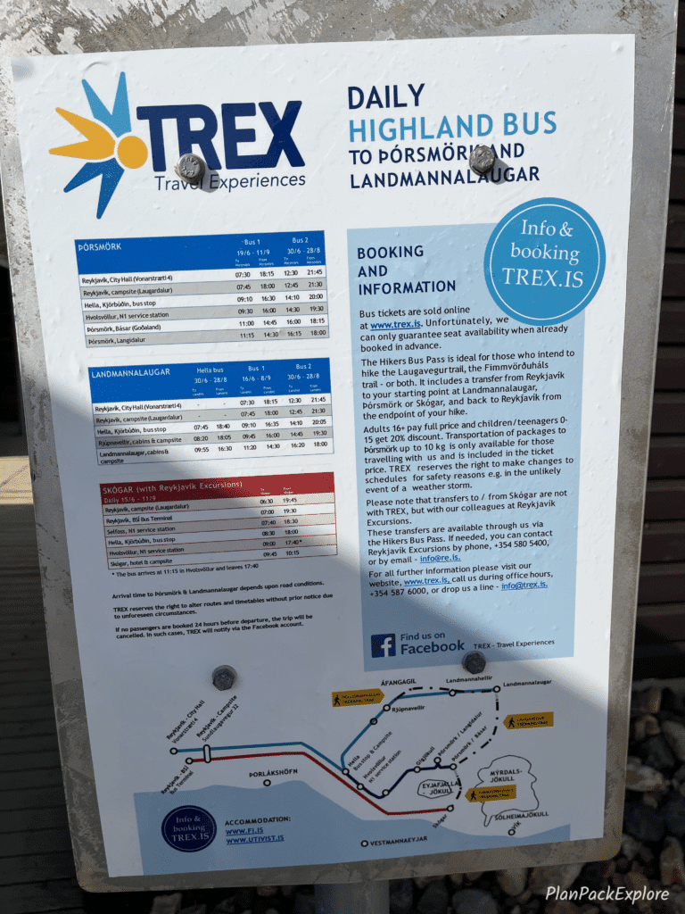
Be mindful of the bus return times if you’re here for one day.
Again, the Trex bus gives you the most flexibility with a few departure times to choose from, even as late as 6:00 pm.
Always check the schedule before you buy your tickets – and buy them well in advance, as they sell out quickly!
Do I have to be fit to hike Bláhnúkur and/or Brennisteinsalsa trails?
Let me start by saying that these hikes do take some time and effort to get to the summit for the rewarding views. However, it doesn’t take a marathon-like prep to be able to complete them. If you are of average fitness, you will have no problems. BUT if exercise isn’t really a part of your routine yet, it may not be a bad idea to start incorporating some light cardio and/or some leg exercises to improve your stamina and to get your leg muscles used to doing more work. You will simply enjoy your experience on the trail more.
Where to stay in the area?
Landmannalaugar can easily be done as a day trip, especially if your accommodation is on the Golden Circle. But if you’d like to spend more time in this incredible area, you have a few options.
In the summertime you can stay at the campsite. It is huge and you don’t need a reservation. The cost is 2000 ISK per person per night.

READ MORE: Camping in Iceland: A Complete Guide and Tips from My Campervan Adventure.
The other option is staying at the mountain hut. The Landmannalaugar hut can house 78 people in rooms with bunk beds and a common kitchen.
You have to book you spot online, and keep in mind that the huts fill up very far in advance as that’s where most tour companies provide accommodations as well.
So if you know you’d like to stay there, book as soon as you have a plan for your trip. The cost is 13000 ISK per person per night.
Outside Landmannalaugar, your closest option is the Hrauneyar Highland Center. Located on rt. 26, just before you get to F208, it’s a 51-room hotel with free parking, a restaurant, a café and a gas pump! It also has a sauna that is free to use for guests.
You can also easily access Landmannalaugar from the Golden Circle towns, like Flúðir. We stayed in Selfoss and made it a day trip, with plenty of time to hike the Bláhnúkur – Brennisteinsalda loop and enjoy the area.
Are these hikes worth the long bumpy drive?
Absolutely! A day in Landmannalaugar and hiking in this incredible landscape is an unforgettable experience. Just please make sure you have the right vehicle for this drive!

Let me help you pack for your trip!
Get organized with this printable, fillable, practical ICELAND PACKING LIST!
Imagine all your Iceland essentials organized in a checklist that you can access from any device or print to have a hard copy!
Make packing for Iceland easy with this comprehensive, easy-to-follow checklist!
You may also like:
- Landmannalaugar Travel Guide – All You Need to Know + Best Things to Do
- 6-day Iceland Itinerary (How to See the Best of Iceland in a Short Time)
- The Amazing Kerlingarfjöll and Hveradalir Geothermal Area in Iceland.
- Best Places to Visit on the South Coast of Iceland.
- Möðrudalur – a Complete Guide to the Most Charming Farm in Iceland.
- Golden Circle in One Day – Full Guide to the Main Stops and Best Detours.
- Snæfellsnes Peninsula – A Complete Guide and Top Things to See.
- Reykjadalur Valley – a Beautiful Hike to a Hot River (+ Tips for the Best Experience)
- Stuðlagil Canyon Guide: Tips for Hiking and Best Viewpoints.
For more Iceland inspiration and travel guides click HERE.
Need more help planning your trip? Join my Explore Iceland: Travel Tips & Advice FB Group community to ask questions, share your experiences, plus get expert travel tips and advice from a supportive community of Iceland enthusiasts! Join today!
🎙️ Prefer to listen to the travel guides instead? Check out my Explore Iceland Travel Podcast and easily plan your trip on the go!
About Monika
An avid traveler and a passionate trip planner, mildly obsessed with being organized and prepared 🙂
Well aware of how precious travel time is, I’m here to share my experience and help you get the most out of your vacation time.
“Taking the hassle out of trip planning”