By Monika
Landmannalaugar Travel Guide – All You Need to Know + Best Things to Do.
If you ever wanted to visit a place with amazing landscapes, colorful mountains, lava fields and natural hot springs all in one area, Landmannalaugar is your destination!
It’s a stunning area in the Icelandic Highlands, that’s famous for epic hiking trails and incredible views.
I’d definitely recommend adding it to your Iceland itinerary.
You can do it as a day trip (this is what we did – more on our experience later in the post) or stay a night or two and explore the area at a more relaxed pace.
In this guide I’ll give you all the information you need to have a stress-free, memorable visit to this magical place.
This post contains affiliate links to trusted products and services that I use and love myself. If you make a purchase through these links, I may receive compensation at NO EXTRA COST TO YOU. I appreciate your support! Also, as an Amazon Associate I earn from qualifying purchases. See the Disclaimer Policy and the Privacy Policy for more details.
- Landmannalaugar Travel Guide – All You Need to Know + Best Things to Do.
- Where is Landmannalaugar?
- Do I have to be a hiker to enjoy Landmannalaugar?
- How to get to Landmannalaugar?
- What to do in Landmannalaugar?
- Do you have to be fit to hike Landmannalaugar trails?
- Best time to visit Landmannalaugar
- How to prepare for a day trip to Landmannalaugar
- What facilities are available at Landmannalaugar?
- Where to stay in Landmannalaugar?
- What can you see on the way to or from Landmannalaugar?
- How much time do you need for Landmannalaugar?
- FAQ
Where is Landmannalaugar?
Landmannalaugar is located in the southern part of the Icelandic Highlands – an interior area that’s not inhabited year-round but is a busy tourist destination in the summer months.
Part of Fjallabak Nature Reserve, it’s mostly known for its amazing multicolor rhyolite mountains, ancient volcanoes, lava fields, and hot geothermal pools.
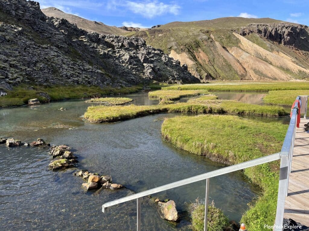
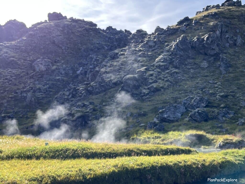
How did these colors come about? Well, rhyolite is a result of silica-rich magma cooling very slowly after the 1477 volcanic eruption, during which the Laugahraun Lava Field in Landmannalaugar was formed. The hot spring (known as “People’s Pool”) and multiple steam vents that you see during your hikes through this area are heated by the hot lava still present underneath the surface.
Do I have to be a hiker to enjoy Landmannalaugar?
Absolutely not! Landmannalaugar is a place that anybody can enjoy!
Even if you don’t venture much past the main base camp area you will still be surrounded by landscapes that will make you feel like you are on another planet. There are easy short hikes through the lava field, a natural hot pool to dip in, and views that will take your breath away.
And watching cars cross the river right before you get to the campsite is a fun bonus activity – video below, read on!
How to get to Landmannalaugar?
By car:
Driving is definitely the best option if you like flexibility and exploring at your own pace.
Getting to Landmannalaugar involves driving on F-roads (which are unpaved, sometimes rough gravel roads) so you need to have a proper car for the trip. If you do have an F-roads approved 4×4 rental car or a campervan, self-driving is the way to go.
Keep in mind that you need at least a midsize SUV with decent ground clearance for the easiest, northern, route (more on route options below). We had a Toyota Rav4 and were totally fine. We saw a lot of Dacia Dusters as well. The bigger your car, the more comfortable the drive.

Rent a proper car for your adventure with a 5% discount automatically applied to your reservation from a trusted local company I always rent from – Blue Car Rental!
Driving route options
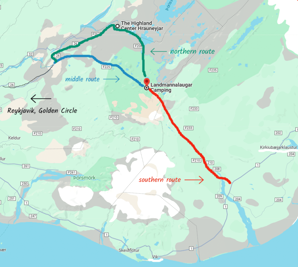
There are three main route options to get to Landmannalaugar.
The northern and the middle ones are good if you’re starting from Reykjavik or the Golden Circle area, and the southern one if you’re departing from the South Coast (and are an experienced F-roads driver – read more below).
Here are brief descriptions of the routes, based on the difficulty of the drive and a map to help you plan:
The easiest route – F208 from the north (Fjallabaksleið Nyrðri):
From your accommodation, you’ll get to rt. 26 (depending on where your starting point is), then turn right to follow rt. F208 and at the very end take a turn to rt. F224 leading you directly to the Landmannalaugar area and the campground.
This is the route we took. We stayed in Selfoss, so we had to take rt. 30, then rt. 32 before we joined rt. 26 to take us to F208.
Be careful! If you just put “Landmannalaugar Campsite” in your Google Maps and you’re starting in the Selfoss area, or another town on the Golden Circle, your navigation may automatically direct you to the middle, a bit tougher route, because it’s a little shorter distance-wise.
To ensure you’ll be directed via the northern route, type in “The Highland Center Hrauneyjar” as a stop on your route and then add “Landmannalaugar Campsite” as your final stop.

The Highland Center is a great place for a quick break before the turn to F208.
It has a café, bathrooms (the fee is 150 ISK or you can use them for free if you purchase anything from the café) and – important! – a gas station!
It’s just a single self-service gas pump, but you CAN get fuel and I strongly suggest having a full tank any time you venture into the Highlands. It is the last pump before you embark on your Highlands adventure so if you need to refuel, this is the place to do it at.
The Highland Center and the nearby Highland Hotel are also great accommodation options if you’d like to shorten your drive to or from Landmannalaugar and spend the night here.
If this is your first time driving the F-roads and you don’t have a large SUV, or if you simply don’t want to deal with crossing the rivers, the northern route is the best option for you.
We’ve driven the entire length of rt. F35 (Kjölur) at the beginning of our trip to Iceland, as well as on some other pretty bumpy unpaved tracks (like the access road to Stuðlagil Canyon), so we were quite comfortable with the easier F-roads and still felt we chose well with this option.
If you’re looking to break up the drive, take a detour from rt. 32 to explore Þjórsárdalur (Thjorsardalur) Valley – it’s beautiful!
Both rt. 26 and the initial portion of rt. F208 are paved.
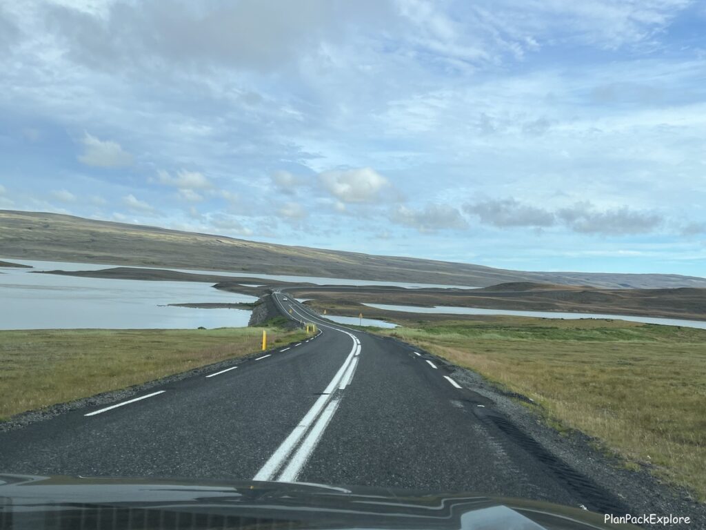
The rough road starts after you pass the hydroelectric plant, about 30 km before you get to the campsite.
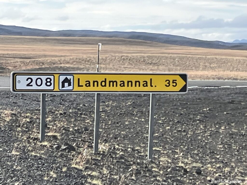
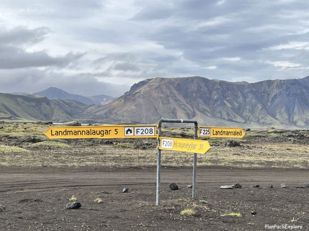
The unpaved stretch of F208 is rough and bumpy and has some bigger potholes that you want to avoid, so the smaller your car, the slower and more careful you want to go.

But it is safe and totally doable. We enjoyed it.
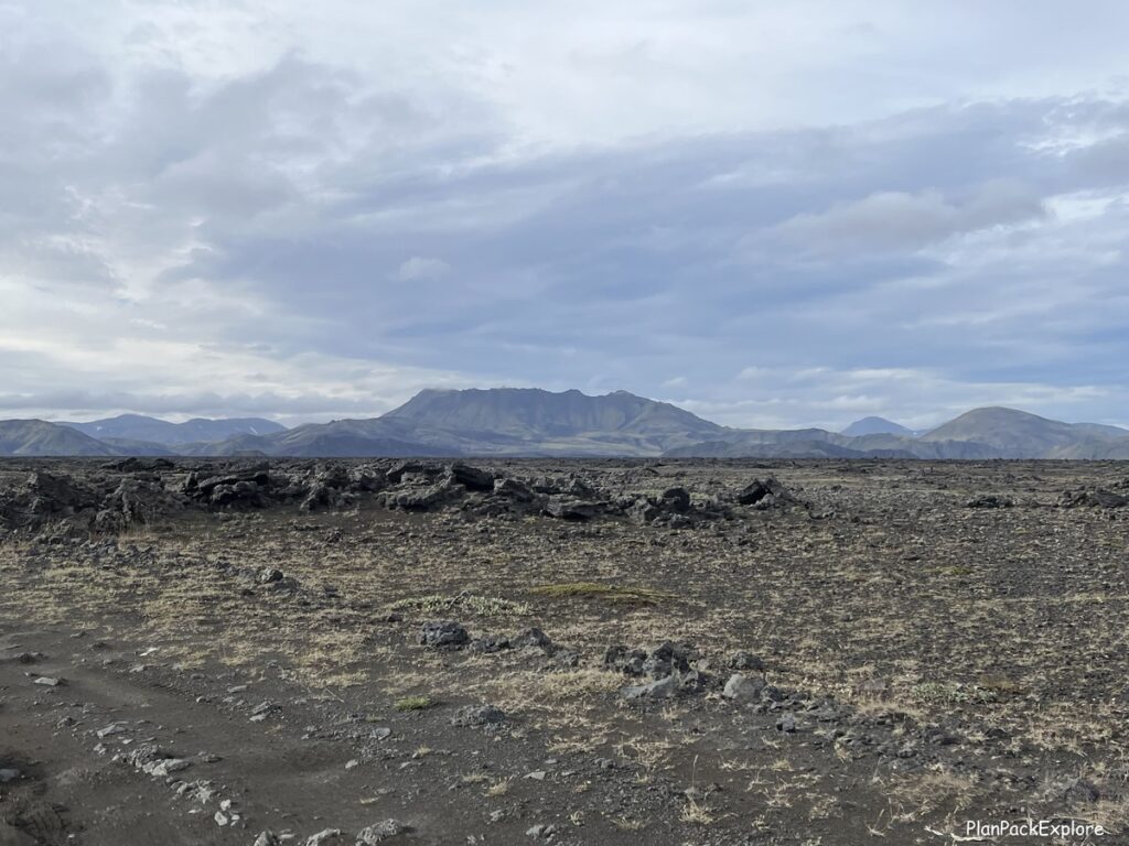
The views are amazing, changing from green mountains to black volcanic desert-like landscapes. Don’t rush and take it all in!
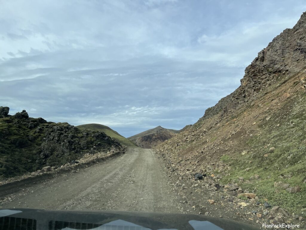
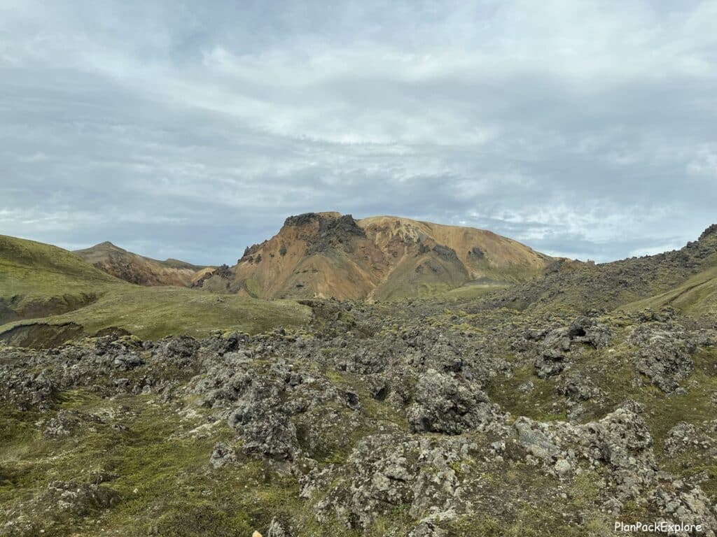
Here is a video of the drive to give you an idea of what to expect:
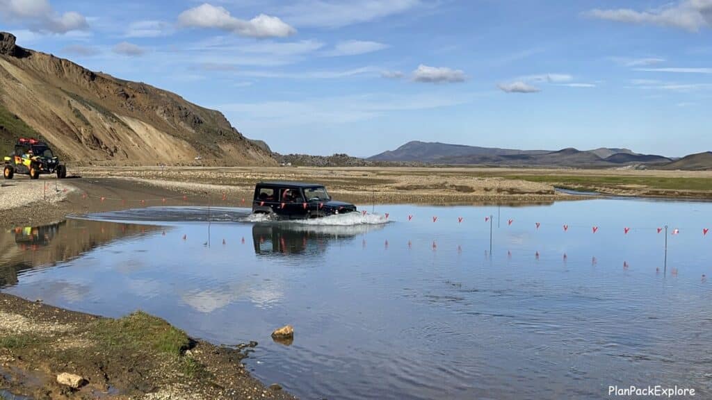
Are there river crossings on this route? Yes and no!
Yes, there are two rivers to cross directly before the campsite but NO, you don’t have to cross them to get to Landmannalaugar main area. More details and a video below in the “Parking” section of this post.

The more difficult road – F225 (Landmannaleið)
That’s the route that your Google Maps may automatically pick for you if you’re starting from the Golden Circle/Selfoss area.
It is a few kilometers shorter but the F-road part of your drive is longer and the conditions of it are rougher. From tr. 26 you’ll turn right to rt. F225, then join rt. F208 and F224 to the campsite. Shortly before F225 joins F208 you’ll have 2 river crossings. According to my research they seem to be on the smaller side and may be a good starting point to your river crossing practice, but you may want to do that in a bigger, F-road approved SUV (if it’s marked as a “river crosser”, that’s even better – always check with your rental company!)
And remember – if your rental car is a hybrid DO NOT DRIVE THROUGH THE WATER!!! You may cause serious damage and lose your insurance coverage.
If you think you want to try this route, a good option is to drive to Landmannalaugar via the northern route and check with the warden about the road conditions and the water level in the rivers you’ll be crossing. They will advise you if it’s ok to take the middle route as your return drive. That’s what we plan to do on our next visit.
The toughest route – F208 from the south
This is supposed to be the most picturesque drive – at least that’s what I’ve read while researching route options for our trip.
You take F-208 from South Iceland (not quite halfway between Vik and Kirkjubæjarklaustur) all the way to Landmannalaugar, crossing a few rivers on the way. I don’t recommend attempting that route without an appropriate car and at least some river-crossing experience.
How long is the drive to Landmannalaugar?
From the Golden Circle area it will take anywhere between 2-2.5 hours.
We left Selfoss at 7:30 am and arrived at the Hrauneyjar Highland Center at 8:45am. After a quick stop to check it out and talk to the warden we continued on, arriving at the Landmannalaugar parking lot (the one before river crossings) at 10:10 am. So the easiest northern route took us about 2.5 hours to drive.
If you’re driving from Reykjavik you should add about 45 minutes to 1 hour to this drive time, so about 3.5 hours one way.
It’s a long day and a lot of driving but if you can make it work, the experience of visiting Landmannalaugar is well worth the effort.
Parking in Landmannalaugar:
The main parking lot is located near the campsite.

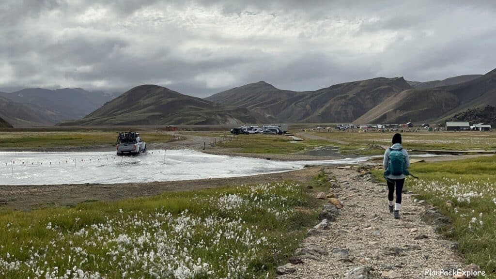
Right before the campsite are two river crossings, but don’t worry – for those unable or unwilling to attempt that, there is also a parking lot before you have to cross, where you can leave your car.
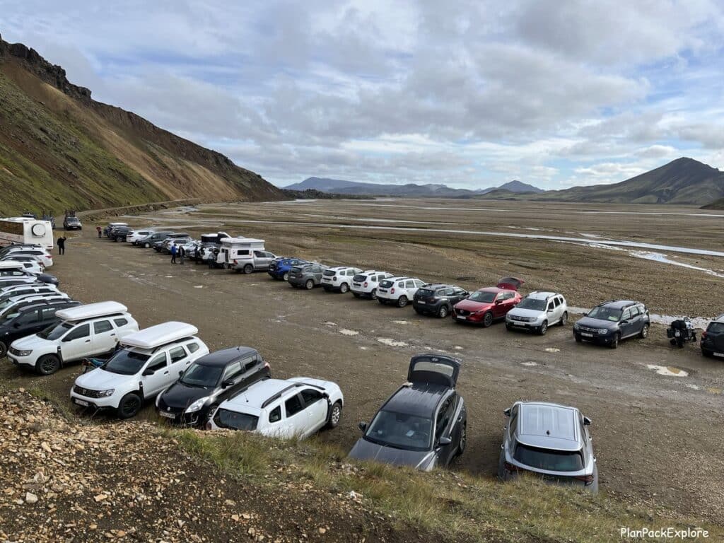
I recommend getting there early as it does fill up by midday.
IMPORTANT UPDATE: As of February 2024, a decision was made by the Icelandic Environmental Agency to implement a parking reservation system. You now have to reserve your parking spot, especially for the parking area before the river crossing. The system is meant to relieve congestion at Landmannalaugar and prevent drivers being forced to cross the rivers without an adequate vehicle and/or skill because they can’t find a parking spot. More information about this new reservation system here.
Here is a short video to give you an idea of what the river crossings look like:
To get to the campsite, the warden’s hut, and the hiking trails from the “outside lot” you just follow the path on the right of the parking area. It’s only about 0.5 km long and you can see the large campground from the lot.
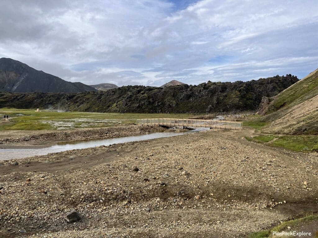
Cross a small wooden bridge and you’re ready to start your Landmannalaugar experience.
Follow the short walking trail towards the main Landmannalaugar area.
Important tip: If you’re reading this post in the winter while doing research for your visit to Lanmannalaugar (or anywhere in the Highlands actually) there is a good chance that Google Maps will not show you the correct route options and driving times. You’ll most likely get a warning “unable to find directions due to road conditions” or a long incorrect route. That’s because the Highlands area roads are closed in the winter and Google knows that. So for now, trust the above timelines and check back closer to the summer for correct directions/driving details.
For an awesome backup paper map (which I recommend always having with you when you’re traveling in Iceland) check out this “Iceland Adventure and Travel Map” – the only one I found with a clear, easy-to-read listing of roads, popular sites and GAS STATIONS – and THAT to me is priceless!
By bus:
Bus transportation is a very convenient option if you’re not up for driving into the Highlands but still want to explore on your own.
There are various bus companies, so it’s good to check and compare their prices, schedules and stops to choose the right one for your needs. They all depart from the BSI Bus Terminal in Reykjavik but stops between there and Landmannalaugar vary.
I recommend booking tickets online in advance – they tend to sell out quickly.
Highland Bus | Reykjavik Excursions – the cost is about $82 per person one way
Landmannalaugar – Trex bus – ticket costs about $92 per person one way
Volcano Trails bus – about $80 per person one way
The bus ride is typically about 4.5 hours long.
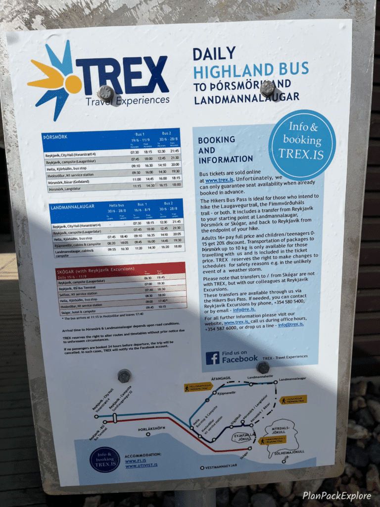
This bus schedule was posted in front of the hut at Landmannalaugar.
With a tour:
Would you like a guide for your first tip to Landmannalaugar? No problem! There are some really great tours available, most of them offering pick up from Reykjavik
- Landmannalaugar & Háifoss Waterfall Tour – this tour includes stops at some wonderful waterfalls on the way to Landmannalaugar, a walk through Laugahraun Lava Field and allows time to soak in Landmannalaugar’s famous natural hot spring. (more about these attractions later in this article)
- Landmannalaugar Guided Hiking Experience – this tour is perfect for hiking enthusiasts – you’ll be hiking Mt. Brennisteinsalda (“the Sulfur Wave”) and depending on time and conditions, possibly Mt. Bláhnúkur (the “Blue Mountain”)
- Landmannalaugar Hike and the Valley of Tears – this tour combines waterfall and hiking in Landmannalaugar with an additional stop at the stunning Sigöldugljúfur Canyon (“The Valley of Tears”)
Need a little more excitement? How about a super jeep tour?
Not staying in Reykjavik? Check out tours departing from Hella or Vik.
Helpful hint: Sometimes if you’re looking at seasonal summer-only tours in the winter they will show up with a message that “this activity is not bookable at this time”. Don’t get discouraged, keep checking in, the schedule will eventually show up and you’ll be able to book your tour.
It happened to me with a puffin tour we tried to book too far ahead of our trip!
Now that you know how to get to Landmannalaugar, let’s talk about how you can spend your time there. Then I’ll explain how to best prepare for your visit.
What to do in Landmannalaugar?
Most visitors come to this area with hiking in mind, but as I mentioned earlier, there are other things you can do there. For an easy walk, you can choose the Laugahraun Lava Field loop, or go for one of the other popular hikes, which I will describe below. You can just soak in the natural hot spring and relax. The hot pool is also a nice way to recharge after a hike.
Landmannalaugar natural hot spring
The hot spring is called “People’s Pool” and is very easily accessible from the main hut area. You can see it from there if you look in the direction of the parking lot.
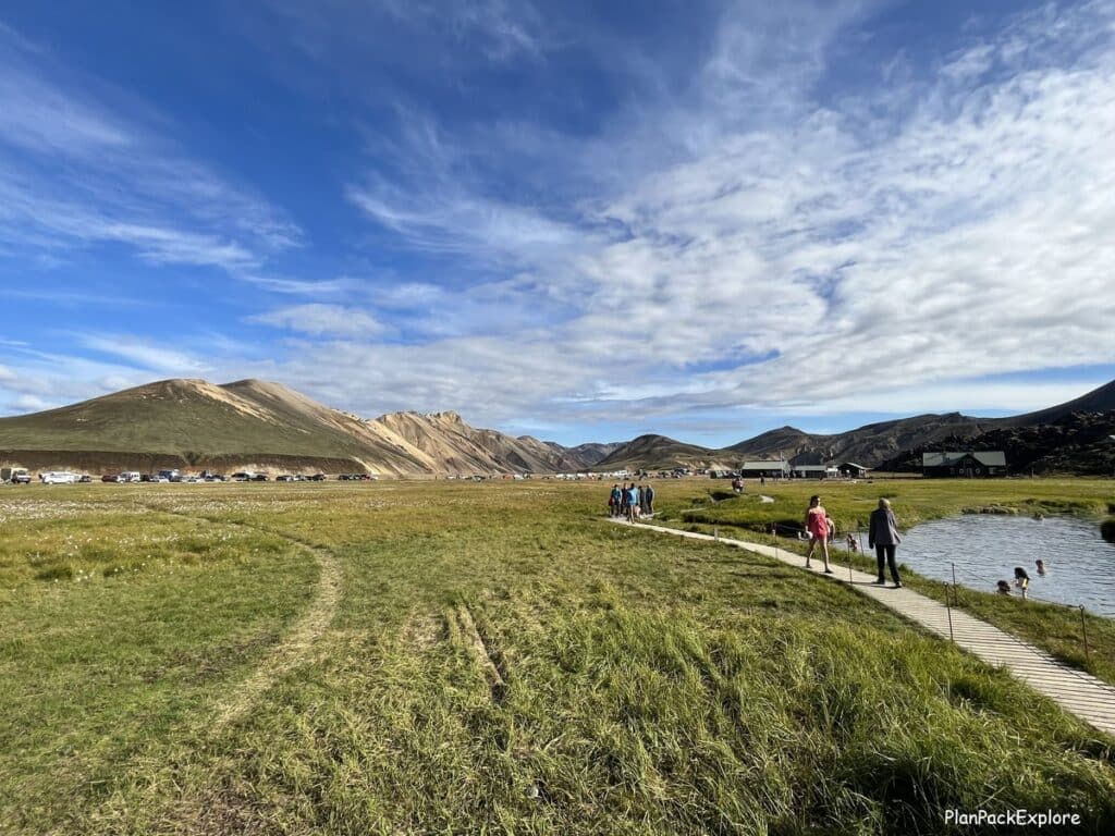
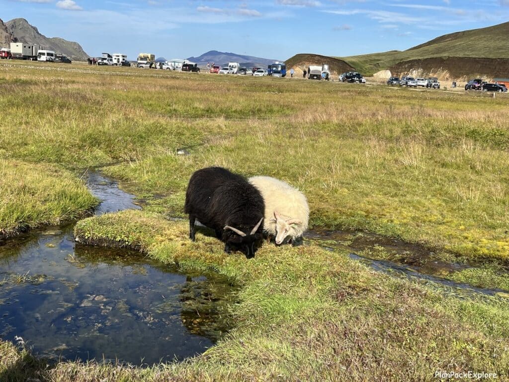
Just follow the wooden walkway, which will take you to the hot spot. It’s a 2-3 minute walk and you may see some sheep on the way.
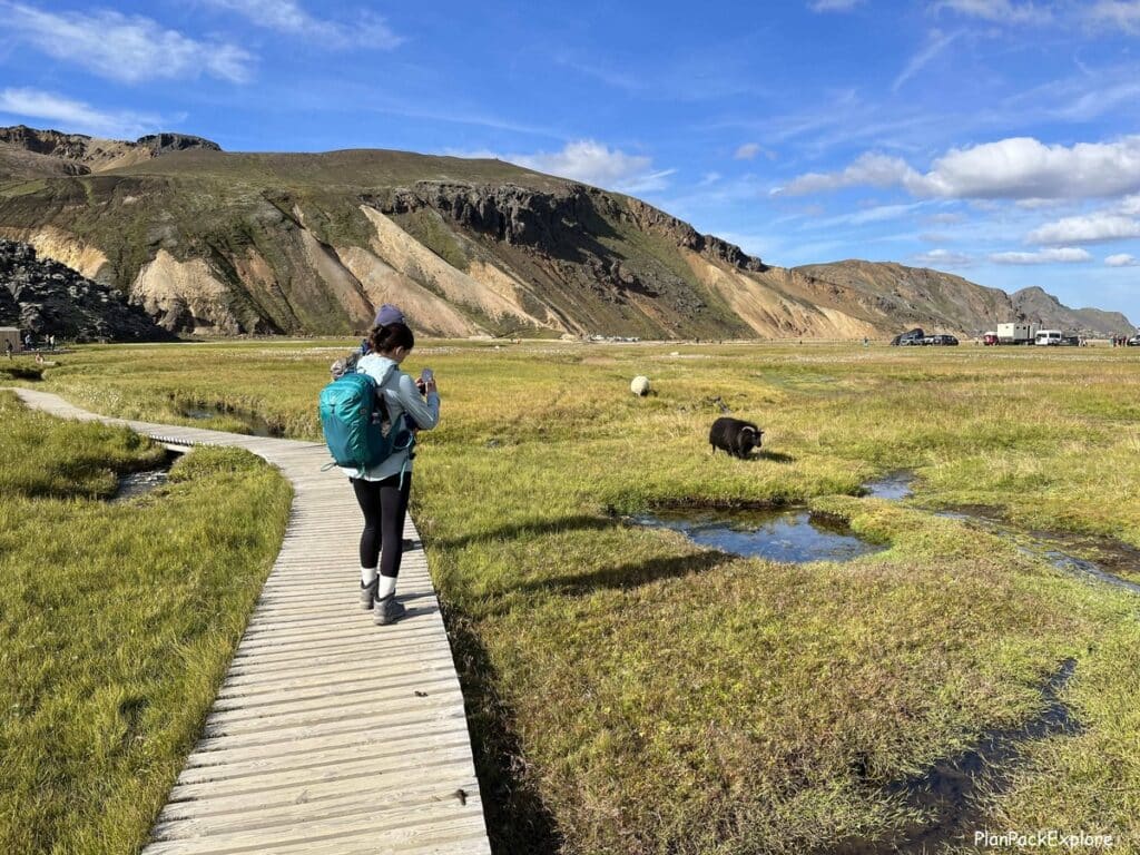
There are no changing facilities, just two wooden booths with racks to place your clothes and towels. You can see them in the distance in the photo below.
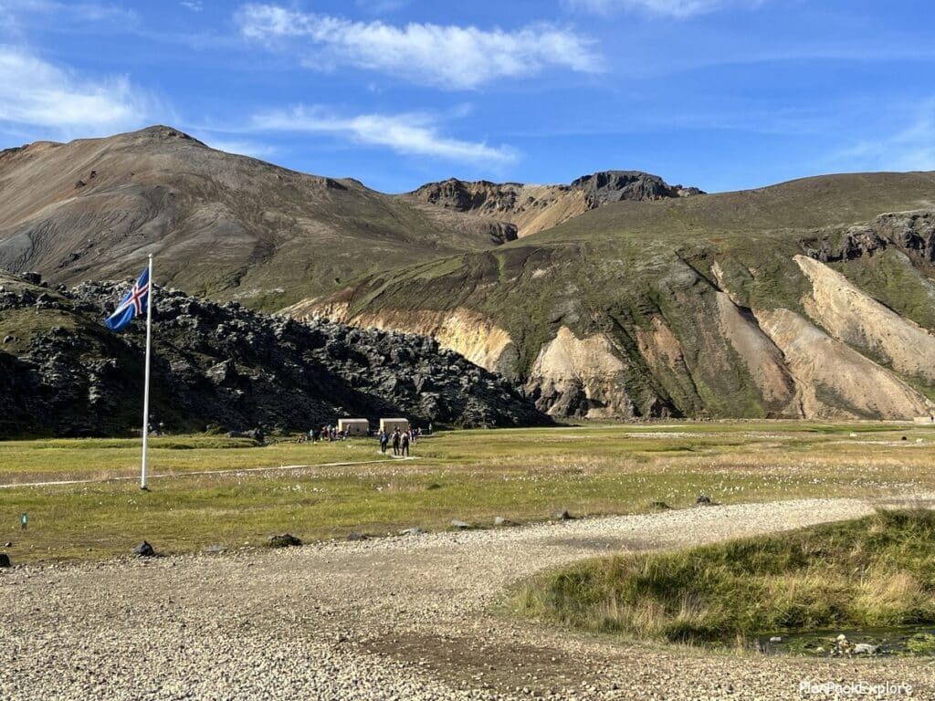
The water is as clean as in any natural Icelandic hot spring – there is a sign stating that it’s not sanitized with any chemicals or monitored.

We did not go in just because of time but it did look inviting and judging from the amount of steam and the number of people in it – nice and hot!
Best hikes in Landmannalaugar
Landmannalaugar is often called a “hiker’s paradise” thanks mostly to the many choices of trails for hikers of all abilities and of course the amazing surroundings.
Before you start any hike, you should get a map at the warden’s information desk. You can purchase them for 300 ISK and it’s a rough guideline for the trails in the area. If, like us, you received a map from someone who has previously visited, just pay extra attention to the trail colors on the markers.
We visited in August of 2023 and purchased the map. Our friends also gave us one before our trip, that they purchased just a month earlier, in July. Notice the difference in trail colors?

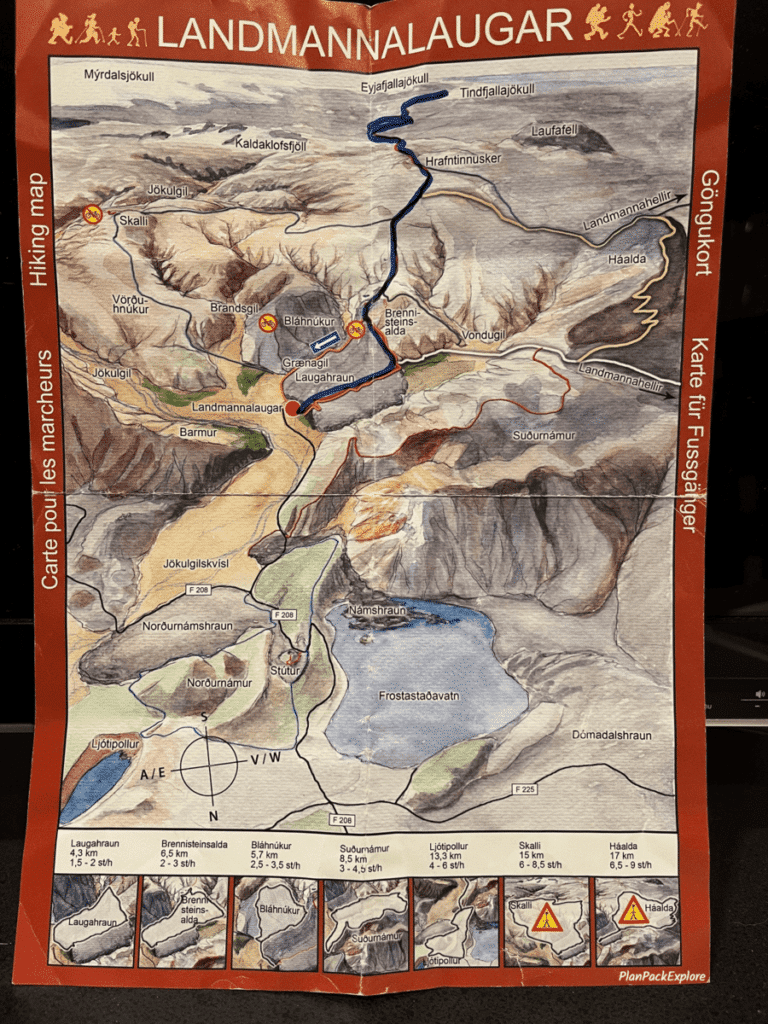
It looks like sometime between July and August of 2023 the Laugavegur trail, part of which coincides with Mt. Brennisteinsalda trail, had its color changed from red to blue. We did follow stakes marked with blue on our way to Brennisteinsalda, so I believe this is a permanent change.
Did you notice these changes? Please let me know in the comments!
1. Laugahraun Lava Field
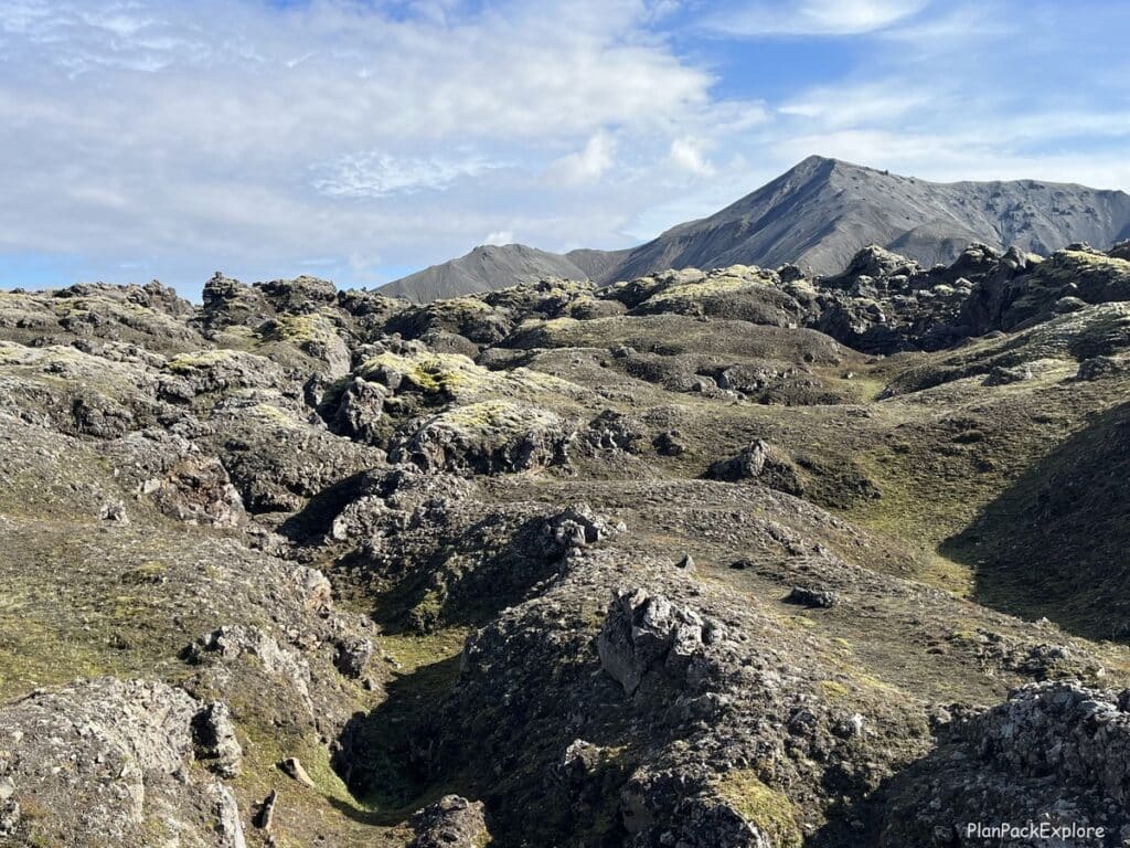
Take a walk through a lava field and take in the beauty of the surrounding rhyolite mountains and the volcanic area. It’s a relatively flat easy hike, great for people of all ages.
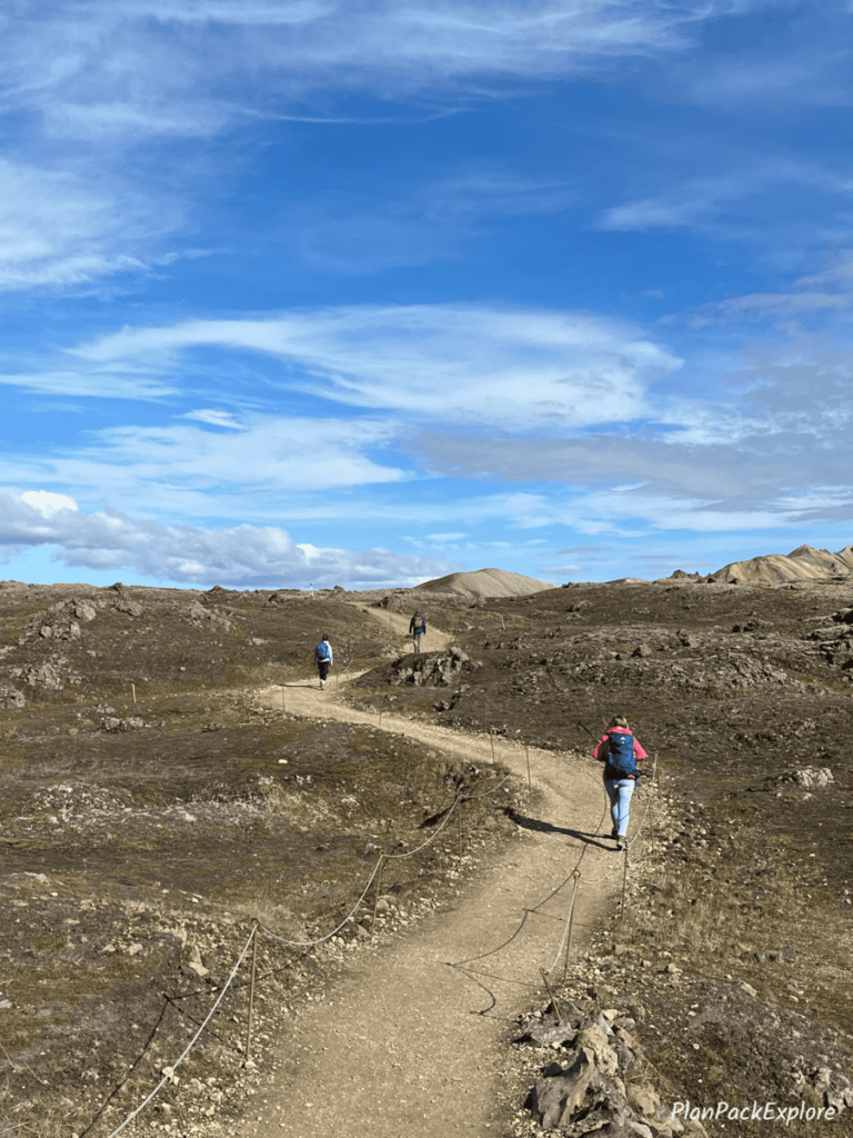
The trail is well defined, and the entire loop is about 4.5 km long.
On average it takes about 2 hours to complete it but it’s possible to only do a part of it as an out-and-back trail.
Start near the main hut building if you want to do the loop counterclockwise (that’s also the best place to start if you choose to only do a part of the trail, not the complete loop) or head towards the Grænagil Canyon and then follow the trail to the right to complete the loop clockwise.
2. Mt. Brennisteinsalda

Also known as the “Sulphur Wave” or the “Rainbow Mountain” due to its incredible colors, it’s one of the most popular hikes in Landmannalaugar. It is included in most group tour itineraries so expect company on the trail. But don’t let that discourage you, it is an amazing hike and once you reach the summit you are rewarded with breathtaking views of the area and Mt. Bláhnúkur (the “Blue Peak”).
You have a few different options to complete this hike. The most popular loop will take you through the Laugahraun lava field and Vondugil Valley to the summit and back to the campsite through the Grænagil Canyon.
This loop is about 6.5 km long and on average takes about 2-3 hours to complete.
For more details, photos and trail choices please read my Ultimate Guide to Hiking the Bláhnúkur – Brennisteinsalda loop
3. Mt. Bláhnúkur
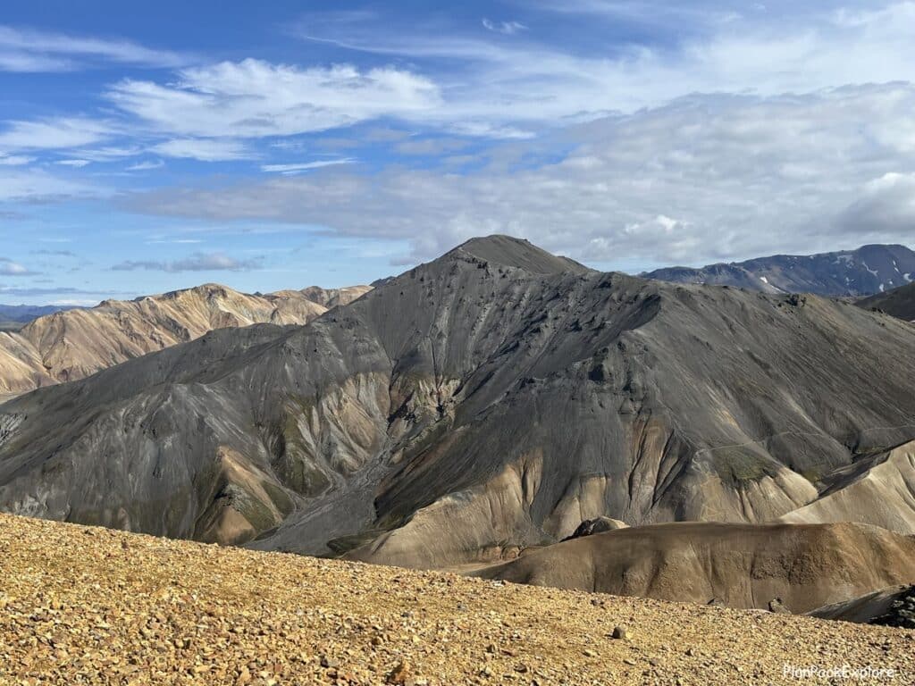
You can’t miss this peak – also known as a “Blue Peak” or a “Blue Mountain” for its bluish-black color, this volcano definitely stands out in the rainbow-colored Landmmanaugar landscape.
It is a steeper and tougher hike that the Brennisteinsalda hike but it’s so worth the effort! The views are stunning, not just from the summit but along the whole trail. And the satisfaction of reaching the summit is priceless!
The full Bláhnúkur trail loop is about 5.7 km long and it takes about 2.3 – 3.5 hours to hike.
For more details, photos and trail choices please read my Ultimate Guide to Hiking the Bláhnúkur – Brennisteinsalda loop
4. Bláhnúkur – Brennisteinsalda Loop
For a full Landmannalaugar hiking experience you can combine the Brennistainsalda and Bláhnúkur trails into one epic loop. I definitely recommend it if you have the time and are up for a bit more challenging but incredibly rewarding hike.
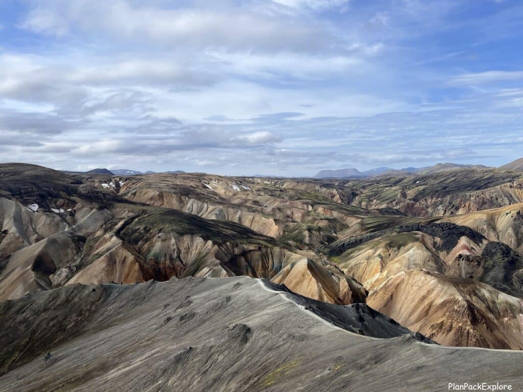
This is what we ended up doing after a lot of discussions and going back and forth on our decision and I couldn’t be happier that we did that!
To find out more about how we hiked this loop and for tips and tricks for the best experience on the trail check out this detailed photo guide: Ultimate Guide to Hiking the Bláhnúkur – Brennisteinsalda loop.
5. Suðurnámur
This is considered a challenging half-day hike, offering breathtaking views of the Landmannalaugar areas.
It starts about 1 km from the campsite, along F224, where the trailhead is marked with red-topped wooden posts. It is a loop hike taking you back to the campsite via Vondugil Valley and Laugahraun Lava Field.
There are several small creek crossings on this trail, usually passable by jumping stone to stone, but after the rain, you may need water shoes to cross them.
At times parts of this trail are closed, so always check with the warden before you head out, as you may not be able to complete it as a loop, but rather as an out and back trail. In that case you can start via Laugahraun Lava Field and Vondugil Valley, then after reaching the summit, come back the same way.
As a loop it’s 8.5 km long and takes about 3-4 hours to hike.
6. Skalli
This trail is described as the one of the longest and most strenuous hikes in the area. The loop will take you around Mt. Bláhnúkur and into the rhyolite landscape for some incredible views.
The loop is about 15 km long and takes about 6-8 hours to complete.
7. Grænihryggur
This is a long and challenging hike to the famous “Green Ridge”, and it’s best done with an experienced guide.
You can book a tour departing from Reykjavik, or one that has an option of meeting the tour group on location if you’re already at Landmannalaugar.
If you prefer a private tour – click here.
8. Laugavegur Trail
Landmannalaugar is a starting point for the famous multi-day hike – the Laugavegur Trail – a 55 km trek to Thórsmörk (also spelled Þórsmörk) – the “Valley of Thor”.
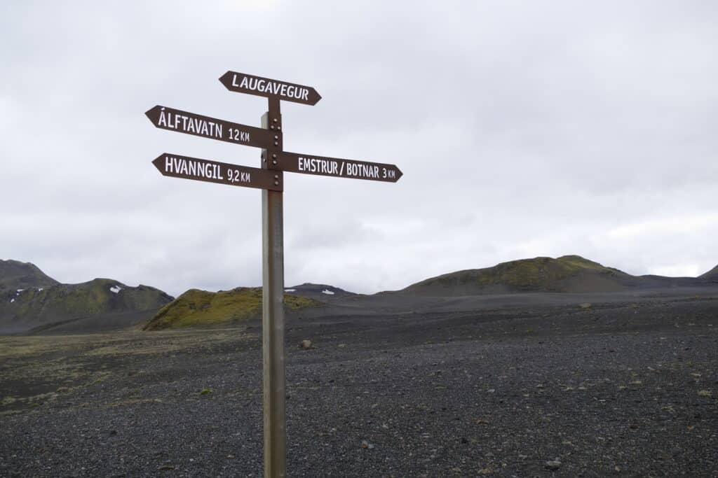
You can hike this “bucket list trail” on your own, or with a guided tour.
Do you have to be fit to hike Landmannalaugar trails?
Let me start by saying that with the exception of the Laugahraun Lava Field walk, the trails here are actual uphill hikes. They do take some time and effort to get to the summit for that rewarding view.
With that said, it doesn’t take a marathon-like prep to be able to complete them. If you are of average fitness, you will have no problems. However, if exercise isn’t really a part of your routine yet, it may not be a bad idea to start incorporating some light cardio and/or some leg exercises to improve your stamina and to get your leg muscles used to doing more work. You will simply enjoy your experience on the trail more.
Best time to visit Landmannalaugar
If your goal is hiking and you’d like to drive yourself, then the only time you can do that is in the summer. Typically, F-roads open around mid to late June and close sometime mid-September, although some stay open till October. Their opening/closing dates vary by location, so always check the current road conditions.
Can you visit Landmannalaugar in the winter?
Yes, you can! You do need to book a super-jeep tour for that experience, and you won’t be able to hike but you’ll get to see Hekla, Ljótipollur and other amazing sites in all their winter glory plus there is usually a visit to the People’s Pool at Landmannalaugar planned in the itinerary.
How to prepare for a day trip to Landmannalaugar
- pack correctly! I can’t stress that enough! This is the Highlands which means the weather can be very different from wherever your starting point is and it can also change in a heartbeat. So be prepared with layers, raingear, windproof jacket/pants, hats and gloves. Bring good hiking shoes and trekking poles are also good to have on your hikes.
- check the weather! It’s good to have a bit of flexibility in your schedule, to pick a nice clear day for your visit if possible. If that’s not possible, make sure to prepare for all four seasons.
Important: Please don’t check the weather for the Highlands (or anywhere in Iceland actually) on AccuWeather or another commonly used weather app. Always go to the most reliable source, Icelandic Meteorological Office for the most accurate forecast and do your final check a day or two before your trip.
- check the roads! To get to Landmannalaugar you’ll be driving on mountain roads (F-roads). They are usually fine and passable in the summer but please be sure and double check for any closures/incidents to avoid any surprises!
- have the right car to get you there safely!
- fuel up before you come! There are no gas stations in the Highlands, so be prepared with a full tank for your trip. Like I mentioned above, on the northern route to Landmannalaugar, the last gas pump is located at Hrauneyar Highland Center.
- bring food and drinks! There are some provisions and ways to buy some food here (more on that below) but it’s best to bring your own. For your hikes you’ll have to carry enough food and drinks for everyone to last the duration of your hike. Be prepared especially with the drinks – some of the hikes are tough and there aren’t always streams to refill your water bottles, so please take enough with you to stay hydrated.
Check my packing list for helpful tips and practical items to make preparing for Highlands easy!
- always check in with the warden for the latest trail and hiking conditions before you take off. They have information that may not be available to you otherwise. They know the area very well and can give great advice on how to best plan your day at Landmannalaugar.
- download the trail maps to your phone! The cell signal is spotty at best so cell communication and using navigation apps may not be possible. If you have a charged Wi-Fi box in your rental car it may be a good idea to take it with you as it will provide a way to use your cell phones. A portable GPS can also be helpful. The maps sold at the warden’s office are not the most detailed, but it is good to have one as a general area guide.
- bring a portable power source for your electronics! You’ll be draining those batteries taking photos of this incredible area!
Helpful hint: don’t hesitate to ask questions on the trail – for advice, directions, really anything. Most hikers are willing to help and there are plenty of tour guides to answer your questions, too! Read here about an act of kindness from a complete stranger who saved our Bláhnúkur hike!
For all you need to know before visiting the Highlands, read this guide: How to Visit the Highlands of Iceland – 15 Essential Tips for a Safe Road Trip.
What facilities are available at Landmannalaugar?
Warden’s Information Office:
Always stop by and check in before you start your adventures.

The office is located near the hut and the bathrooms building.
That’s where you get information, pay for the use of the bathrooms/showers if you’re here for a day trip or for a campsite if you’re here for a longer time.
The day fee is 500 ISK, but you can pay a “family rate” of 1000 ISK if you’re a group. There were 4 of us and that’s what the warden offered us. You get green wrist bracelets and that’s your ticket.
Bathrooms/showers
They are located right by the warden’s office. They are nice and clean, and we never had to wait in a long line even though Landmannalaugar was a busy place on this gorgeous summer day!
The Mountain Mall
Hungry? Forgot your snacks? No problem. A short distance behind the bathrooms, as yoou head towards the trailhead for Mt. Bláhnúkur, you’ll see 3 green school buses set up in a “U” to form a “Mountain Mall”.
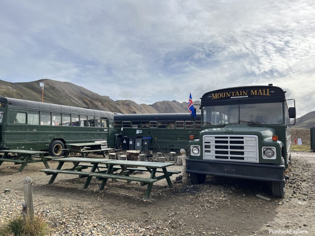
You can buy snacks, drinks, backpacking meals, and other things to keep you fed and hydrated during your visit.
There is even a café, providing simple hot meals (like soups) till 7 pm.
Where to stay in Landmannalaugar?
In the summertime, you can stay at the campsite. It is huge and you don’t need a reservation. The cost is 2000 ISK per person per night.

READ MORE: Camping in Iceland: A Complete Guide and Tips from My Campervan Adventure.
The other option is staying at the mountain hut. The Landmannalaugar hut can house 78 people in rooms with bunk beds and a common kitchen.
You have to book you spot online, and keep in mind that the huts fill up very far in advance as that’s where most tour companies provide accommodations as well.
So if you know you’d like to stay there, book as soon as you have a plan for your trip. The cost is 13000 ISK per person per night.
Outside Landmannalaugar, your closest option is the Hrauneyar Highland Center. Located on rt. 26, just before you get to F208, it’s a 51-room hotel with free parking, a restaurant, a café and a gas pump! It also has a sauna that is free to use for guests.
You can also easily access Landmannalaugar from the Golden Circle towns, like Flúðir. We stayed in Selfoss and made it a day trip, with plenty of time to hike the Bláhnúkur – Brennisteinsalda loop and take a little detour to Sigöldugljúfur.
Right, let’s talk about detours!
What can you see on the way to or from Landmannalaugar?
It all depends how you plan your day, how early you start it and how much you feel like you can pack into one day trip itinerary.
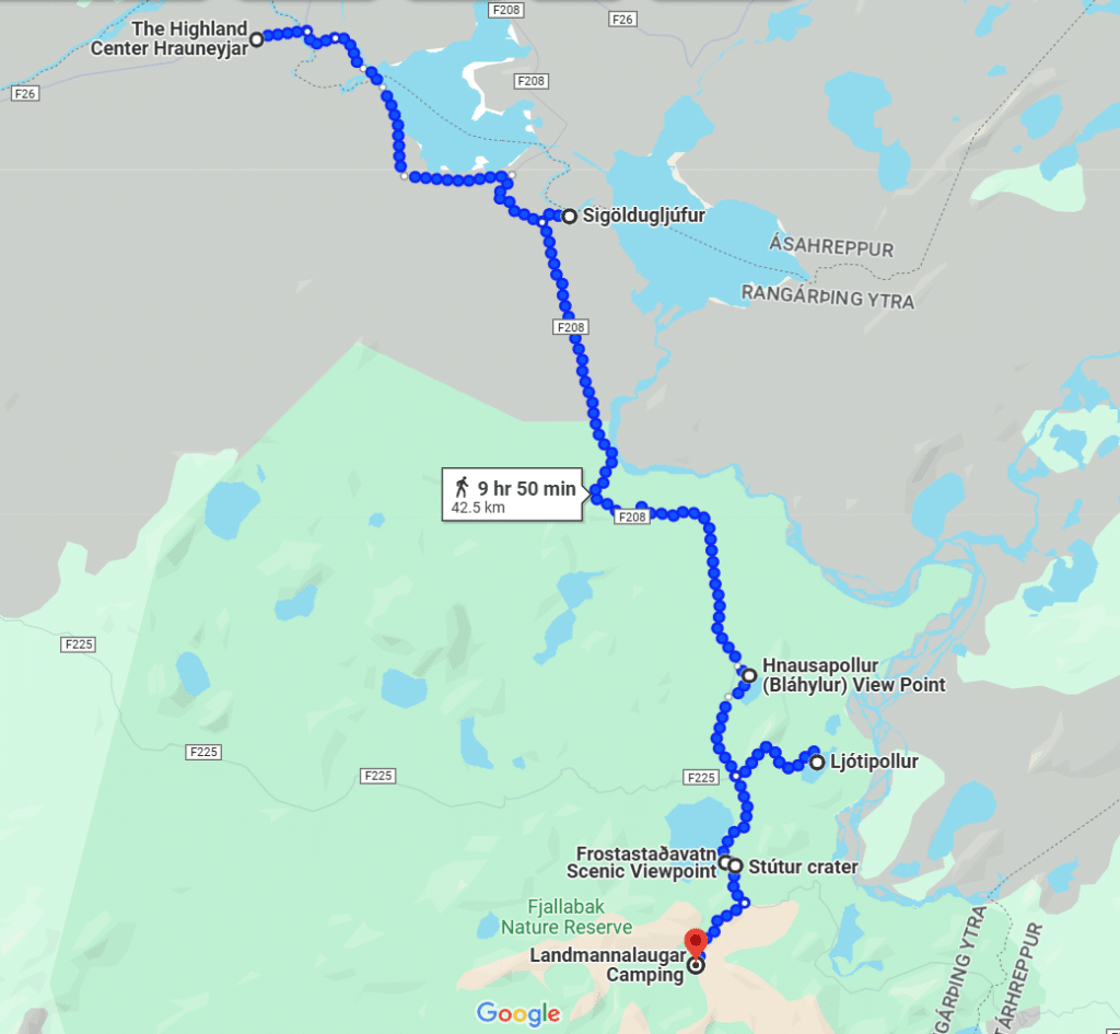
Here are some options to add to your drive along F208 and a map to help you plan. Don’t mind the “walking directions”, of course you can drive to all these destinations, Google Maps just wouldn’t generate the driving route for me and I wanted to show you where these detours are on F208.
Sigöldugljúfur
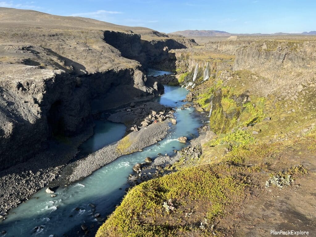
Also called the “Valley of Tears” it’s a breathtaking canyon with multiple waterfalls falling from its sides. When we stopped there the water was bright blue and the whole place was just stunning.
Important! The access road off F-208 (unmarked, with no signs for Sigoldugljufur) is VERY rough, definitely worse than the F-road itself. We were not aware of that fact and it was not a nice surprise! We did make it safely, just drove super slow and carefully. On your way to Landmannalaugar it will be to your left, and on the way back, to your right.
Here is a short video of the drive to Sigöldugljúfur:
As you can see it’s a short drive, but if you’re not comfortable, you can leave your car just before the turn-off and hike to the canyon along the road.
Hnausapollur (Bláhylur)
It’s a blue crater lake that’s easily visited from rt. F208. There is a sign to guide you up a hill where you get the best view. It can be a short drive up and look stop or you can walk around a bit.
On your way to Landmannalaugar it will be on your left, and on the way back, on your right. We didn’t do enough research before our visit, so we didn’t drive up the hill, which I definitely regret in hindsight.
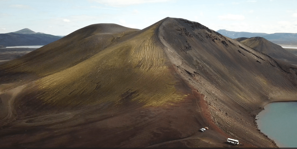
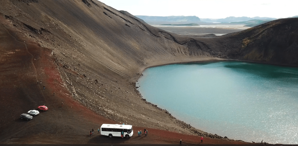
These cool photos are screenshots from an aerial video taken by a talented Adobe Stock photographer – thank you!
So if you have the time, go up for the stunning view! I do believe that it’s a one-way drive as the track is narrow, so just watch how other cars go (or are parked up top) and enter at the sign from F208.
Ljótipollur (“The Ugly Puddle”) Viewpoint
Another crater lake, just past Hnausapollur, located at the junction of rt. F208 and F225. It will be on your left if you’re driving to Landmannalaugar.
The photos below were taken by my dashcam so please excuse the dust spots from the windshield!
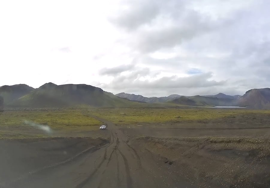
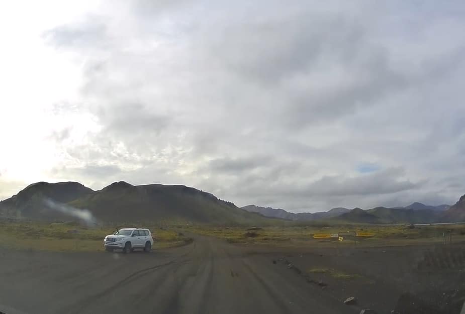
Despite the name meaning “The Ugly Puddle” it is actually a very scenic spot. There is a sign for a steep, 2 km long track to the parking lot at the rim and a viewing platform.
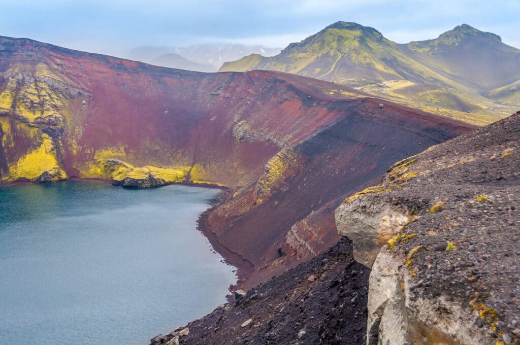
The track IS steep and challenging at the end, so as an alternative you can leave your car at the intersection of F208/F225 or at the nearby Frostastaðavatn parking area and hike from there. (it will take about 1-2 hours, depending on whether you’ll be walking around the rim).
You can also hike to Ljótipollur straight from the Landmannalaugar campsite area, with the trail passing near the next two stops I’ll list: Frostastaðavatn and Stútur crater. That’s a 4-5 hour loop.
Frostastaðavatn Viewpoint
Yet another crater lake, offering beautiful panoramic views of the area.
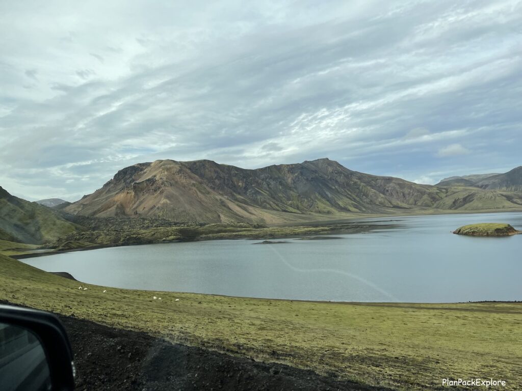
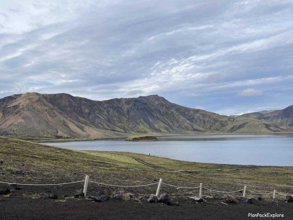
As mentioned above, the parking area is around the junction of F208 and F225, on your right when driving to Landmannalaugar. You can’t miss it – it’s right next to the road.
Stútur crater
The closest stop to Landmannalaugar along F208, just past the Frostastaðavatn Viewpoint. You can see it from a distance.
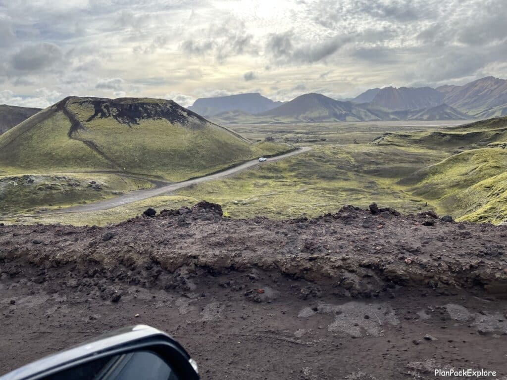
We saw it, too! I read about it but didn’t realize that was it! And we were rushing to get to Landmannalaugar so we didn’t stop… Don’t make our mistake and take some time to visit this crater. Definitely on the list for next time!
There is a small space where you can leave your car next to the road from which you can take a short trail up to the rim of the crater for some great views of the area. This is about a 30-minute stop.
Have we stopped in all these places? No, unfortunately not. Some of them I didn’t know about, some we simply didn’t have time for.
The truth is also that we were so pumped to hike in Landmannalaugar that we didn’t want to spend any time for any stops before we got there, and afterwards we were quite tired and only had the energy to stop to see Sigöldugljúfur.
We almost went up the hill to Hnausapollur…. but we didn’t. That’s probably one of the easiest stops, so don’t be like us and drive up to see it!
Now that I know so much more about the area and have a much better understanding of the locations of all the potential stops, I will definitely be planning my return trip to Landmannalaugar with plenty of time to work them in the day’s schedule.
Because we are absolutely coming back to Landmannalaugar!
How much time do you need for Landmannalaugar?
You need at least a day to get a taste of what this amazing area has to offer.
If you’re planning on hiking the Blahnukur – Brennisteinsalda loop I’d allow about 5 hours for that. This is how much it took us at a very unrushed pace.
Even if you’re not a hiker, one full day will give you a chance to expolre the lava field, soak in People’s Pool and just enjoy the incredible views. You will also have a chance to stop by some of the sites along F208 I mentioned above.
You will definitely need more days if you’d like to hike more trails.
👉 Don’t forget TRAVEL INSURANCE! I don’t travel without it. Get a quote from my personal #1 choice – Travel Guard – or check more options here!

FAQ
Yes, it’s very safe, as long as you take proper precautions – be mindful of the size of your car. The smaller the car, the slower you should go to keep both you and the car safe. Don’t stop on the road for any reason – it’s too narrow! Wait for a wider spot to get off the road. Have a full tank of gas and be prepared for a bumpy but exciting drive.
Yes, you do! You need a proper F-road approved AWD car or a 4×4 campervan to get there safely.
No, there are no river crossings on the way, except for two small ones right before the campsite. But you can leave your car in the parking lot before the crossings and just walk a short distance to the campsite.
Absolutely! Just make sure to plan your day well, get an early start and be ready with proper gear and food.
Yes, absolutely! A day in Landmannalaugar is an unforgettable experience. It’s a unique destination definitely worth the effort of getting there.
If you’re wondering how you can incorporate a visit to Landmannalaugar into your travel plan, check out our 10-day Ring Road and the Highlands itinerary for some inspiration!

Rent a proper car for your adventure with a 5% discount from a trusted local company I always rent from – Blue Car Rental!
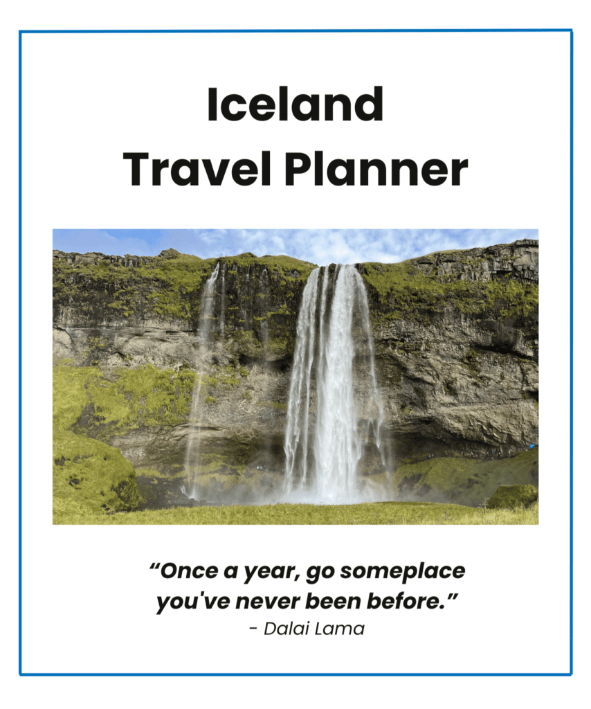
Let me help you plan your trip!
Get organized with this printable, fillable 45-page ICELAND TRAVEL PLANNER – keep track of flights, hotels, tours, daily itineraries and even your trip budget!
BONUS! The planner has journal pages for your memories!
You may also like:
- 6-day Iceland Itinerary (How to See the Best of Iceland in a Short Time)
- Best Places to Visit on the South Coast of Iceland
- Golden Circle in One Day – Full Guide to the Main Stops and Best Detours.
- Snæfellsnes Peninsula – A Complete Guide and Top Things to See.
- Reykjadalur Valley – a Beautiful Hike to a Hot River (+ Tips for the Best Experience)
- Diamond Circle in North Iceland – a Perfect Itinerary.
- The Amazing Kerlingarfjöll and Hveradalir Geothermal Area in Iceland.
For more Iceland inspiration and travel guides click HERE.
Need more help planning your trip? Join my Explore Iceland: Travel Tips & Advice FB Group community to ask questions, share your experiences, plus get expert travel tips and advice from a supportive community of Iceland enthusiasts! Join today!
🎙️ Prefer to listen to the travel guides instead? Check out my Explore Iceland Travel Podcast and easily plan your trip on the go!
About Monika
An avid traveler and a passionate trip planner, mildly obsessed with being organized and prepared 🙂
Well aware of how precious travel time is, I’m here to share my experience and help you get the most out of your vacation time.
“Taking the hassle out of trip planning”